imagine a wilderness
larger than many countries around the world
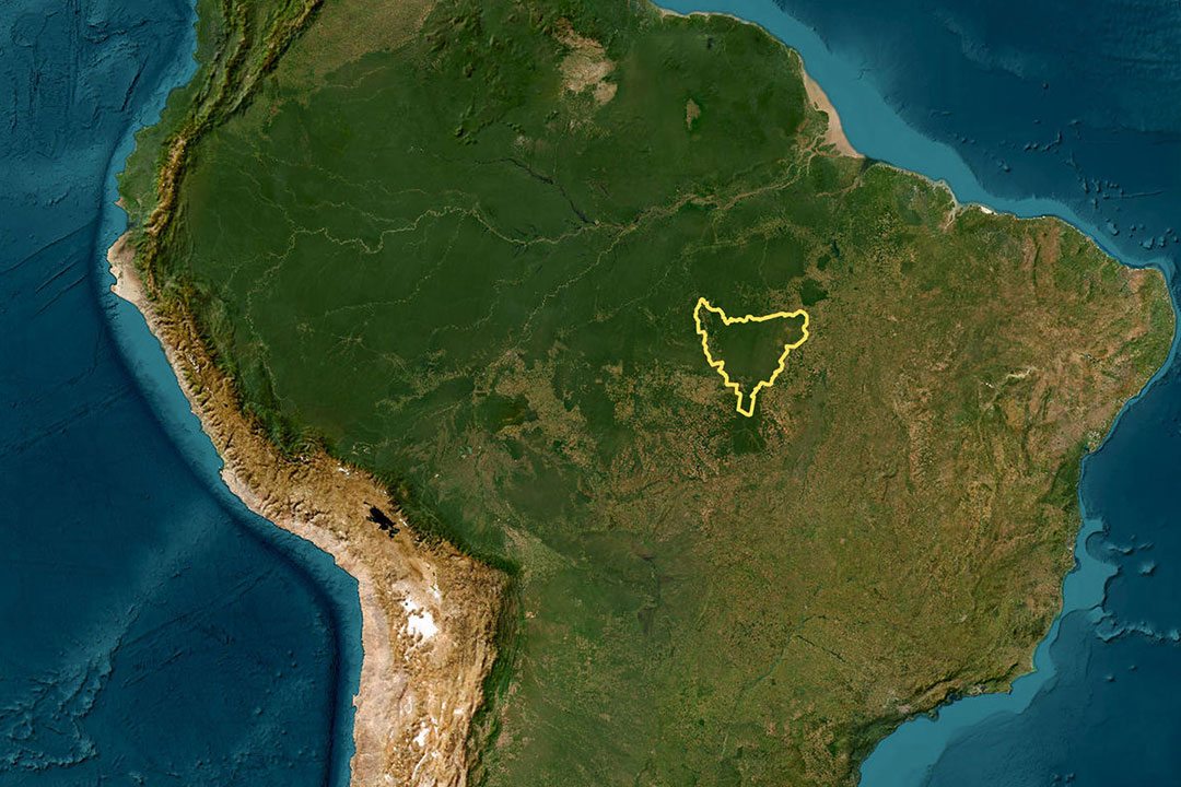
It is difficult to grasp the sheer scale of the Kayapó Indigenous Territory. Covering nearly 100,000 square kilometers, it is larger than many sovereign nations. If it were a country, it would rank around 90th in the world by land area—bigger than Hungary and even Portugal.
This immense expanse remains largely intact: a continuous block of forest broken only by a band of cerrado savanna in the south. It is one of the last great, connected forest landscapes in southeastern Amazonia — an ecological stronghold in a region otherwise transformed by deforestation.
A Constitutionally Recognized and Demarcated Territory
This ancestral land is legally recognized under Brazil’s Constitution as Indigenous Territory. Formal demarcation secures collective land rights and affirms permanent Indigenous stewardship over the area. However, demarcation is not the end of the struggle. Agricultural expansion, illegal extraction, and infrastructure pressures continue to intensify along the perimeter of the territory. Legal recognition provides a foundation. Ongoing protection requires constant vigilance.

Indigenous Territory as a Barrier to Deforestation
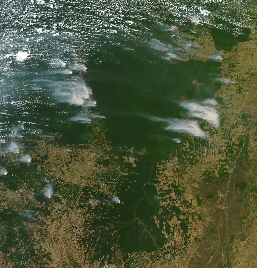
At the frontier of large-scale agricultural expansion, the boundary of this Indigenous Territory forms a visible ecological divide.
Inside the demarcated land, primary rainforest remains standing. Outside, forest has largely been cleared for cattle ranching and industrial soy production.
Scientific studies consistently show that legally recognized Indigenous Territories are among the most effective barriers against deforestation in the Amazon. By maintaining intact forest cover, this territory safeguards huge carbon stocks, stabilizes regional rainfall systems, and preserves landscape connectivity across the basin.
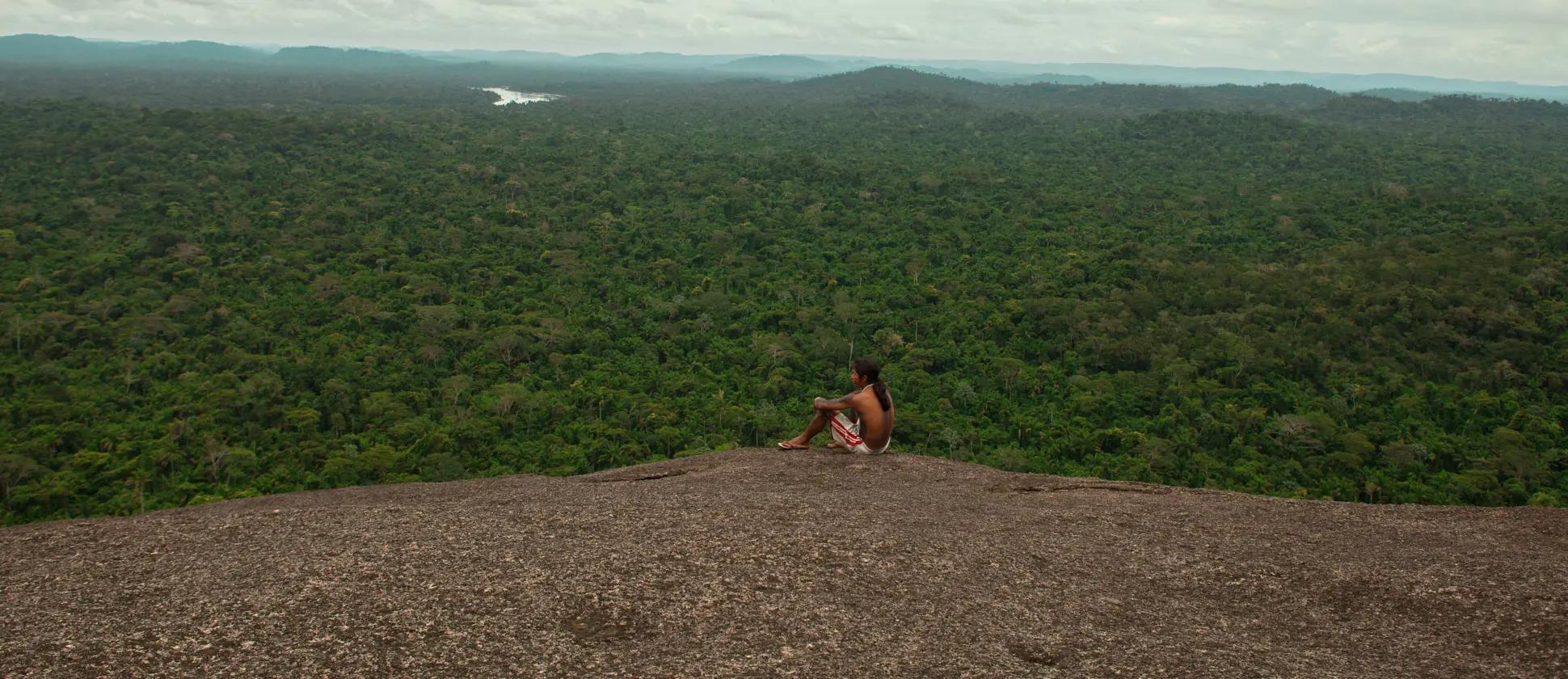
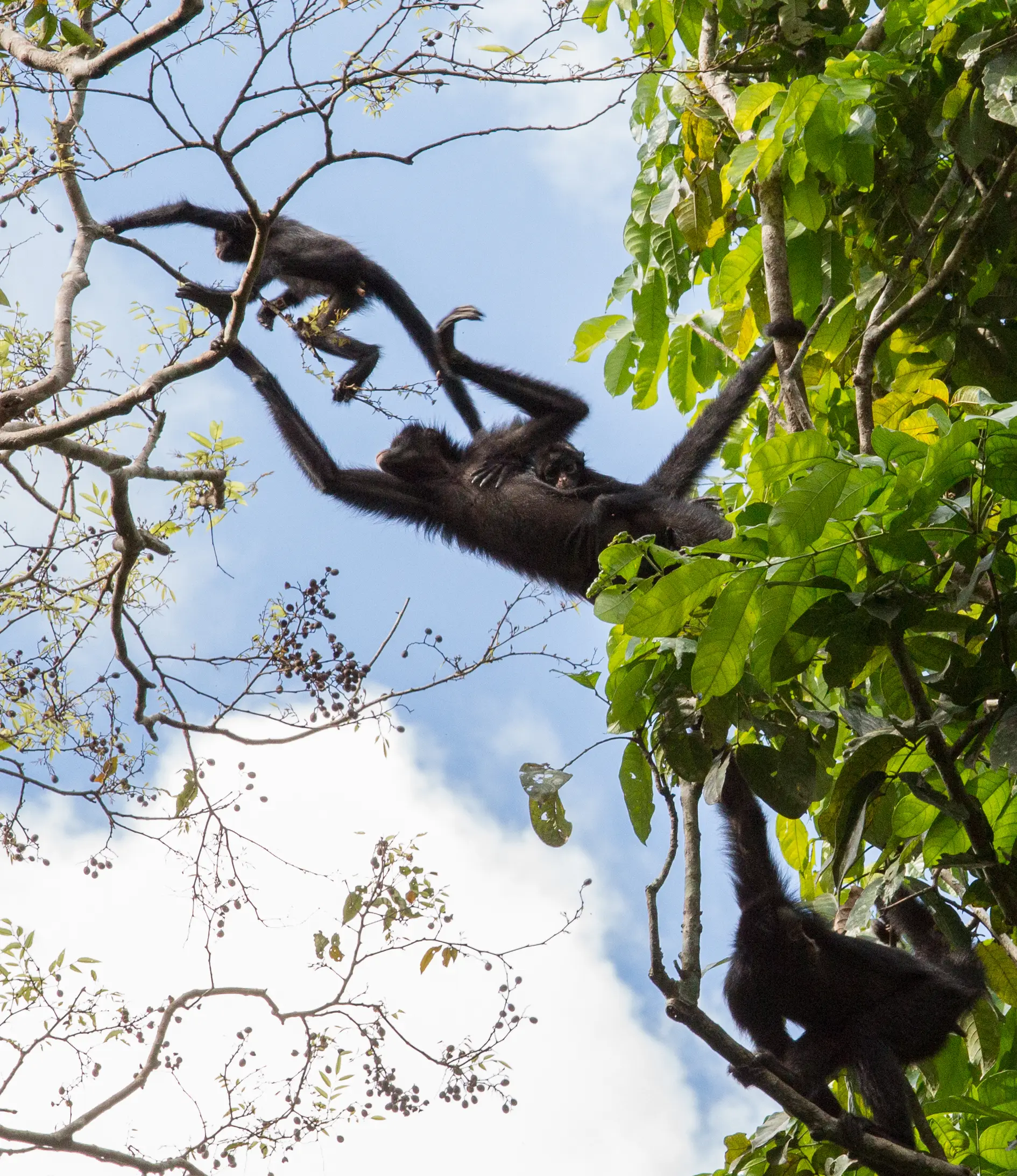
Kayapo’s land supports extraordinary ecological richness.
The border of industrial development
A small section of the 2200km border of Kayapo’s indigenous territory. Within the 10 million hectares of Kayapo land, a lush rainforest continues to flourish as it did for millennia. Outside of Kayapo’s borders, the trees have been cut, burned and the land was turned into pastures and soy fields.

Photo: Simone Giovine

Photo: Simone Giovine
A small section of the border of Kayapo’s indigenous territory. Within the 10 million hectares of Kayapo land, a lush rainforest continues to flourish as it did for millennia. Outside of Kayapo’s borders, the trees have been cut, burned and the land was turned into pastures and soy fields.
Defending a 2,200 Kilometer Border
Satellite imagery frequently reveals fires burning immediately outside protected areas — a reminder of the constant external pressure.
To defend this demarcated territory, Indigenous monitoring teams operate strategically positioned Guard Posts at critical access points. These posts help prevent illegal logging, mining, and land invasion, reinforcing the integrity of the territory on the ground.
Territorial defense is not abstract — it is active, organized, and ongoing.
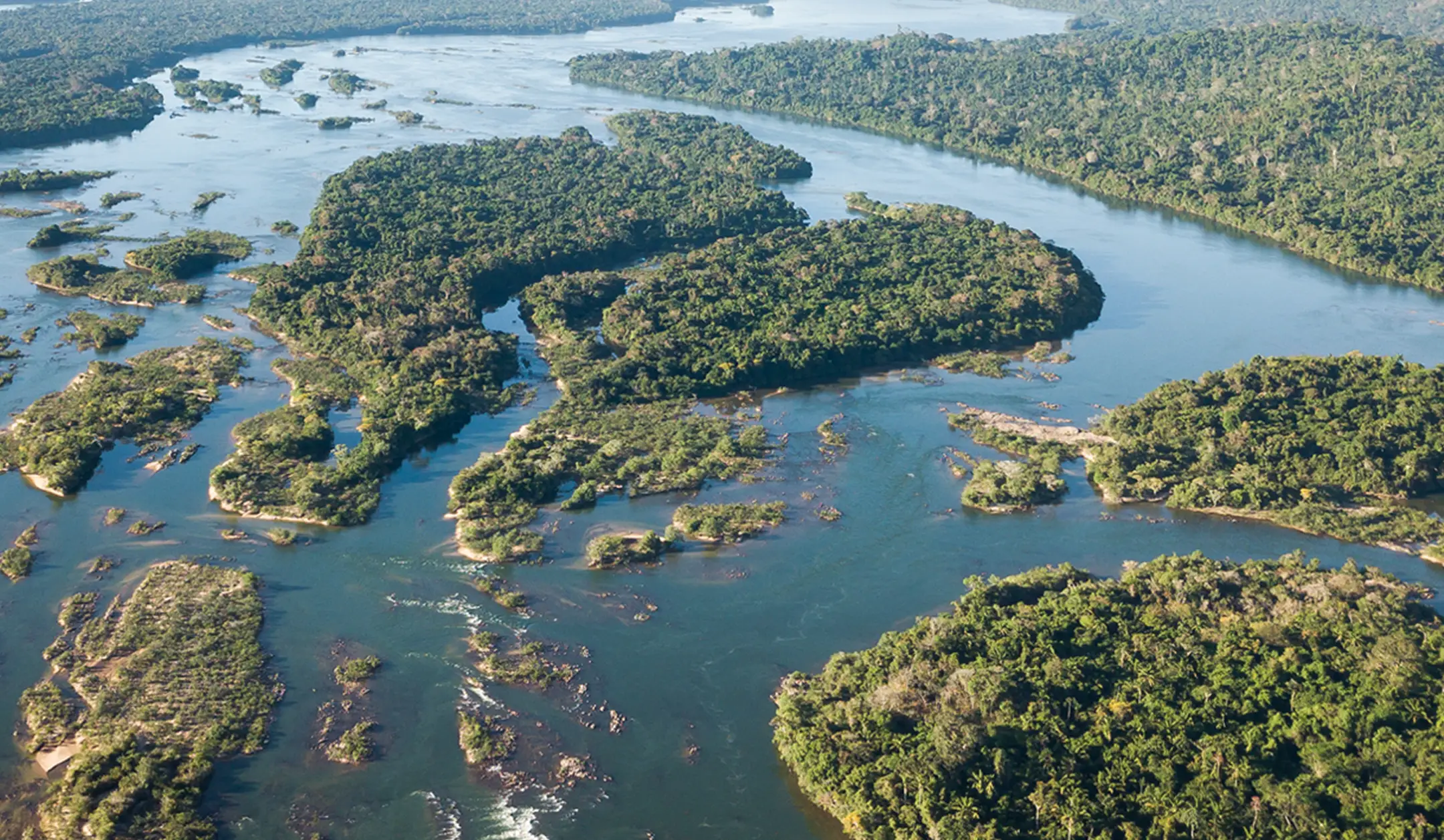
Where Forest and River Flow as One
This Indigenous Territory lies on the Central Brazilian Plateau, shaped by river valleys and interwoven with countless streams.
Two major river systems – the Xingu and its tributary the Iriri, flow freely across the land, sustaining fisheries, wildlife, transport routes, and cultural life. Seasonal flooding replenishes forest soils with mineral-rich sediments, strengthening ecological resilience.
The region follows a marked seasonal rhythm: a dry season (May–October) and a rainy season (November–April), with annual rainfall ranging between 1,900 and 2,500 mm. This hydrological cycle sustains both rainforest ecosystems and human communities.
The Kayapo people refer to themselves as “Mebengokre” in their native language, which roughly translates to “the people of the big water”. Water defines the territory. Forest and river function as one integrated system.


