
The Ancient Trails Project
The expedition was one of the first field activities of the Ancestral Trails project, approved under the Amazon+10 initiative. Coordinated by the Federal University of Pará (UFPA), the project is developed in partnership with the Federal University of Amazonas (UFAM), the University of São Paulo (USP), the State University of Campinas (Unicamp), the Federal University of Mato Grosso (Unemat) and the Protected Forest Association (AFP). The Amazon +10 initiative also has the support of the State Research Support Foundations (FAPs) of Mato Grosso (FAPEMAT), São Paulo (FAPESP), Amazonas (FAPEAM), and Pará (FAPESPA).
The project seeks to revisit historically important paths from a socio-environmental perspective to better understand the biodiversity of mammals, birds, and aquatic fauna in the context of regional agroextractivist production systems, considering different contexts of conservation and threat to natural resources.
From Kubenkàhnkej to Kokraimoro
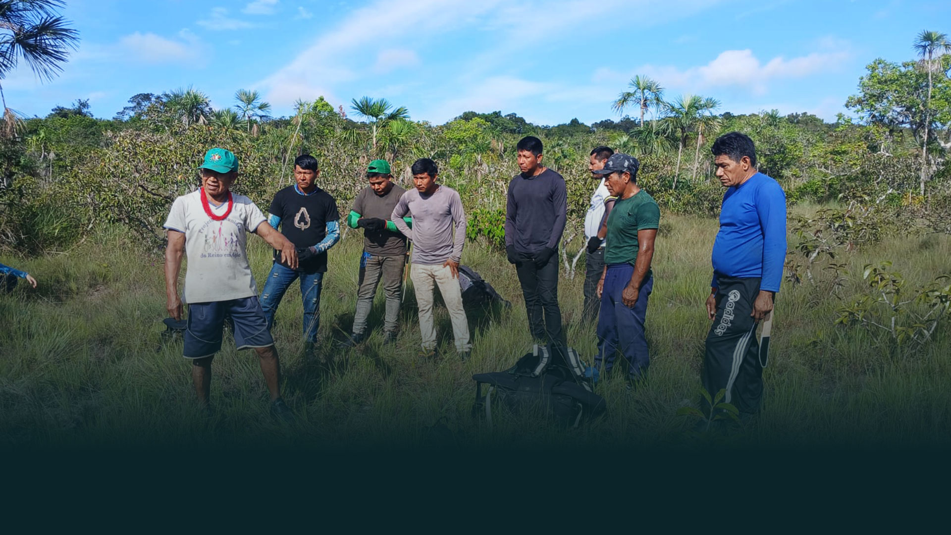
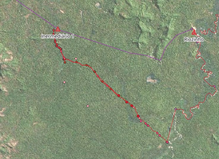
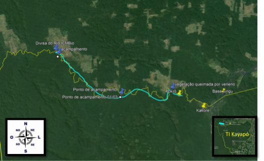
The first expedition was carried out between May 31 and June 10, 2026 and its main objective was to reopen an old trail used by the Kayapó people, connecting the Kubenkàhnkej village, on the banks of the Riozinho River, to the Xingu River region, near the Kokraimoro village. The route, approximately 90 kilometers long, represents an important record of the history of occupation and circulation in the territory.
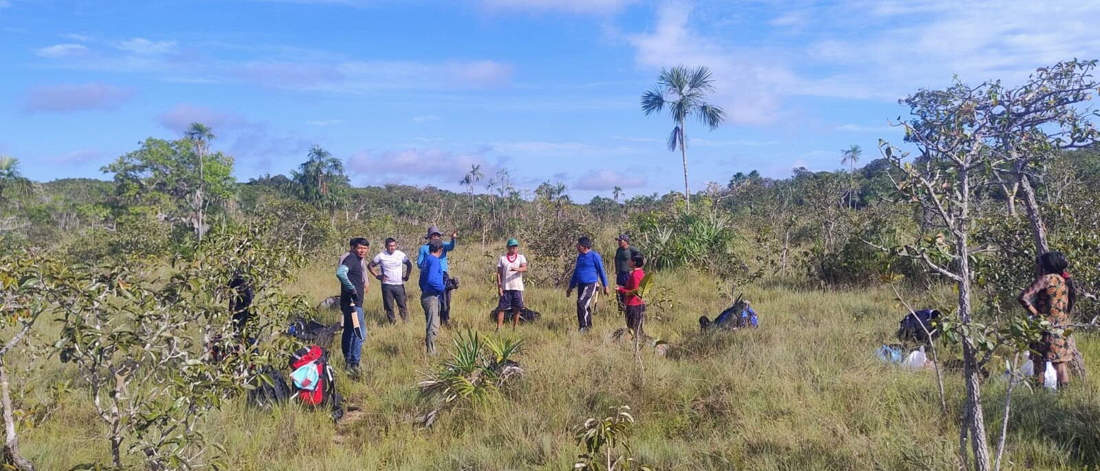
Two teams traveled between the rivers, —the Xingu Team and the Riozinho Team — starting from opposite ends of the trails The teams were composed of Kayapó indigenous and non-indigenous collaborators, including men and women of different age groups. The two teams walked towards the meeting point, reconstructing the ancestral path.
Throughout the expedition, in addition to the reopening of the trail, traditionally managed Brazil nut trees, old areas of Indigenous occupation and traces of local fauna were identified and recorded. As part of the project’s scientific protocol, camera traps were also installed to inventory the region’s biodiversity.
The route revealed an expressive diversity of Amazonian environments, including upland forests with large trees and open understory, old scrublands with dense vegetation and an abundance of lianas, shoal areas dominated by palm trees and waterlogged soils, as well as igapós subject to flooding during the rainy season.
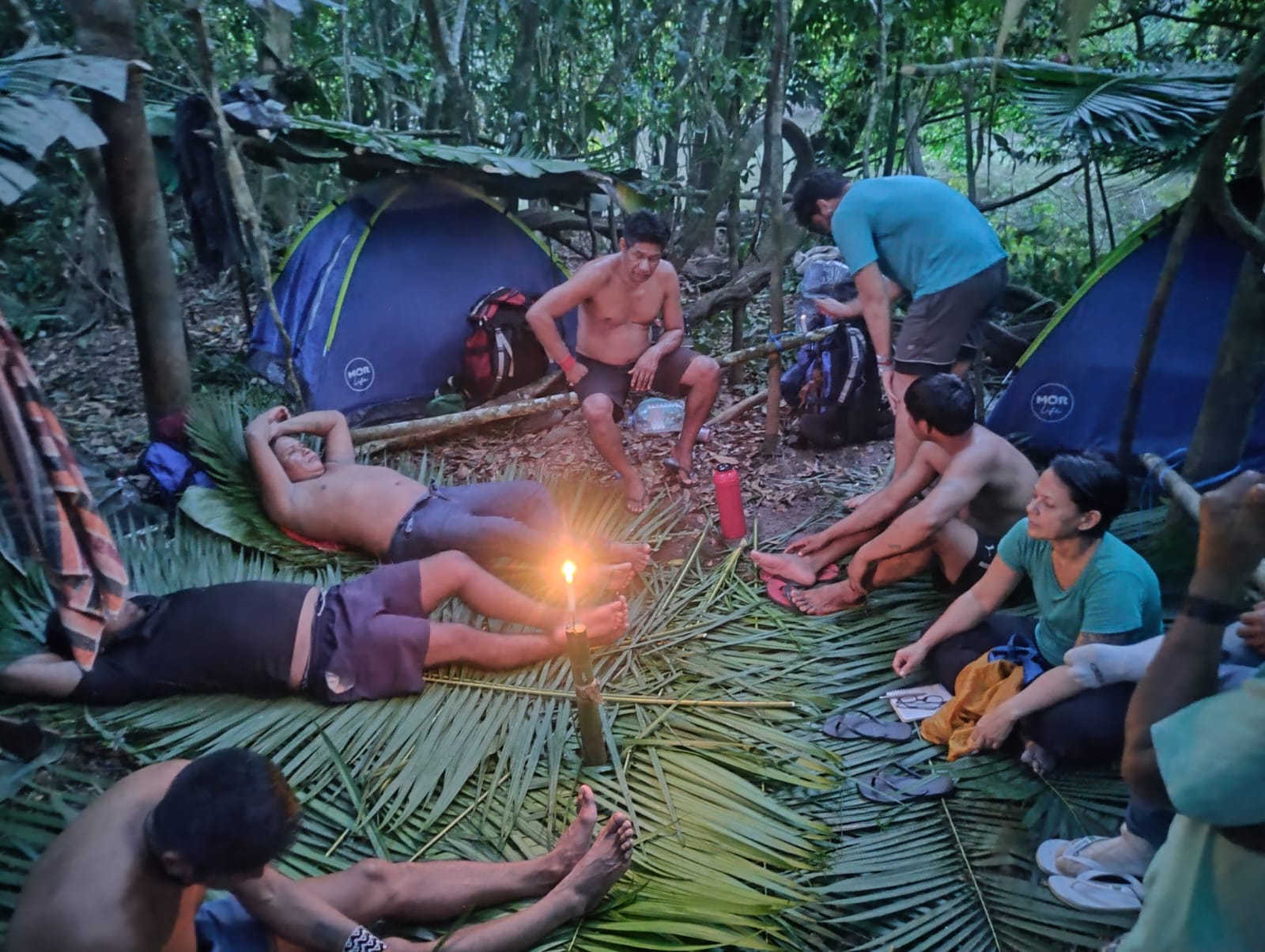
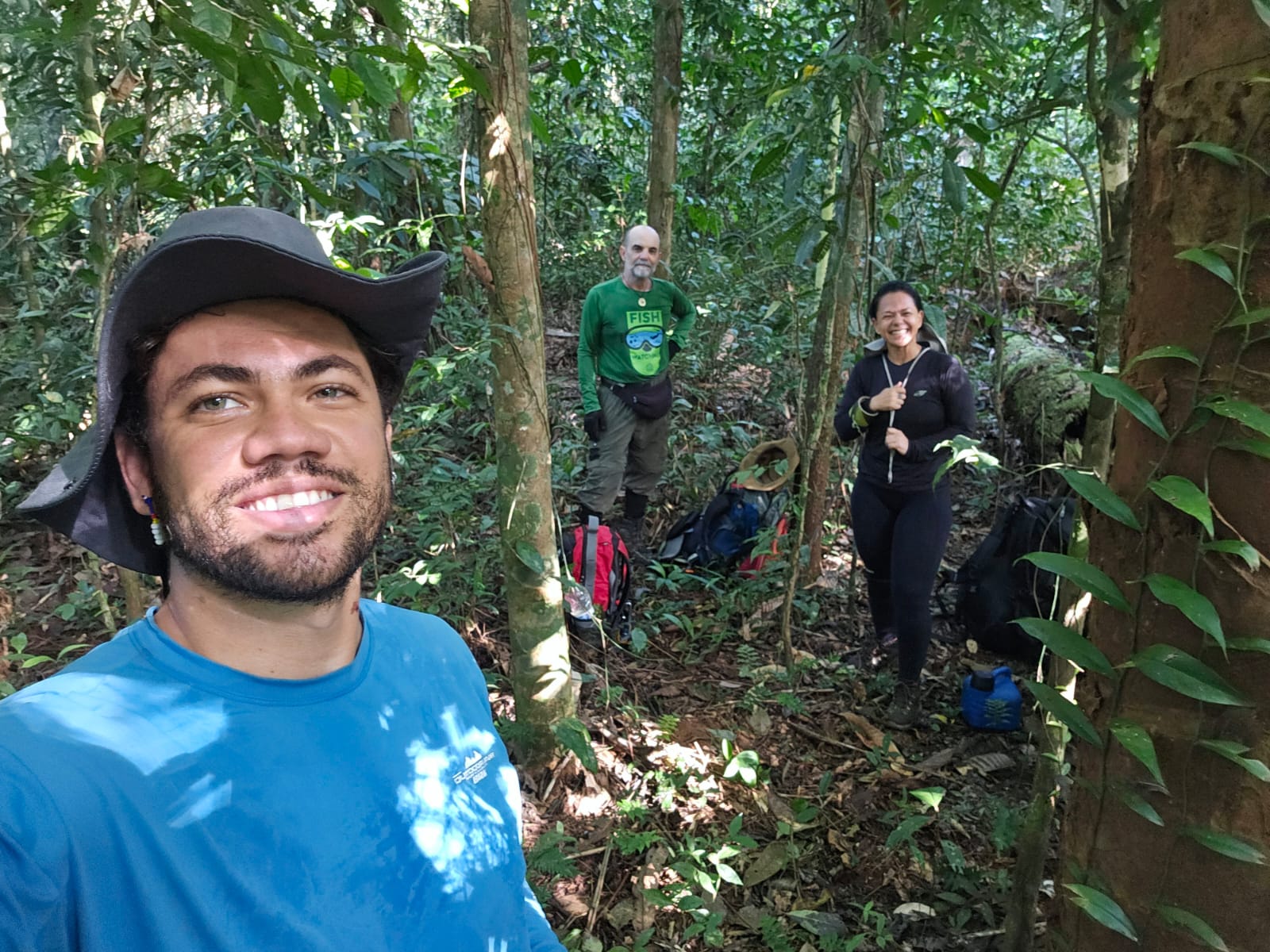
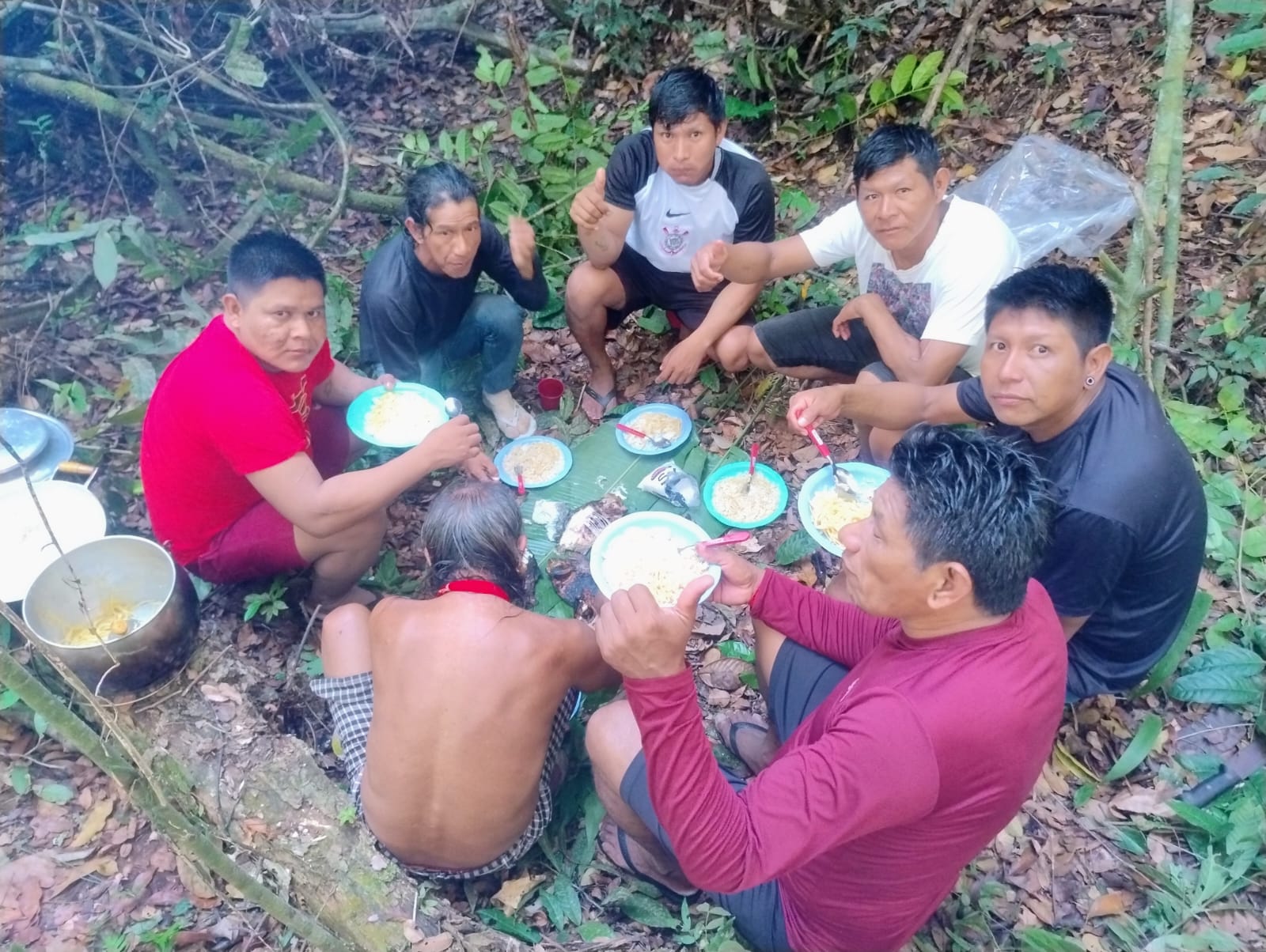
More than reopening a trail, the expedition strengthened the exchange between traditional knowledge and scientific research, laying the foundations for the next stages of the project. The information obtained will be fundamental for the planning of the main expedition, scheduled for the first half of 2027, when the team will be expanded with researchers from the areas of anthropology, archeology, ecology and other specialties.

Large Scale Conservation
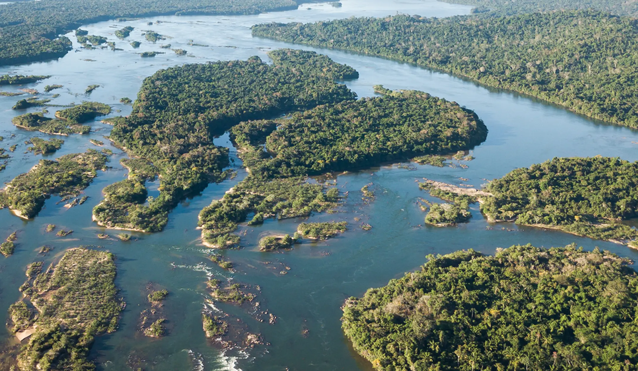
Kayapo territory, spanning approximately 9.4 million hectares across the southeastern Amazon, is one of the largest continuously protected Indigenous forest landscapes on Earth. Here, the forest is not a fragment. It is whole, connected, and alive.

Stability at Scale
Across the Amazon and beyond, once-continuous ecosystems are being fragmented into smaller and smaller patches broken apart by roads, agriculture, mining, and expanding infrastructure. What remains are often isolated fragments, no longer large enough to sustain the full systems that once thrived there. But in some places, the original scale still exists.
For decades, the Kayapo people have defended their lands against encroaching deforestation: from illegal logging and gold mining to expanding agriculture. Through strong governance systems, including territorial monitoring and guard posts, they have maintained the integrity of their forest across millions of hectares.
This continuity creates stability across a vast, intact landscape. It allows the forest to function as a system, not just a collection of trees, but a living, interconnected whole. And it is precisely this kind of large-scale stability that makes forests so important for climate stability.
Kayapo territory stores an estimated 720 million metric tons of above-ground carbon. Keeping this carbon locked in trees and soils helps prevent massive greenhouse gas emissions that would otherwise accelerate climate change.
Large forest systems are more resilient to drought, fire, and external pressures. When protected over time, they provide a form of climate security that smaller, fragmented forests cannot.

Kayapo Territory seen from space, surrounded by forest fires.

Life Needs Space
Wide-ranging species like jaguars depend on vast territories to hunt, reproduce, and maintain healthy populations. Their presence signals something deeper: a complete and functioning food web beneath them. From large herbivores like tapirs and peccaries to birds, fish, and countless smaller species, each layer of life depends on the others.
In fragmented forests, these relationships begin to break down. Species lose the ability to move, populations become isolated, and ecological balance is lost.
In Kayapo territory, the scale of the landscape allows life to move freely. Rivers like the Xingu and Iriri still run largely undisturbed, supporting rich aquatic ecosystems. Forests remain connected across vast distances, enabling species to roam, adapt, and thrive.
The rainforest creates its rain
Through evapotranspiration, trees release vast amounts of water vapor into the atmosphere, recycling moisture and feeding clouds. This process sustains rainfall locally and helps transport moisture deep into the continent through what we call “flying rivers.” These aerial flows carry water across thousands of kilometers, influencing rainfall patterns far beyond the forest itself.
Large, intact forests are essential to this system. When forests are fragmented or degraded, this moisture cycle weakens, with potential impacts on ecosystems and agriculture across South America.
As one of the largest intact forest blocks in the southeastern Amazon, Kayapo territory plays a critical role in maintaining this hydrological system. Its scale helps ensure that the forest continues to function as a living engine of water and climate.

Kayapo territory shows that when forests remain whole, they function as stable, living systems that sustain climate, biodiversity, and water cycles. Protecting forests at scale is about maintaining the conditions that make life on Earth possible.
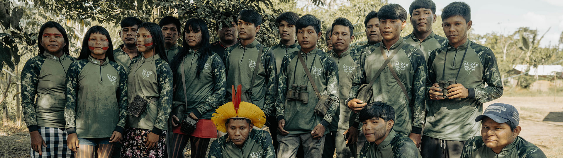
The Prince Albert II of Monaco Foundation launches a new partnership with Associação Floresta Protegida
Safeguarding Indigenous Land and Culture: Prince Albert II of Monaco Foundation Announces Partners with the Associação Floresta Protegida and the Kayapo People in the Brazilian Amazon
The Mebêngôkre-Kayapó-led Associação Floresta Protegida (AFP – Protected Forest Association) and the Kayapo Project are pleased to announce a new partnership with the Prince Albert II of Monaco Foundation’s Forest and Communities Initiative (FCI). This collaboration will help strengthen the Kayapó people’s long-standing efforts to safeguard approximately 9.4 million hectares of tropical forest across six federally demarcated Indigenous Territories in south-central Pará and northern Mato Grosso.
Home to nearly 12,000 people, these lands form a vital ecological barrier against deforestation in one of the most threatened regions of the Amazon Basin. Together, The Prince Albert of Monaco Foundation and the AFP will fortify the protection of Kayapo culture and lands through community-led education and territorial monitoring and surveillance programs.
From 2026-2028, the FCI will work with the AFP and the Kayapo Project to support and implement the Kayapo Forest School to prepare the next generation of Kayapo leaders. Each year, the Kayapo Forest School will provide hundreds of Kayapo youth a five-day field program that integrates traditional Indigenous knowledge with conservation technologies such as drones and camera traps. Each year of the partnership, the Kayapo Forest school will expand to other regions of the Kayapo managed Indigenous lands.
At the same time, the FCI will support the Kayapo territorial monitoring and surveillance guard post program. The guard post program trains and employs more than 1,500 Kayapo guardians to protect more than 2200km of Kayapo border from invasion. The guard posts are a clear signal that the Kayapo are organized and prepared to protect their territory from land invasions.
Together, these initiatives will ensure that Kayapo lands and culture are safeguarded for future generations.
Patkore Kayapo, President of AFP said: “The Forests and Communities Initiative provides important resources directly to Indigenous associations and communities. The partnership with the Prince Albert of Monaco Foundation will provide essential support for the protection of Kayapo culture, rivers, lands, and biodiversity. The partnership reinforces durable Indigenous governance and autonomy.”
Romain Ciarlet, Vice-Chairman and CEO, Prince Albert II of Monaco Foundation, added: “Protecting the world’s forests requires strong partnerships with those who have safeguarded them for generations. Indigenous peoples are not only guardians of biodiversity; they are key actors in the global response to climate and environmental challenges. Through the Forests and Communities Initiative, the Prince Albert II of Monaco Foundation is committed to strengthening Indigenous-led conservation by supporting local governance, education and territorial protection.”
About the Forests and Communities Initiative
The mission of the Forests and Communities Initiative is to support conservation of forest ecosystems through the action of indigenous peoples and local communities (IP and LCs) and through the development of a supporting network of actors providing a multidisciplinary set of expertise. To learn more about the Forests and Communities Initiative, visit www.forestsandcommunitiesinitiative.org.
About the Prince Albert II of Monaco Foundation
Founded by HSH Prince Albert II of Monaco in 2006, the Foundation is a global non-profit organisation dedicated to advancing planetary health for current and future generations. It co-creates initiatives and supports hundreds of projects in three priority areas: the Mediterranean Basin, the Polar Regions, and the Least Developed Countries (as classified by the United Nations). Its key missions include preserving endangered species, protecting freshwater ecosystems, developing a sustainable blue economy, and supporting the younger generations.
About the Kayapo Project
The Kayapo Project, a flagship program of Biome Conservation, is an Indigenous-led NGO alliance ensuring Mebêngôkre-Kayapo (Kayapo) cultural, economic, political, and territorial autonomy over more than nine million hectares of federally demarcated Indigenous lands located in the highly threatened southeastern Amazon. For more on the Kayapo Project, visit kayapo.org.
About Associação Floresta Protegida
The Associacao Floresta Protegida is an Indigenous-led nonprofit organization based in Tucumã, in the Brazilian State of Pará. The AFP works with 43 communities in the Kayapo, Menkragnoti, and Las Casas Indigenous Territories. Visit florestaprotegida.org.br to learn more.

Kayapo Territorial Surveillance 2024
In 2024, a remarkable Amazon success story continued to unfold despite the wildfire, and smoke that darkened Amazonian skies. The Kayapo People stood strong, protecting over nine million hectares (23 million acres) of their forest territory. This achievement stands as a testament to decades of Kayapo resistance, institution-building, and sustained philanthropic support.
The cornerstone of this ongoing success is the Kayapo Territorial Surveillance program. This program plays a vital role in safeguarding their constitutionally recognized lands from immediate threats like illegal logging, gold-mining, and fishing. Through this effort, other conservation projects flourish, and the integrity of their territory remains intact.
Defending the Land
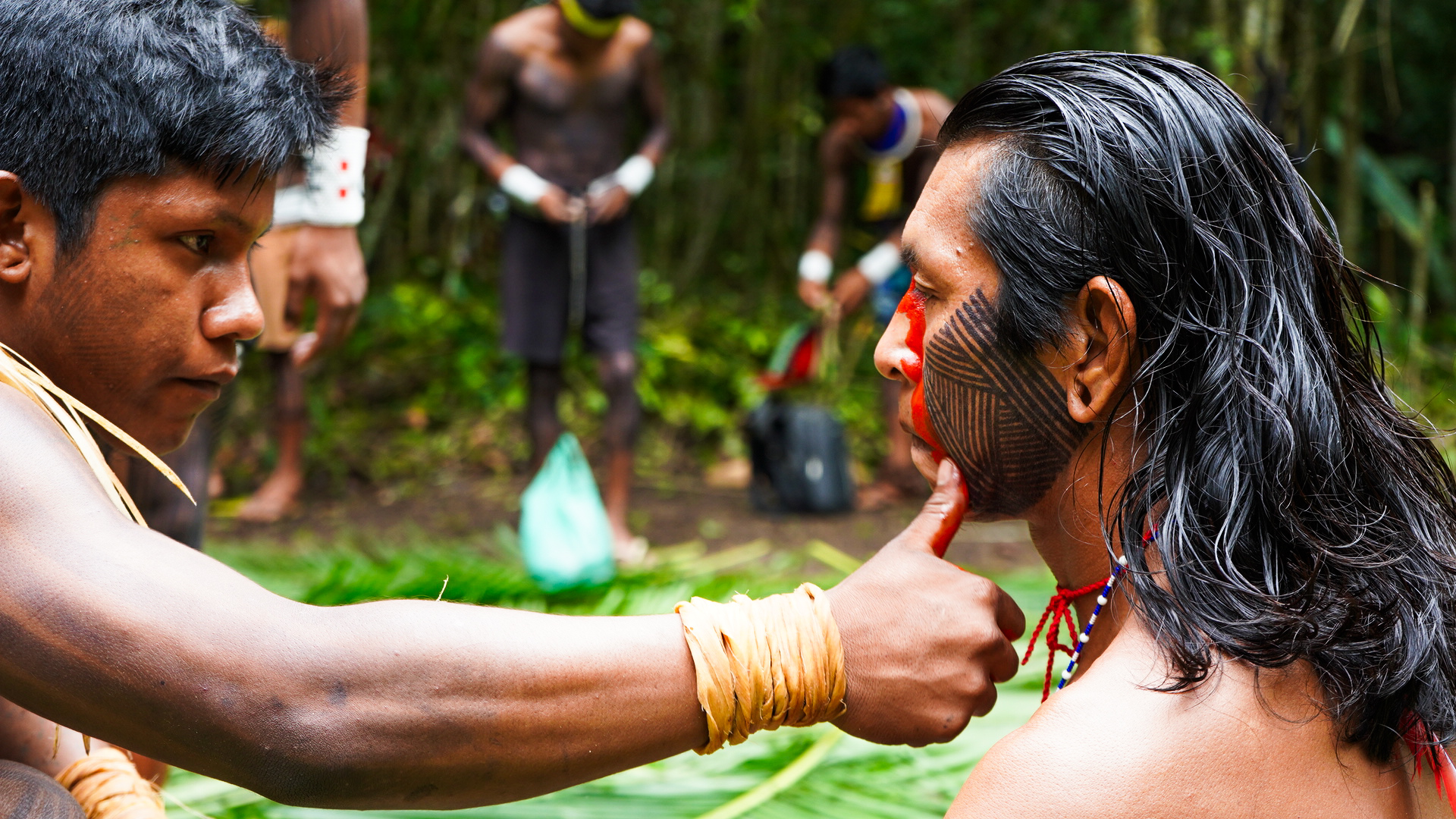
Photo: Takakrua Kayapo
More than 1600 Kayapo Guardians from 71 villages representing 3 Indigenous Associations participated in 2024.
The vastness and remoteness of Kayapo territory make its protection a formidable challenge. To confront this, the Kayapo and their allies have established guard posts at vulnerable entry points, serving as deterrents against illegal incursions. These posts signal to outside society that the Kayapo are organized and determined to defend their land rights.
Guard post teams typically consist of five or six Kayapo members from a single community, rotating weekly, biweekly, or monthly depending on logistical challenges. In 2024, 16 border guard posts operated for five to seven months, maintaining the integrity of Kayapo territory.
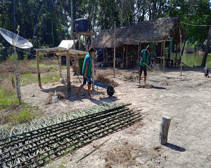
Sixteen Kayapo Guard Posts strategically monitor 80 –90% of the Kayapo’s 2,200 km border.
Guard posts are built with huts for sleeping, cooking, storage, and a bathroom. Each post is equipped with a freezer, water pump, generator, water tower, parabolic antenna and television, and solar power. Transportation to and from the guard posts relies on boats along rivers and/ or 4×4 trucks at posts with road access. All posts are outfitted with satellite internet to facilitate logistics, delivery of a video education program, and safety. Post operation is supported by two non-Kayapo administrators responsible for controlling supplies of food and fuel and coordinating logistics with their regional Kayapo NGO. Following traditional Kayapo values of egalitarianism, Kayapo guard teams rotate weekly to maximize participation and benefits sharing. This system necessitates permanent post administrators to coordinate day-to-day logistics, supplies, equipment maintenance, and team rotation.
Each post costs approximately US$ 12,000 per month to operate. Given the vast area protected, the conservation return on this investment is unparalleled.
Guard Post Duties
Each guard post team undertakes numerous responsibilities:
- Checking authorization of any non-Kayapo individuals entering the territory
- Patrolling border sections in their assigned areas
- Maintaining the camp, gathering firewood, fishing, and building structures
- Opening and closing posts as needed
New in 2024
Guard posts also became hubs for education, using video-based curricula to empower Kayapo youth with knowledge about territorial protection and indigenous sovereignty.


Logistic Challenges
The work is not easy and several guard posts present exceptional logistical challenges:
- Iriri Post: Supplies must be transported over 600 km of rough dirt roads and a 10-hour boat ride, followed by a 50 km river journey.
- Raoni Post: Access requires traversing 500 km of bad roads, a three-hour boat trip, and navigation through a dangerous frontier region.
- Rio Vermelho Post: Supplying the Rio Vermelho post involves a three-day boat trip and a two-day, 40 km hike through forest and savanna.
- Pista Nova/Angme-e Post: Access requires a day-long boat ride and a 35 km forest trek.
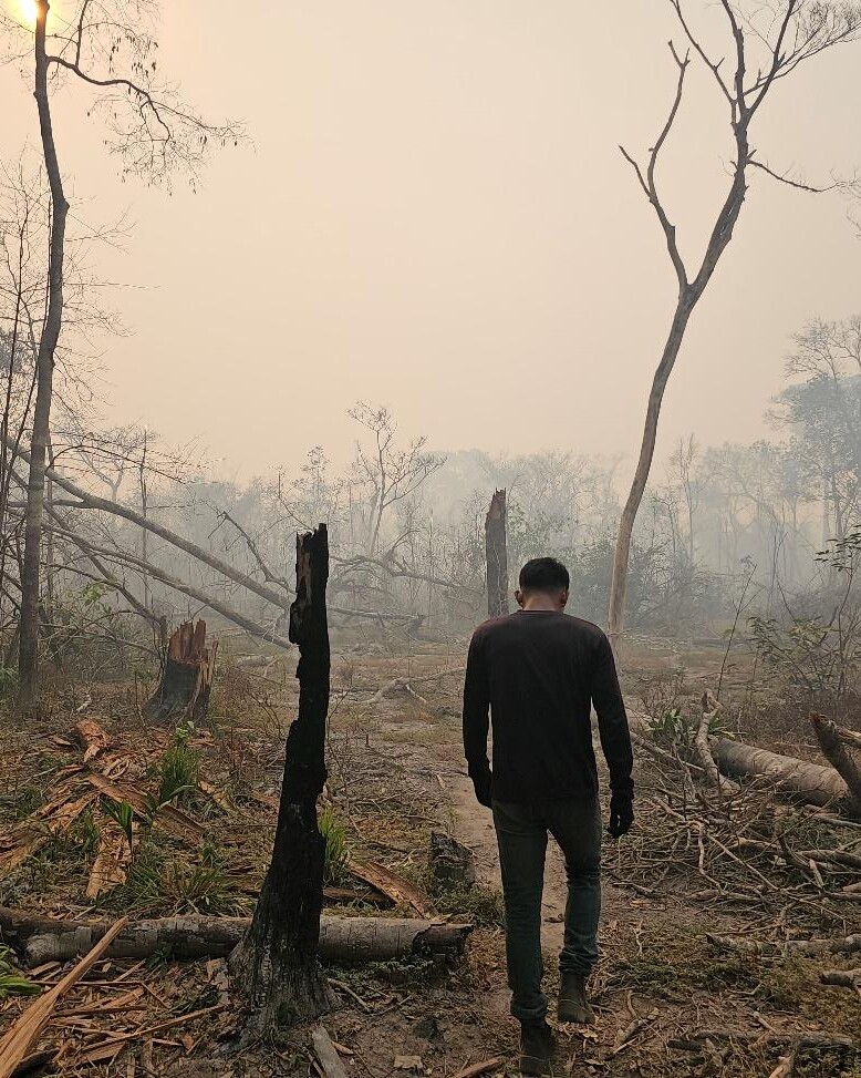
Team following a trail in the forest affected by fire, Tepdjàti village, Kayapó Indigenous Territory, Pará, Brazil.
The state of the 10.6 million hectare block of ratified Kayapo Indigenous territory as of December 2024.
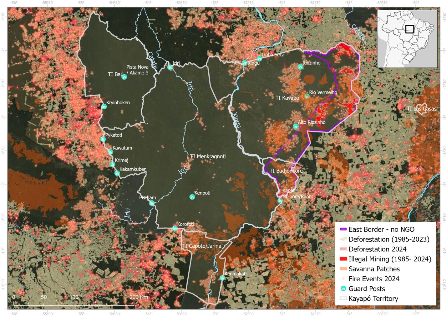
Kayapo indigenous territories (TI) are outlined in gray with an eastern band of ~ 1.2 million hectares outlined in purple that does not form part of this project so receives no conservation NGO investment and has, therefore, been lost to illegal logging and goldmining. Approximately 9.4 million hectares of Kayapo territory to the west of the interior purple border is protected with conservation and development investment and remains intact. Note the heavy presence of fire in 2024. Fire concentrated on the dry savanna patches and highly degraded forest along the eastern border (outlined in purple) that receives no conservation investment and does form part of the Kayapo project. Undisturbed forest remained largely unscathed.
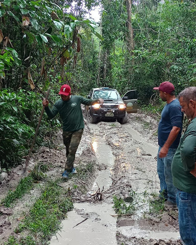
Bringing supplies to Iriri guard post
Mining and logging outside the NGO alliance
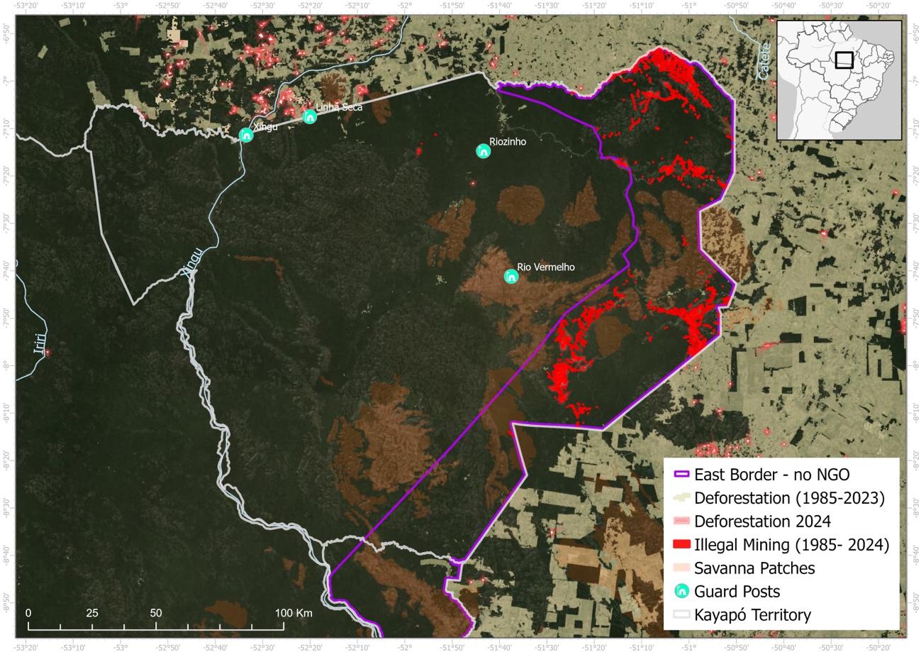
The northeastern sector of Kayapo territory (TI Kayapo) showing the eastern band of territory (delineated in purple) where the Kayapo did not ally with the conservation NGOs and therefore has been heavily invaded by goldmining (red) and logging. Guard post locations are shown (green dots). The brown in Kayapo territory are patches of savanna (cerrado) on Brazilian shield rock. The tan colour outside Kayapo territory is deforestation for ranching.
Cumulative deforestation as of 1997 and 2023
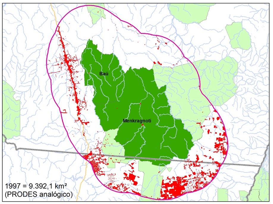
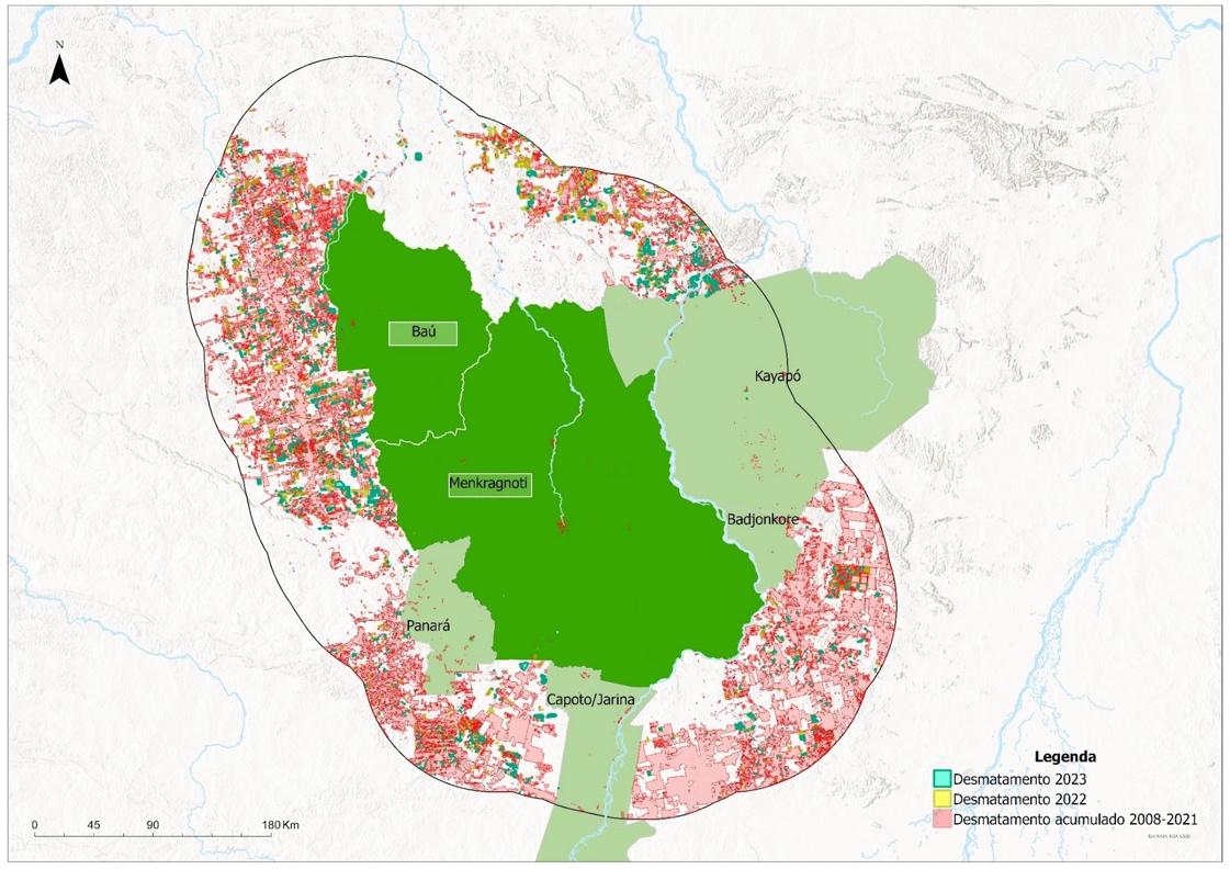
Cumulative deforestation as of 1997 and 2023 in Kayapo territories Bau and Menkragnoti (dark green) that are represented by the Instituto Kabu. The buffer zone-study area is delimited by the purple line. Other Kayapo territories (TI Kayapo, TI Capoto/ Jarina, and TI Badjonkore) and the neighbouring Panara indigenous territory on the western border are marked in light green. Red and pink indicates deforestation.
Expeditions and Patrols
To complement guard activities the Kayapo undertake expeditions by foot, vehicle, or boat along and within the border. These patrols mark Kayapo presence and deter illegal incursions. Expeditions include weekly or bi-weekly patrols along rivers and longer surveys of remote areas. There are two types of expeditions:
– weekly or bi-weekly patrols by post teams along stretches of river, and
– expeditions of several days that survey areas not reached by guard posts.
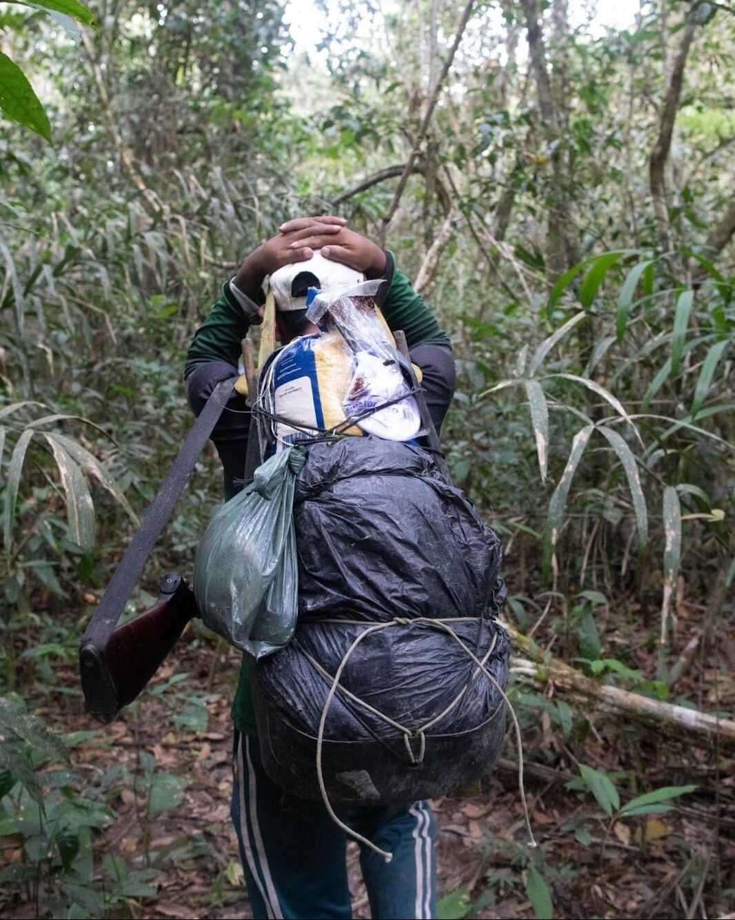
Trekking to supply and rotate guards at the Angme-e guard post
2024 Results: Successes and Ongoing Challenges
Through their vigilance and coordinated efforts, the Kayapo resolved several longstanding territorial threats:
- Resolved in 2024: logging access at Kranbari on the north-western border of Menkragnoti TI
- Resolved in 2024: goldmining at the P14 site on near the northeastern border in TI Kayapo
- Resolved (in 2023): logging access at Kororoti on the western border
- Resolved (in 2023): goldmining at Pista Nova and Novo Horizonte locations in the interior of Bau territory
- Resolved (in 2023): goldmining at Cheiro just inside the northern border near the Iriri river
Despite these victories, two goldmining sites remain active and unresolved:
- Unresolved (active): goldmining at Pista Velha in TI Kayapo near the northeastern border
- Unresolved (active): a new goldmining site started in the interior of Bau TI

An overflight in July 2024 by the northeastern Kayapo NGO Protected Forest Association shows the Cheiro goldmine in the north remains inactive as the excavations are growing over with vegetation