
Raoni
Kapôt Nhĩnore: Chief Raoni’s ancestral territory wins its Declaratory Ordinance after decades of Indigenous resistance
With President Lula and Mẽbêngôkre and Yudjá leaders present, Brazil’s federal government signed an ordinance recognising 362,000 hectares of traditional occupation between the states of Mato Grosso and Pará. The historic victory reaffirms original rights and opens the way to complete the demarcation of a territory marked by forced displacement, land conflicts, agribusiness expansion and millions in financing for rural properties overlapping the area.
Hectares declaredTraditionally occupied by the Mẽbêngôkre and Yudjá
Of struggleRaoni has called for demarcation since the 1980s
Indigenous cemeteriesIdentified in the territory, including the grave of Raoni’s father
Still forestedDespite pasture and soy spreading inside its boundaries
The Kapôt Nhĩnore Indigenous Territory, ancestral land of Chief Raoni Metuktire, reached a decisive stage in its demarcation on Thursday, 19 November 2026. At a ceremony held at Instituto Raoni in Peixoto de Azevedo, Mato Grosso, the federal government signed the Declaratory Ordinance recognising the boundaries of 362,243 hectares traditionally occupied by the Mẽbêngôkre (Kayapo) and Yudjá peoples, between the states of Mato Grosso and Pará.
The signing was attended by President Luiz Inácio Lula da Silva; the Minister of Indigenous Peoples, Eloy Terena; the Minister of Justice and Public Security, Wellington César Lima e Silva; the Minister of the General Secretariat of the Presidency, Guilherme Boulos; the Attorney General, Jorge Messias; the president of the National Foundation for Indigenous Peoples (Funai), Lucia Alberta Baré; and Mẽbêngôkre Indigenous leaders.
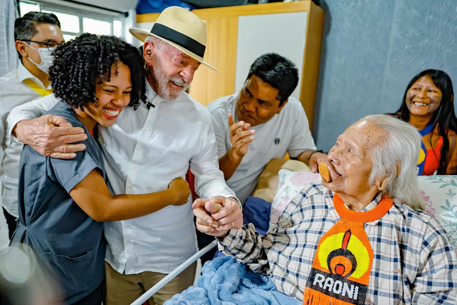
During the visit, Lula also met Chief Raoni Metuktire, 94, who is receiving medical care at home in Peixoto de Azevedo. The meeting came at an especially meaningful moment in Raoni’s life: for more than four decades he has called for the demarcation of Kapôt Nhĩnore, the land where he grew up and spent part of his youth.
The ordinance, due to be published in Brazil’s Official Gazette (Diário Oficial da União) on 20 November, declares the boundaries of the Indigenous Territory and orders its demarcation to proceed. Completing the process will depend on further steps, including physical demarcation, presidential ratification and land registration. The victory is the result of a long history of Indigenous mobilisation, sustained by Mẽbêngôkre and Yudjá leaders, their organisations and the successive generations who kept the claim to the territory alive.
Two stages done, three to go
- Identification studyFunai report published, July 2023
- Declaratory OrdinanceSigned 19 November 2026
- Physical demarcationNext
- Presidential ratificationTo come
- Land registrationTo come
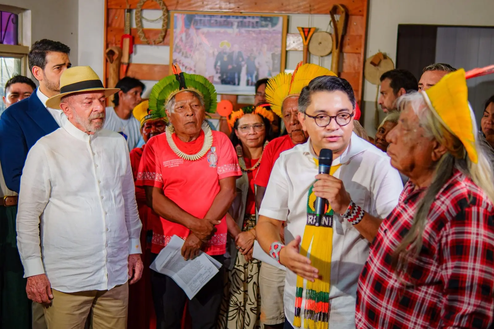
For Minister Eloy Terena, the ordinance recognises this history and the Brazilian state’s commitment to Indigenous peoples’ rights. He highlighted the importance of Raoni’s life’s work for the defence of land and the environment in Brazil:
Today’s signature, as well as being a historic moment, represents our government’s commitment to the rights of Indigenous peoples.
The Declaratory Ordinance was also signed amid growing economic pressure on Kapôt Nhĩnore. A study released by Greenpeace Brazil on 18 November revealed that rural properties overlapping the territory received more than R$ 25 million in agricultural credit between 2023 and 2025, while the demarcation process remained unfinished. The study adds to the evidence on the consequences of delayed recognition and on the economic interests tied to the expansion of farming in the region.
Kapôt Nhĩnore in Mẽbêngôkre memory and history
Kapôt Nhĩnore, which means “Tip of the Cerrado” in the Mẽbêngôkre language, lies in a transition zone between the Amazon rainforest and the Cerrado savanna, in the municipalities of Santa Cruz do Xingu and Vila Rica in Mato Grosso, and São Félix do Xingu in Pará. Its history is bound up with the movements, village-building and territorial circulation of the Mẽbêngôkre Mẽtyktire, the group to which Chief Raoni belongs.
According to Funai’s identification studies, there are records of Mẽbêngôkre presence on the right bank of the Xingu River since the mid-19th century, linked to historical migrations from the Araguaia and Tocantins river regions. Kapôt Nhĩnore was the setting for fundamental events in Mẽbêngôkre history, including the formation of the Mẽtyktire subgroup, great hunts, naming ceremonies, relations between different groups and the founding of old villages and settlements.
The Detailed Identification and Delimitation Report (RCID) identified dwelling sites, traditional gardens, travel routes, hunting and gathering areas, ceremonial spaces and eight Indigenous cemeteries. In one of them lies Bepangati, Chief Raoni’s father. The importance of these places lives on in the elders’ stories and in the ties that connect Mẽbêngôkre families to the places their ancestors travelled.
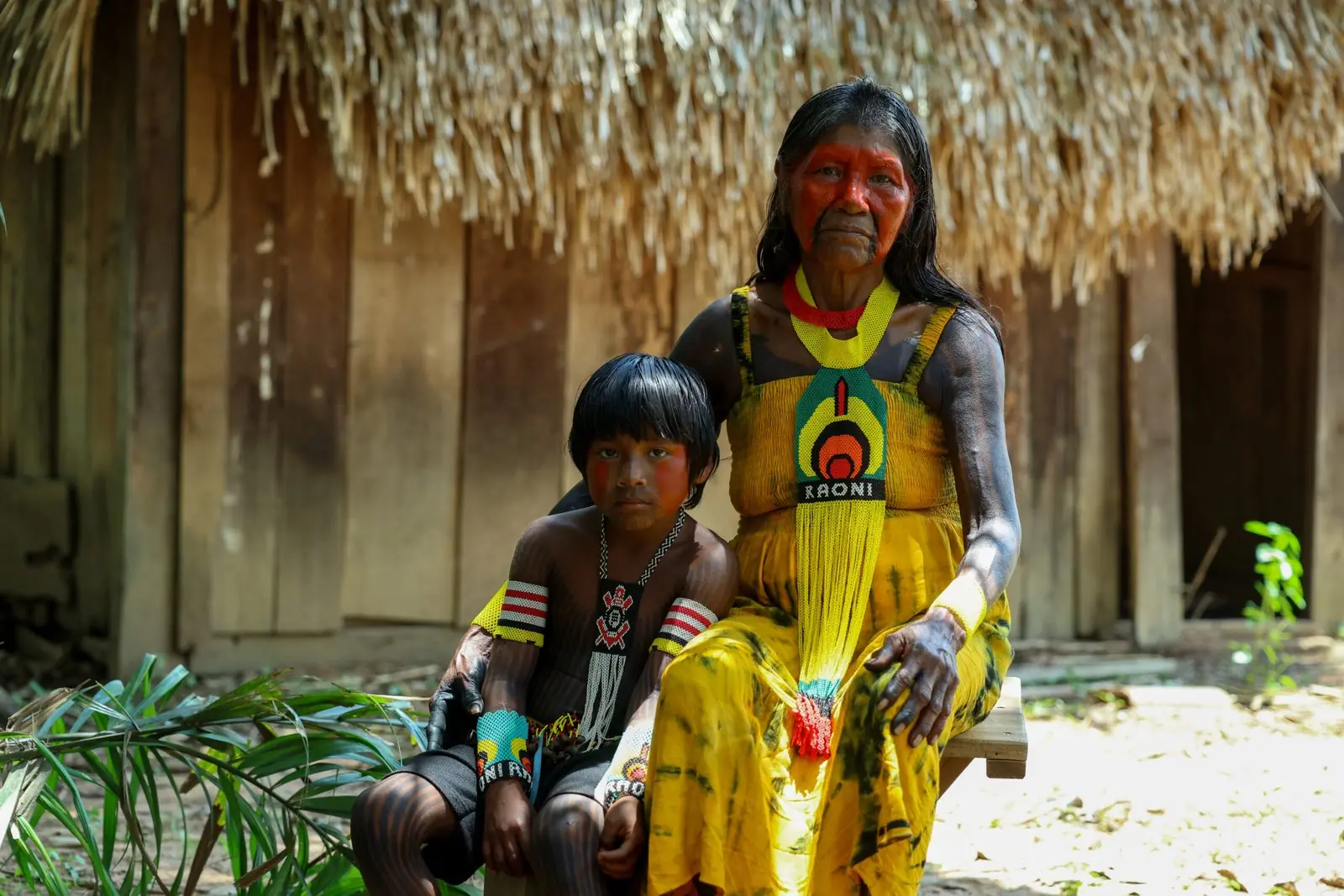
Kenã Metuktire, sister of Chief Megaron Txucarramãe and a resident of Piaraçu village, recalls that her family was forced to leave Kapôt Nhĩnore after episodes of violence.
Kapôt Nhĩnore is my land, where I was born, and my grandfather Bepangati’s grave is there. I want it to be demarcated.
A man called Luiz, and another called Baiano, were responsible for murdering my uncle a long time ago in Kapôt Nhĩnore. That’s why my grandparents and my father fled Kapôt Nhĩnore to survive, that’s why they came here (to the Capoto/Jarina Indigenous Territory).
Her account shows the threats and violence that marked the displacement of Indigenous families as non-Indigenous settlement advanced.
Kenã also reaffirms her bond with the place she comes from. Alongside her grandson Bepakati, she stresses the importance of the land for passing on traditional knowledge. The family’s testimony recalls an abundance of animals and fruits used for food, such as tapirs, peccaries and açaí, and links demarcation to the possibility that new generations can go on living according to Mẽbêngôkre culture. Passing on these memories keeps alive the territorial references of families who were displaced and who continue to claim the right to return to the places of their ancestors.
Why 362,000 hectares? Mẽbêngôkre territoriality and the importance of traditional mobility
The size of the Kapôt Nhĩnore Indigenous Territory must be understood through the historical, cultural and environmental features of Mẽbêngôkre territoriality. Traditionally, the Mẽbêngôkre occupy their land through intense mobility, moving between villages, temporary camps, hunting grounds, fishing and gathering sites, gardens and spaces set aside for collective ceremonies.
The RCID for Kapôt Nhĩnore describes how periods of concentration in the main villages, where the great ceremonies are held, alternate with periods of dispersal into secondary villages and hunting camps. This rhythm is part of Mẽbêngôkre territorial organisation and is tied to how food is obtained, to environmental knowledge and to the maintenance of social relationships.
Mobility involves journeys made at different times of year, according to the availability of natural resources, the character of each environment and collective needs. Hunting and gathering expeditions allow people to know and use different areas of forest and Cerrado. The paths they travel connect named places, old settlements, waterways and places tied to the historical memory of family groups. Knowledge of these routes is handed down between generations through shared life, experience and the stories of the elders.
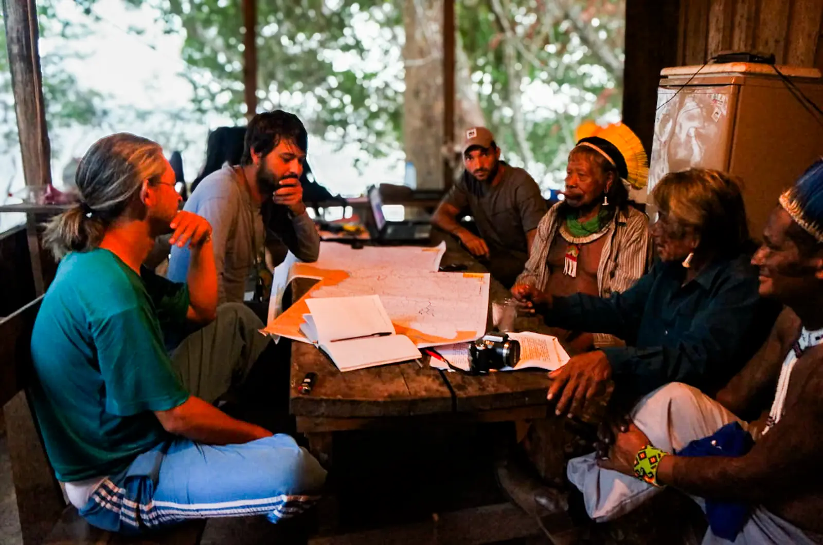
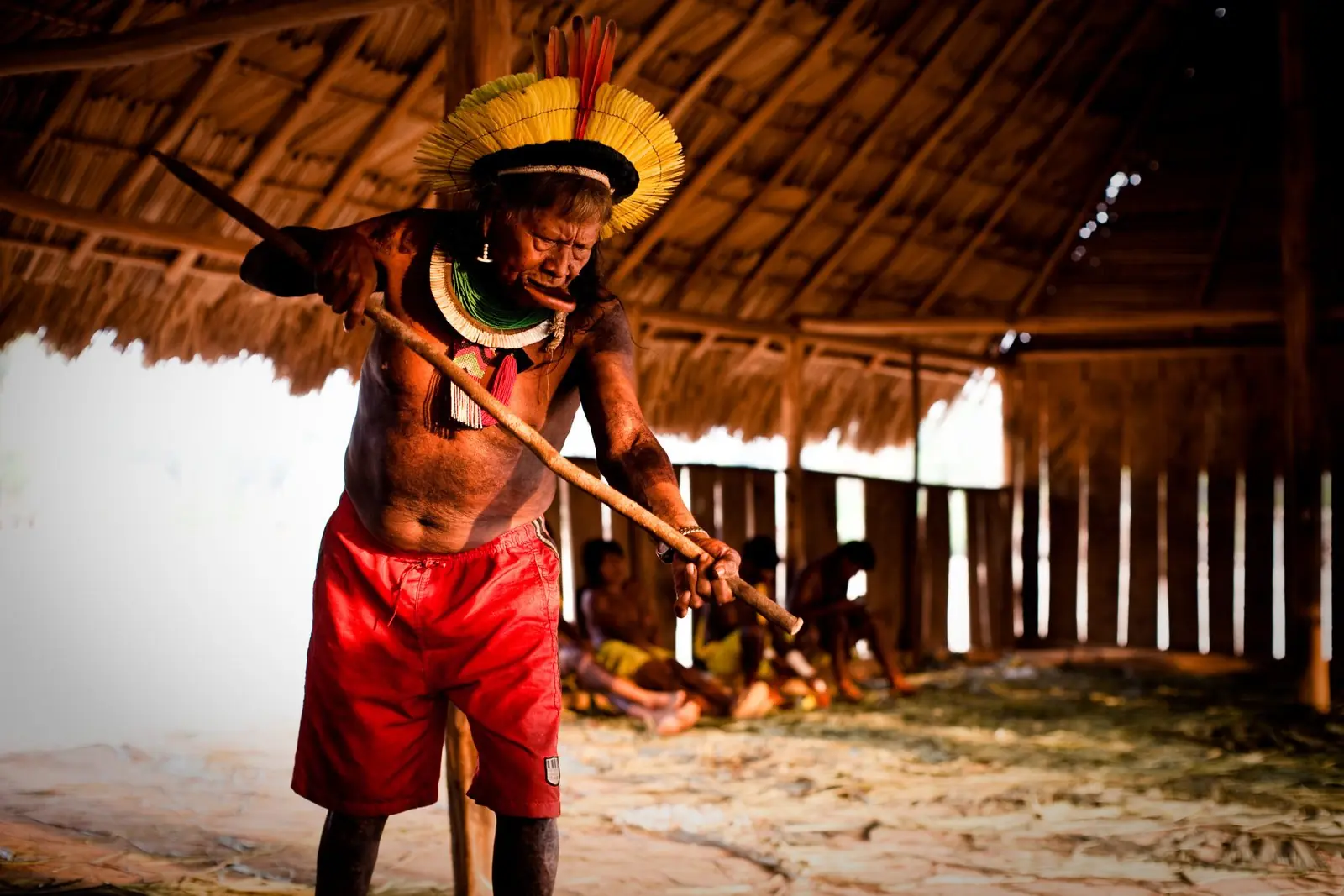
Women play a fundamental role in this territoriality, especially through their work in traditional agriculture, tending gardens, gathering, preparing food and organising ceremonial activities. Families use different parts of the territory in coordinated ways, according to the people’s own social organisation and practices.
The great Mẽbêngôkre ceremonies also require collective mobilisation, food preparation, gathering of natural materials and the participation of relatives from different villages, strengthening the bonds between territory, kinship and ceremonial life. The amount of land these activities need is directly related to the availability of preserved environments, the distribution of natural resources and the ability to move between different places of traditional occupation.
That is why the 362,243 hectares of Kapôt Nhĩnore are grounded in the Mẽbêngôkre’s own forms of territoriality and in the anthropological studies that identified the spaces needed for the people’s physical and cultural reproduction. Article 231 of the Federal Constitution requires that the identification of traditionally occupied lands take into account the uses, customs and traditions of each Indigenous people, including the areas needed for productive activities, for conserving environmental resources and for the continuity of their social and cultural organisation.
Applying this principle requires that boundaries be drawn from the historical and cultural relationships Indigenous peoples have built with the different environments that make up their lands. Kapôt Nhĩnore is part of an extensive network of territorial relationships built by the Mẽbêngôkre, Yudjá and other peoples over generations. Its demarcation will make it possible to restore movement, traditional use and protection of places that are fundamental to the continuity of their ways of life.
Forced displacement and the spread of non-Indigenous occupation
The history of the land dispute in Kapôt Nhĩnore is directly linked to the policies for occupying Central Brazil pursued by the Brazilian state from the first half of the 20th century. Initiatives such as the March to the West and the Roncador-Xingu Expedition intensified contact between state agents, colonisation fronts and the Indigenous peoples of the region. Between 1958 and 1960, Mẽbêngôkre Mẽtyktire families were moved from their traditional areas as a result of the contact and relocation policies the state was carrying out at the time.
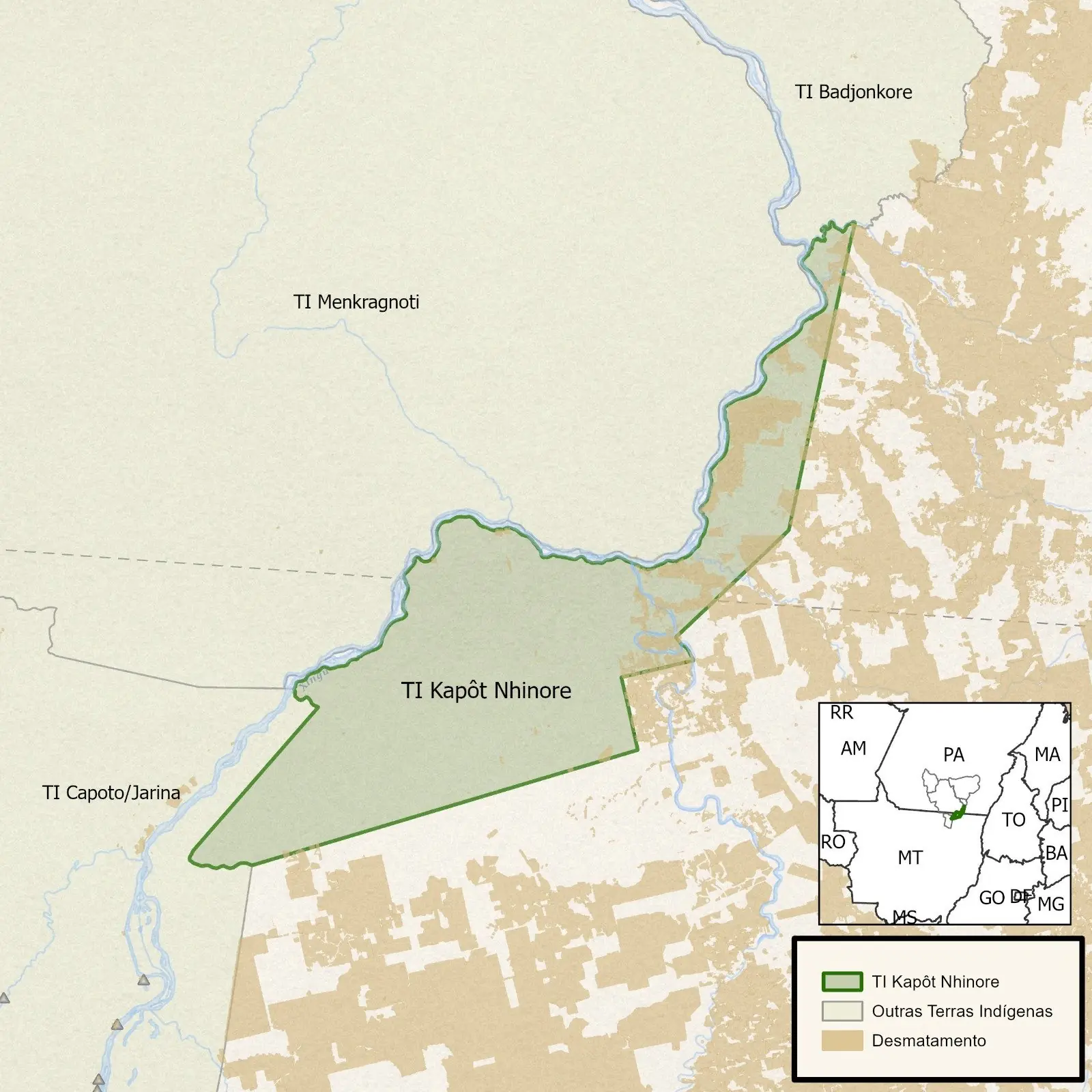
The later opening of roads, the expansion of colonisation projects and the growth of agribusiness led to rural properties being formed on former areas of Indigenous occupation. When the neighbouring Capoto/Jarina Indigenous Territory was regularised in the 1990s, Kapôt Nhĩnore was left outside its boundaries, prolonging the insecurity over the land. Chief Megaron Txucarramãe, Raoni’s nephew, recalls the changes of recent decades and denounces the advance of farming.
In the 60s, 70s, up to the 80s, there was no occupation of that land (by non-Indigenous people). It was from the 80s on that they began to invade the Kapôt Nhĩnore Indigenous Territory. And today we saw soy planters who cleared the Cerrado to plant soy. We were outraged.
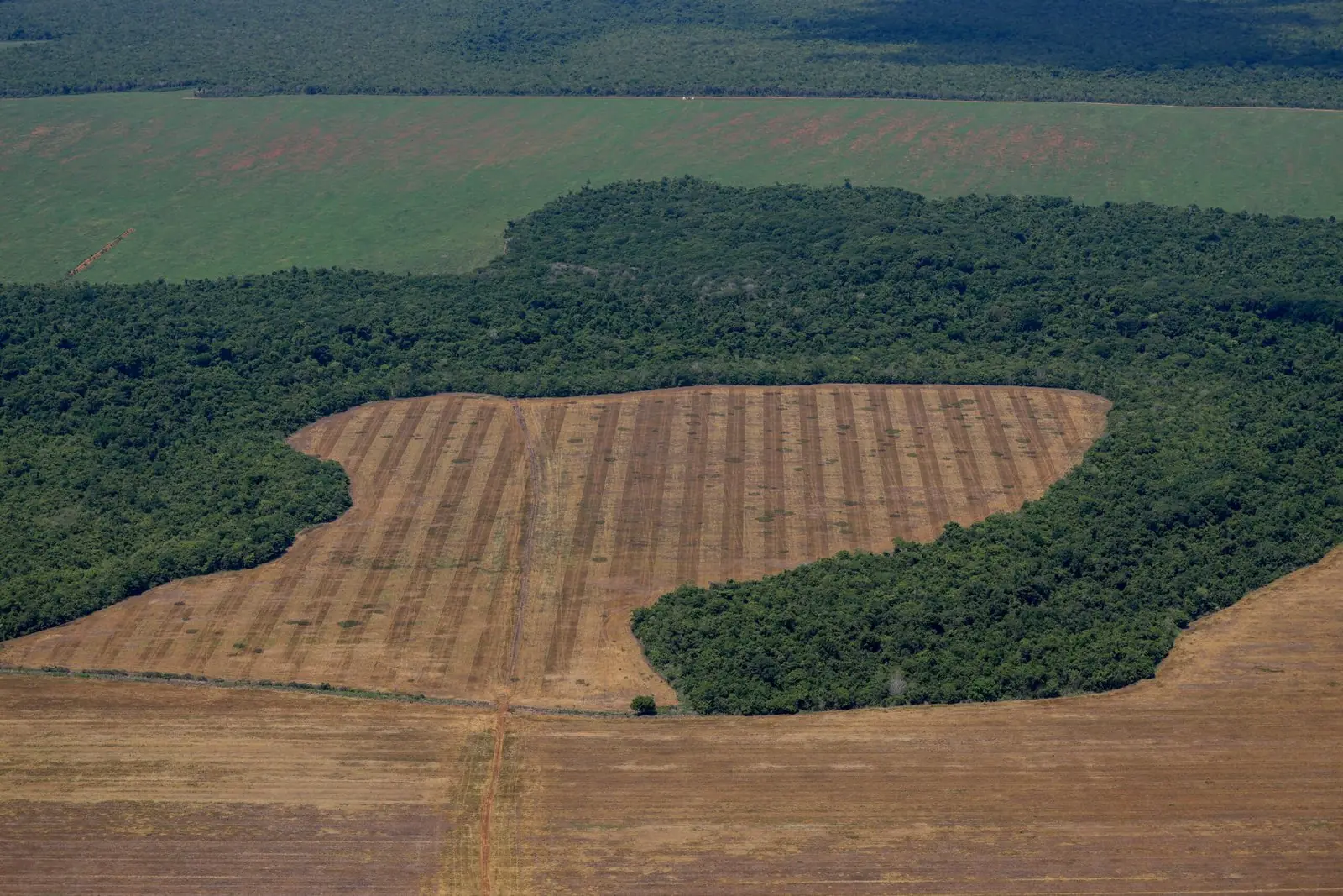
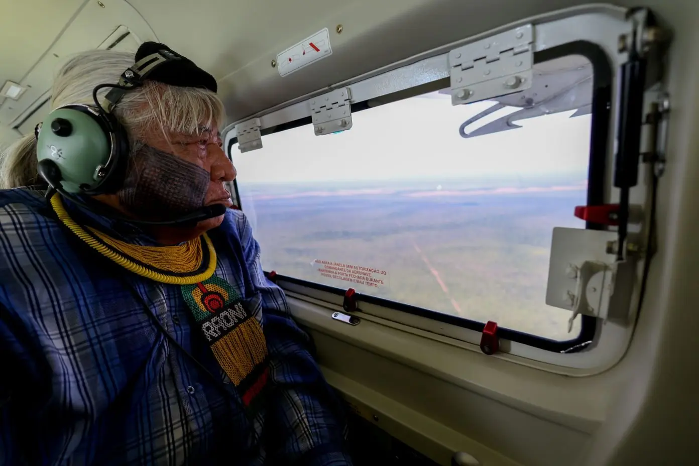
His testimony was recorded during an overflight carried out by Greenpeace Brazil in November 2026, when he joined the observation of environmental changes in the region. Megaron also describes the insecurity that keeps families from returning to their former places of occupation:
Kapôt Nhĩnore is traditionally occupied by the Mẽbêngôkre/Kayapo. And we want the government to demarcate it so that we can go back and occupy this land. For now we don’t go there because it’s dangerous, there’s a danger the invaders will react and we have no way of defending ourselves.
His words show how the completion of demarcation, guaranteed territorial security and the conditions for Mẽbêngôkre families to reoccupy their ancestral places are bound together. Historical violence, land conflicts and resistance from sectors linked to agribusiness form the backdrop against which Indigenous leaders have pressed their claims for decades.
Aldeia Pastana and the Yudjá people’s return to their land
The presence of the Yudjá people in Kapôt Nhĩnore is a fundamental part of the territory’s recent history of occupation and protection. From 2007, Yudjá families descended from Manoel Pastana began to settle on the banks of the Xingu River, with the consent and support of Mẽbêngôkre Mẽtyktire leaders. In 2009, Aldeia Pastana (Pastana village) was established, becoming a landmark of Indigenous reoccupation and permanent presence in the region. The initiative was built through cooperation between Yudjá and Mẽbêngôkre leaders, including chiefs Raoni Metuktire and Megaron Txucarramãe. The following year, the region hosted the Grito pelo Xingu (Cry for the Xingu) gathering, which brought together around 200 Indigenous people in defence of territorial recognition.
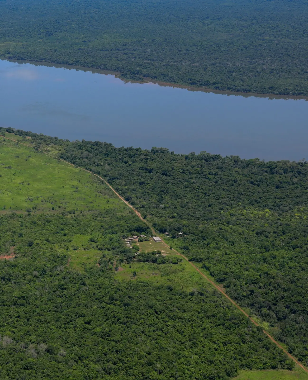
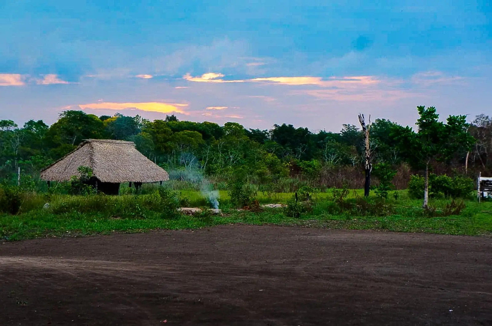
The community maintains traditional practices of farming, fishing, hunting and passing on knowledge tied to the environments of the Xingu basin. Aldeia Pastana is part of the history of resistance of the peoples who claim Kapôt Nhĩnore and plays a fundamental role in the continuity of Indigenous occupation in the region. Its presence also shows the importance of the alliance between the Mẽbêngôkre and the Yudjá in defending a shared territory, whose protection demands respect for the cultural, historical and organisational particularities of both peoples.
Decades of mobilisation leading to the Declaratory Ordinance
Chief Raoni Metuktire has called for the demarcation of Kapôt Nhĩnore since the 1980s. On 14 July 1996, he made the request formal in a letter to Funai, repeating it in 2001. In 2012, following a lawsuit brought by the Federal Public Prosecutor’s Office, the federal courts ordered the federal government and Funai to complete the studies needed to identify the territory. The surveys faced interruptions and resistance, including an episode in which a Funai technical team was intimidated in 2015.
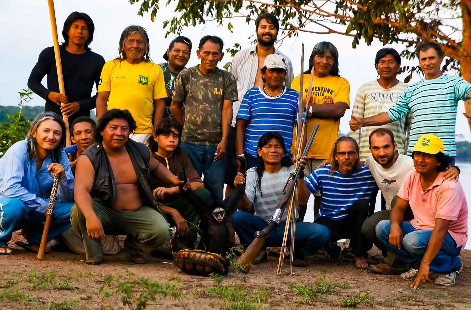
Only in July 2023 did Funai approve and publish the Detailed Identification and Delimitation Report, recognising the traditional occupation and setting the boundaries of the Indigenous Territory. Publication was followed by administrative challenges and lawsuits filed by parties seeking to keep their rural holdings.
In April 2026, during the Acampamento Terra Livre (Free Land Camp) in Brasília, Funai announced that it had finished reviewing the challenges, which the relevant technical and legal bodies found to be without merit. In October, the Federal Regional Court of the 1st Region confirmed that the administrative process could lawfully continue, rejecting an appeal by landowners who disputed traditional Indigenous occupation in parts of Santa Cruz do Xingu. The signing of the Declaratory Ordinance on 19 November is the result of this long path of claims, technical studies, Indigenous mobilisation and institutional action.
The long road to the ordinance
- 1958–1960Mẽbêngôkre Mẽtyktire families are moved out of their traditional areas under state contact and relocation policies.
- 1980sChief Raoni begins calling for the demarcation of Kapôt Nhĩnore.
- 1990sThe neighbouring Capoto/Jarina territory is regularised. Kapôt Nhĩnore is left outside its boundaries.
- 14 July 1996Raoni makes the claim formal in a letter to Funai, and repeats it in 2001.
- 2007–2009Yudjá families settle on the Xingu with Mẽtyktire support. Aldeia Pastana is founded in 2009.
- 2012After a lawsuit by federal prosecutors, a federal court orders the government and Funai to finish the studies.
- 2015A Funai technical team is intimidated while carrying out the surveys.
- July 2023Funai publishes the identification report, recognising traditional occupation and setting the boundaries.
- September 2023The Supreme Federal Court rejects the marco temporal (“time-frame”) thesis.
- April 2026At Acampamento Terra Livre, Funai rejects the landowners’ administrative challenges.
- October 2026The Federal Regional Court of the 1st Region confirms the process can continue.
- 19 November 2026The Declaratory Ordinance is signed at Instituto Raoni, in Peixoto de Azevedo.
- Still to comePhysical demarcation, presidential ratification and land registration.
For Megaron, completing the demarcation is a priority in the face of the pressures on the territory. In testimony recorded before the ordinance was signed, he said:
The Kapôt Nhĩnore land is our traditional occupation. As the demarcation process is already near the end, I hope the Lula government orders it demarcated this year to remove these soy planters, before this occupation of Kapôt Nhĩnore grows any further.
His demand expresses the urgency of securing permanent Indigenous possession and stopping non-Indigenous occupation from spreading over the spaces the communities traditionally use.
Original rights and the constitutional duty to demarcate
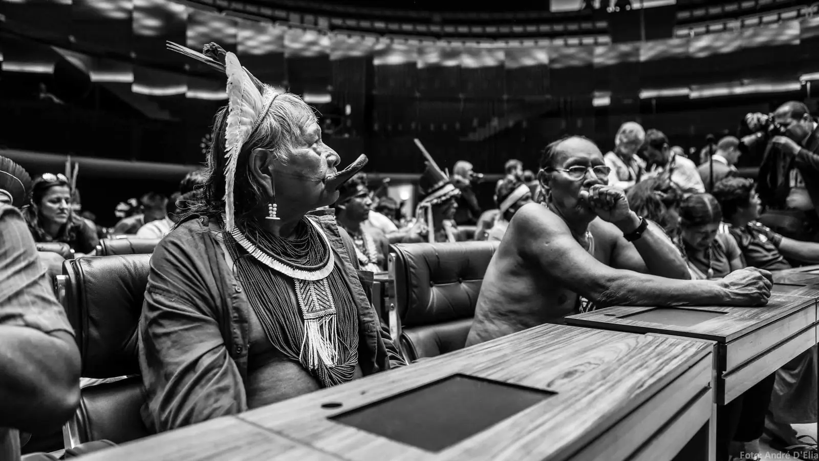
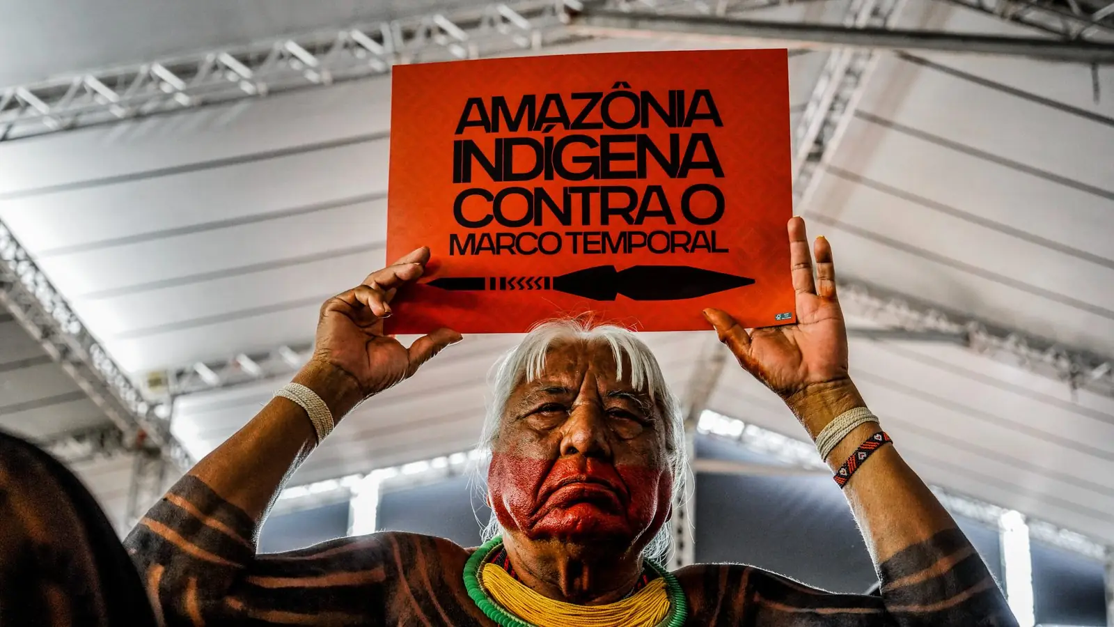
The recognition of Kapôt Nhĩnore is grounded in Article 231 of the 1988 Federal Constitution, which guarantees Indigenous peoples their original rights over the lands they traditionally occupy. The original nature of these rights means they exist before any administrative formalisation by the Brazilian state. Demarcation is declaratory: it identifies the boundaries of a traditional occupation whose history and territorial organisation belong to the Indigenous peoples themselves.
The Constitution establishes that traditionally occupied lands include the spaces of permanent habitation, productive activities, environmental preservation and physical and cultural reproduction, according to each people’s uses, customs and traditions. These criteria are especially relevant to the Mẽbêngôkre, whose territoriality involves movement between different environments, villages, gardens, camps and places of traditional activity.
In September 2023, the Supreme Federal Court rejected the marco temporal (“time-frame”) thesis, striking down the requirement that Indigenous peoples be physically present on their land on 5 October 1988 for it to be recognised. The decision is particularly important for peoples subjected to forced displacement and historical expulsion from their territories, as happened to Mẽbêngôkre families as colonisation fronts expanded.
Assessing traditional occupation requires taking these historical circumstances into account, along with the continuity of territorial relationships and the evidence produced by specialist anthropological studies. Property records and economic activities established later must be examined in the light of this constitutional regime of protection. The recognition of Kapôt Nhĩnore flows from the original rights of the Mẽbêngôkre and Yudjá peoples, whose prior presence underpins the state’s obligation to guarantee the demarcation and protection of the territory.
Deforestation and agricultural finance: the cost of delay
While the demarcation dragged on, Kapôt Nhĩnore went through intense environmental and land-ownership changes. According to the Ministry of Indigenous Peoples, accumulated deforestation in the territory grew from 4,178 hectares in 2000 to around 58,000 hectares in 2026. Despite the pressure, about 83% of the area still has forest cover.
What happened while the demarcation waited
Deforested by 2026Up from 4,178 hectares in 2000
Of pasture in 2025Plus 6,222 hectares of soy inside the territory
Rural registrations (CAR)Overlapping the territory, claiming 95.6% of its area, February 2026
Rural credit, 2023–2025To four overlapping properties; over R$ 12 million came after Funai’s study
In 18 loan contractsLinked to those properties since 2019, some due in 2033
Still forestedThe territory can still be protected
Sources: Ministry of Indigenous Peoples; Greenpeace Brazil, Bancando a Extinção (November 2026), using MapBiomas data.
The study Bancando a Extinção: Como o crédito rural intensifica conflitos em terras indígenas (Banking on Extinction: How rural credit intensifies conflicts on Indigenous lands), released by Greenpeace Brazil on 18 November, assesses the spread of agribusiness and the financing granted to properties overlapping the territory. Using MapBiomas data, it found 41,128 hectares of pasture and 6,222 hectares of soy inside the boundaries of Kapôt Nhĩnore in 2025.
By the study’s criteria, the Indigenous Territory ranks fourth in Brazil for area of pasture and tenth for area of soy.
In February 2026, 259 properties registered in the Rural Environmental Registry (CAR) were found to overlap the territory partly or entirely. Together, the areas declared in these registrations amounted to 95.6% of its extent. Because the CAR is self-declared and is not a property title, these figures show the scale of the land claims registered by third parties and call for review by the responsible authorities.
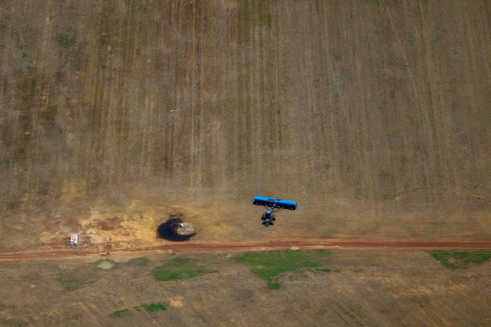
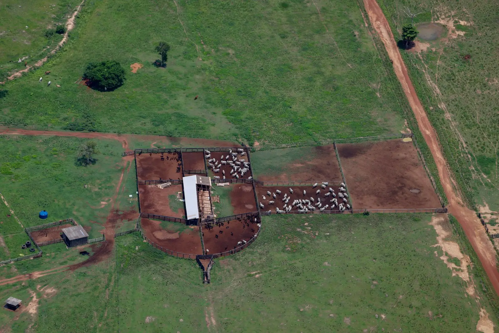
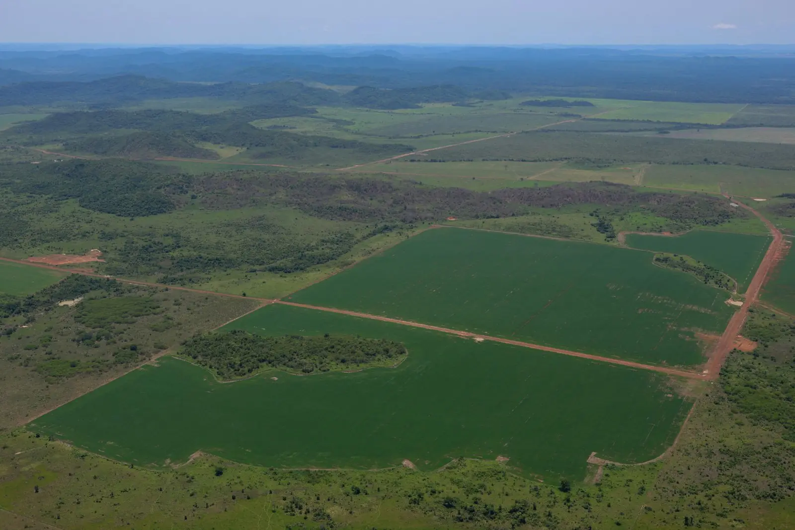
Overflight of Kapôt Nhĩnore Indigenous Territory, between Mato Grosso and Pará, 9 November 2026. Photo: Michael Dantas/Greenpeace
The growth of agribusiness is also tied to the regional economy, which brings together rural properties, grain storage facilities, slaughterhouses and financial institutions. According to Greenpeace, within 360 kilometres of Aldeia Pastana there are 311 soy storage units registered with the National Supply Company (Conab) and 11 slaughterhouses. The proximity of these facilities shows how the region is integrated into large-scale supply chains, although it does not, on its own, prove commercial links between each facility and the farms investigated.
The research also identified more than R$ 25 million in rural credit granted between March 2023 and May 2025 to four properties overlapping Kapôt Nhĩnore, with more than R$ 12 million released after Funai published its territorial identification studies.
Taking into account operations since 2019, the financing linked to the properties analysed totals R$ 48.3 million across 18 contracts. Some of these loans fall due in 2033, showing continued agribusiness investment in areas whose occupation is the subject of a land dispute.
The study also identified cases that call for investigation into compliance with the social and environmental rules on financing. Among them is Fazenda Gamela, which received almost R$ 10 million from Banco do Brasil in 2023 and had 153.25 hectares embargoed by Ibama, Brazil’s environmental agency, the following year for destroying native forest. The legality of these operations must be examined by the financial institutions and the competent authorities, in light of environmental obligations and the requirements of the rural credit system, whose manual should prevent credit from going to invaders of Indigenous lands at any stage of demarcation.
Stopping the financing of occupations on Indigenous lands
Greenpeace’s findings expose a significant gap in the regulation of Brazilian agricultural finance. The Rural Credit Manual (MCR), regulated by the National Monetary Council and the Central Bank, sets specific restrictions for projects located on Indigenous lands that are ratified, regularised or classified as Indigenous Reserves.
The rules do not yet expressly cover delimited and declared lands, even when their boundaries have already been recognised by Funai. This gap allows farming by non-Indigenous occupants to keep accessing finance during important stages of demarcation, as long as other legal requirements are met.
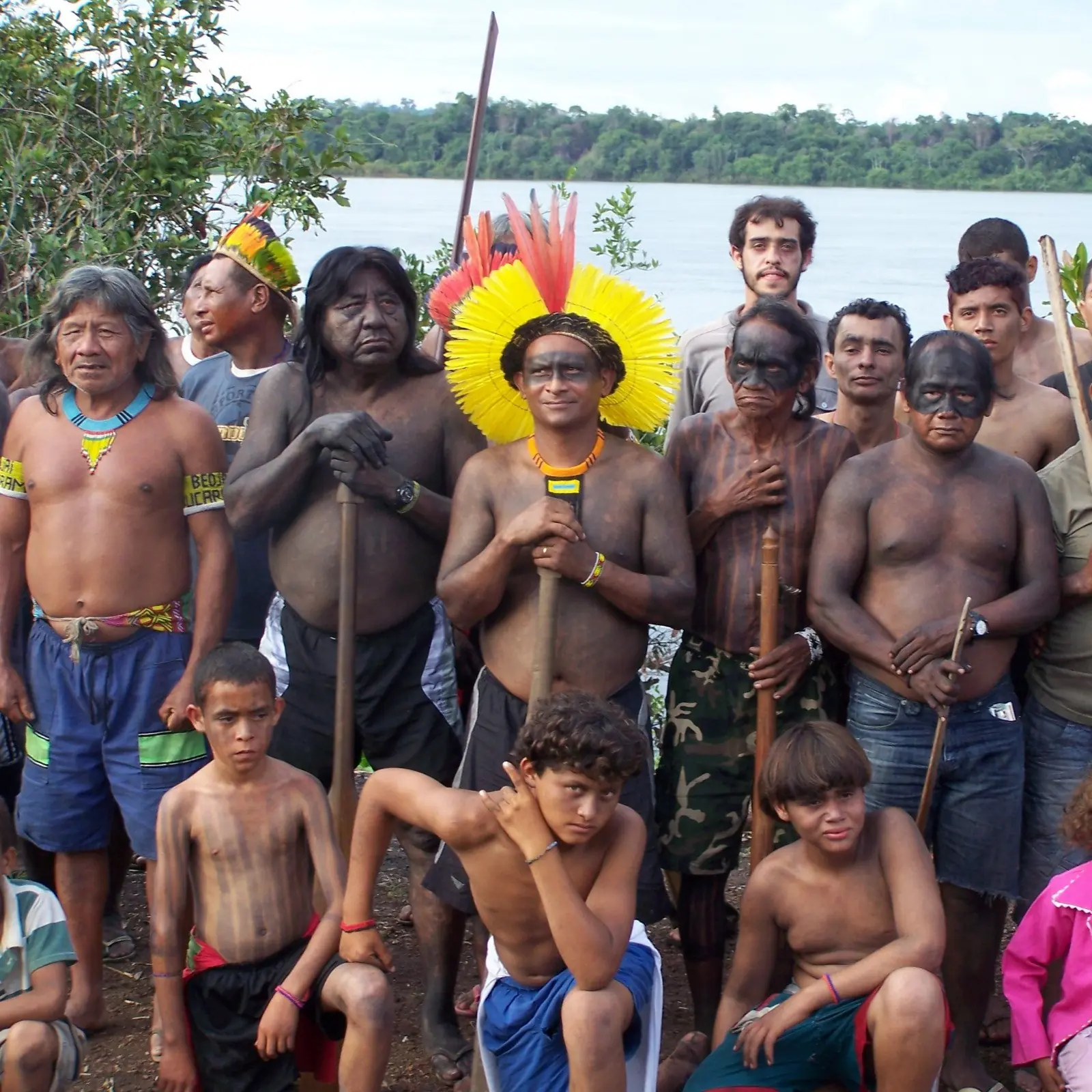
Greenpeace found a similar situation on other Amazonian Indigenous lands. Between January 2023 and August 2026, 23 properties overlapping eight Indigenous territories received R$ 39.7 million in rural credit. Around 97% of that went to properties in delimited territories. Kapôt Nhĩnore shows the need to bring the rules of the financial system into line with the constitutional recognition of Indigenous land rights.
Compensation and the question of occupants’ good faith
Completing the demarcation also raises land challenges tied to the non-Indigenous occupations that exist in Kapôt Nhĩnore. One of the most contested points in Brazilian case law concerns whether private parties can be compensated for the value of the bare land, in addition to necessary and useful improvements made in good faith, in the specific cases recognised by the Supreme Federal Court. Article 231, paragraph 6, of the Federal Constitution declares null and void any acts of occupation, ownership and possession of traditionally Indigenous lands, except for compensation for improvements resulting from good-faith occupation. However, in ruling on Theme 1,031, the Supreme Court also allowed, under specific requirements, compensation for bare land to private parties holding just title and good-faith possession, where resettlement is not feasible.
This interpretation raises questions about the relationship between protecting original rights and recognising property claims arising from later occupations. If Indigenous land rights predate the formation of private property, how should we judge the good faith of occupants who acquired land, exploited it economically or invested in areas whose Indigenous claim was public and documented? In Kapôt Nhĩnore, this question must take into account how old the claims are, the historical processes of Indigenous displacement and the wide publicity of the demarcation process.
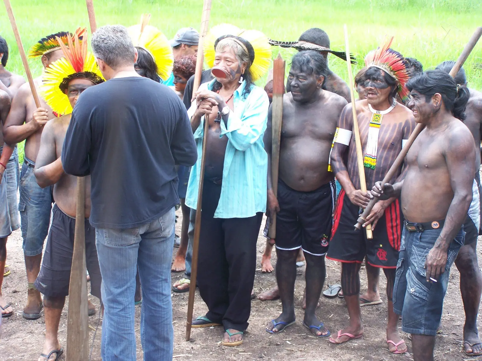
Raoni formalised the claim in 1996; it became the subject of a court order in 2012, and its boundaries were recognised by Funai in 2023. Property records, environmental registrations and financing contracts do not automatically prove an occupant’s good faith. The assessment must consider the circumstances of acquisition, the information available about the territorial dispute, any conflicts and the legal criteria applicable to each case. The debate takes on an economic dimension given the continued flow of agricultural finance.
Money spent expanding infrastructure and making productive improvements could later be presented as compensable improvements, although whether it actually qualifies depends on the nature of the work and the legal conditions under which it was carried out. Administrative delay can therefore make land regularisation more complex and generate new property claims against the state. For Instituto Raoni, compensation criteria must take into account the history of Indigenous occupation, the state’s responsibility for the displacements and the need to prevent bad-faith situations from yielding undue economic advantage.
The possibility of compensation for bare land, accepted by the Supreme Federal Court in certain circumstances, calls for critical reflection on whether it is compatible with the original nature of Indigenous land rights. The legitimacy of compensating for land whose traditional occupation predates private property must be questioned, especially where there has been forced displacement, contested occupation and decades of state inaction. Protecting the rights of the Mẽbêngôkre and Yudjá peoples must guide a review of these compensation criteria, so that the economic value of later occupations does not jeopardise completion of the demarcation and the effective return of their ancestral territory.
The Declaratory Ordinance sets a limit on good faith and could curb agribusiness expansion
Among the most significant legal effects of the Declaratory Ordinance for Kapôt Nhĩnore is that it sets a time limit for recognising the good faith of non-Indigenous occupations. From the date of publication, new improvements made by occupants who have lost good-faith status are, as a rule, no longer eligible for compensation from the federal government.
This understanding is supported by Funai Normative Instruction No. 2/2012 and by Supreme Federal Court case law. The regulation establishes that publication of the Declaratory Ordinance is the final milestone for establishing good faith, except where good faith had already been ruled out earlier.
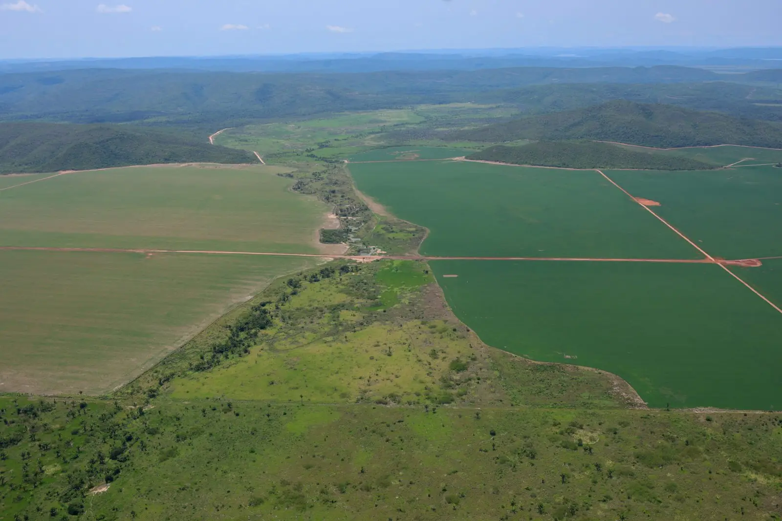
In Kapôt Nhĩnore, this effect is especially important given the spread of pasture, soy fields and other agribusiness infrastructure over areas of traditional Indigenous occupation. Official recognition of the boundaries creates a legal reference point to stop new investments by non-Indigenous occupants from later being presented as compensable improvements.
The measure could help discourage the clearing of new areas, the expansion of pasture and the building of agribusiness infrastructure, reducing the economic incentives to keep occupying and transforming the territory’s environment.
How effective this mechanism is, however, depends on the agencies responsible for environmental enforcement, for monitoring occupations and for completing the demarcation. It also requires financial institutions to take the territorial recognition into account in their risk analyses, avoiding credit for activities that could further degrade traditionally Indigenous lands.
The Attorney General’s Office commits to securing effective possession of Kapôt Nhĩnore
During the signing ceremony for the Declaratory Ordinance of the Kapôt Nhĩnore Indigenous Territory, held on 19 November 2026 in Peixoto de Azevedo, Mato Grosso, Attorney General Jorge Messias reaffirmed the federal government’s commitment to completing the demarcation and guaranteeing effective possession of the territory to the Mẽbêngôkre and Yudjá peoples. In his speech, he stressed that the work of the Attorney General’s Office (AGU) will be essential to ensure the administrative procedures continue, to face any legal obstacles and to guarantee the land rights established by the Federal Constitution.
Greeting President Lula, Chief Megaron Txucarramãe and the authorities present, Messias explained that he was attending the ceremony on the President’s instructions, so that the AGU would follow through on the rights recognised by the Declaratory Ordinance.
I am here as Attorney General because President Lula asked that we, as the Union’s lawyers, make sure that this Indigenous Territory, now recognised by the minister’s ordinance, is effectively handed over into the possession of all the Indigenous people here.
The Attorney General stressed the need to make the administrative measures of territorial recognition effective, given the history of legal disputes that often drag out demarcation and hinder the exercise of Indigenous rights.
No longer like what happened in the past, under other governments, when they signed the ordinance, signed a decree, and then the courts came, other people came, and took that right away.
In his remarks, Messias said the federal government’s commitment includes concrete measures to guarantee that Indigenous peoples can exercise their land rights:
The commitment of President Lula’s government is not just to sign the ordinance. It is to deliver rights and to deliver possession, and to make sure all of you truly have access to what the ordinance has guaranteed.
The statement carries special weight for Kapôt Nhĩnore, whose demarcation has faced repeated interruptions, administrative challenges and lawsuits while agribusiness properties spread over areas identified as traditionally occupied by Indigenous peoples. Turning to next steps, the Attorney General said the AGU will work together with the Ministry of Justice and Public Security, the Ministry of Indigenous Peoples and the General Secretariat of the Presidency to follow the procedures needed to complete the demarcation.
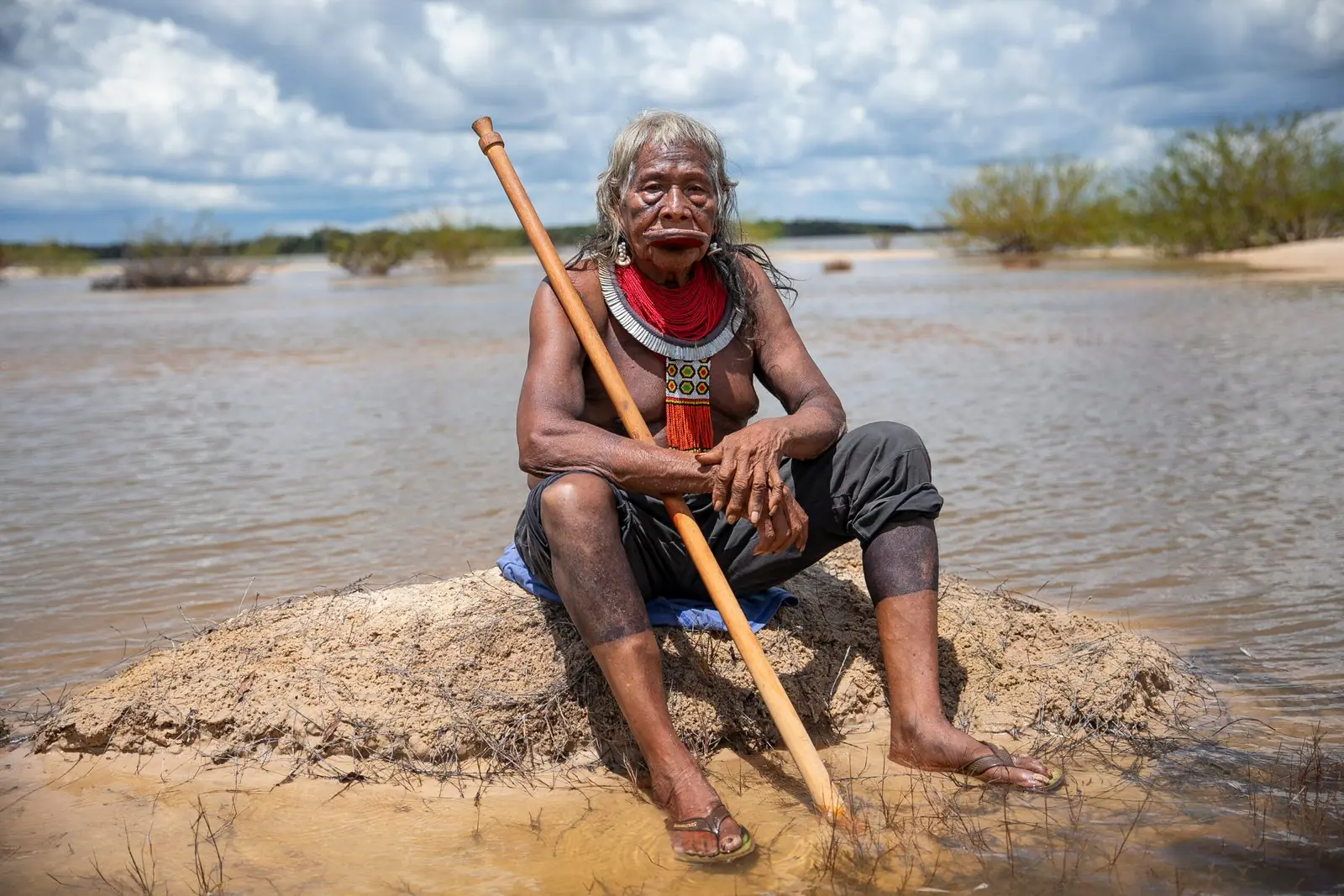
According to Messias, this work should include preventing new legal obstacles and maintaining dialogue with the judiciary and with non-Indigenous occupants.
Our role, together with the Minister of Justice, the Minister of Indigenous Peoples and the General Secretariat of the Presidency, is to keep taking care of every detail of the demarcation process, so that there is no obstruction of any kind, so that no judge comes along with an injunction taking away a right that has been won.
Messias also said the federal government intends to carry out this process through institutional dialogue and coordinated action by public bodies, with the aim of guaranteeing Indigenous possession and avoiding violence.
We will talk to the judiciary, we will keep talking to the people who are occupying peacefully, but with the strength of the Brazilian state we will guarantee the rights of Indigenous peoples, as Article 231 of the Federal Constitution sets out.
His reference to Article 231 came with remarks on the AGU’s work defending original rights and opposing the marco temporal thesis, rejected by the Supreme Federal Court in September 2023.
That is why we fought against the marco temporal, that is why we fought for the rights of Indigenous peoples, starting from what was set down in the Federal Constitution. That is President Lula’s commitment, which I would now like to reiterate to you.
Closing his speech, Messias addressed the Indigenous leaders again, assuring them that the AGU will remain mobilised so that the measures flowing from the Declaratory Ordinance are implemented with legal certainty, speed and respect for the communities’ rights.
Count on the Attorney General’s Office, together with the other ministries, so that all these rights that have now been guaranteed, Chief, will certainly reach the quickest, safest, most peaceful and calm outcome, so that all the Indigenous peoples here can truly enjoy their right to the land without any kind of violence, without any kind of aggression.
The speech sets out a public commitment by the Attorney General’s Office to make the demarcation of Kapôt Nhĩnore a reality. For the Mẽbêngôkre and Yudjá peoples, who have claimed the territory for decades and live with the effects of agribusiness expansion and land conflict, the action announced must be followed by concrete steps that ensure the remaining stages of demarcation are completed, communities are protected and their original rights are fully exercised.
The speech also reinforces the Brazilian state’s responsibility to tackle the administrative and legal obstacles that have historically drawn out the recognition of Kapôt Nhĩnore, ensuring that the victory of the Declaratory Ordinance carries through to the effective guarantee of permanent Indigenous possession.
Raoni’s victory and the commitments that remain
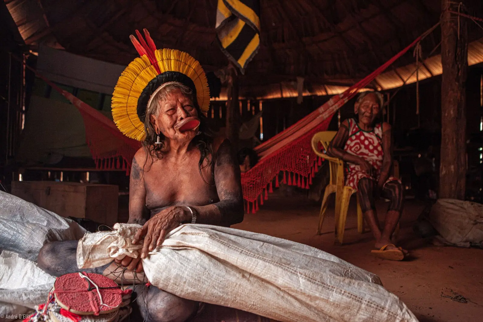
The signing of the Declaratory Ordinance is a historic moment in the life of Chief Raoni Metuktire, whose political work for Indigenous rights gained national and international prominence from the 1970s and 1980s. Raoni took part in major alliances for the demarcation of Indigenous lands and the protection of the Amazon, including international campaigns alongside the British musician Sting.
His work helped bring visibility to Indigenous peoples’ demands and established him as one of Brazil’s foremost Indigenous leaders. Throughout these decades, Kapôt Nhĩnore remained among his main demands, shared with his family, Mẽbêngôkre leaders and Yudjá communities.
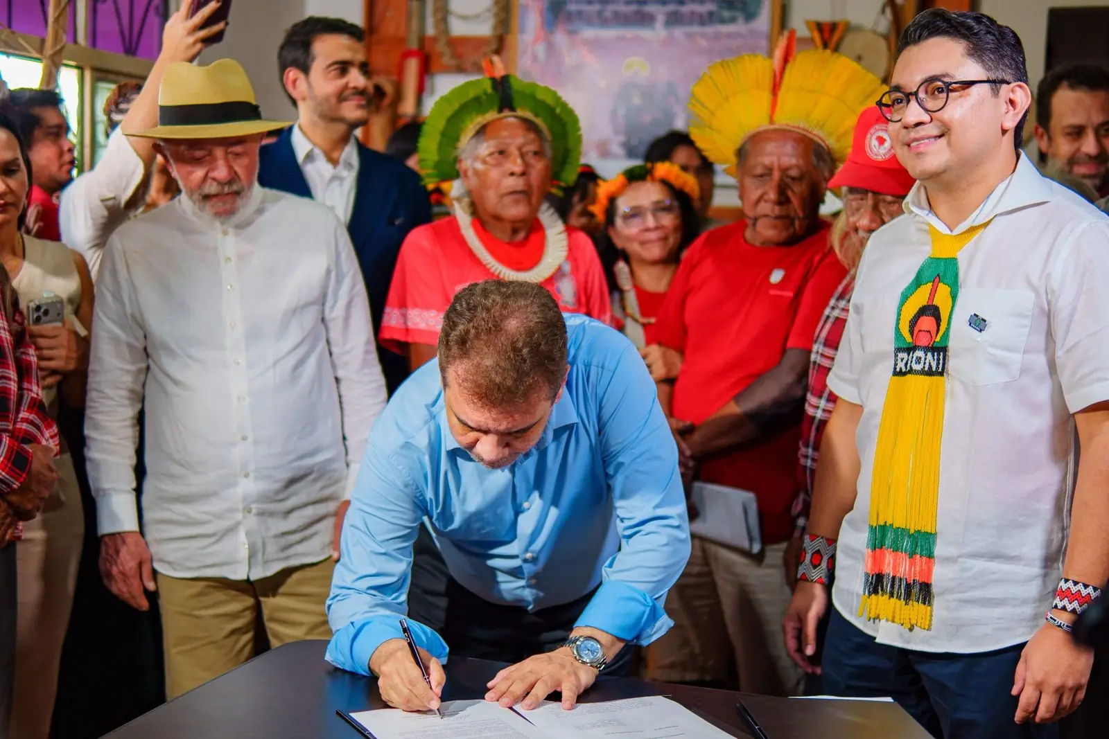
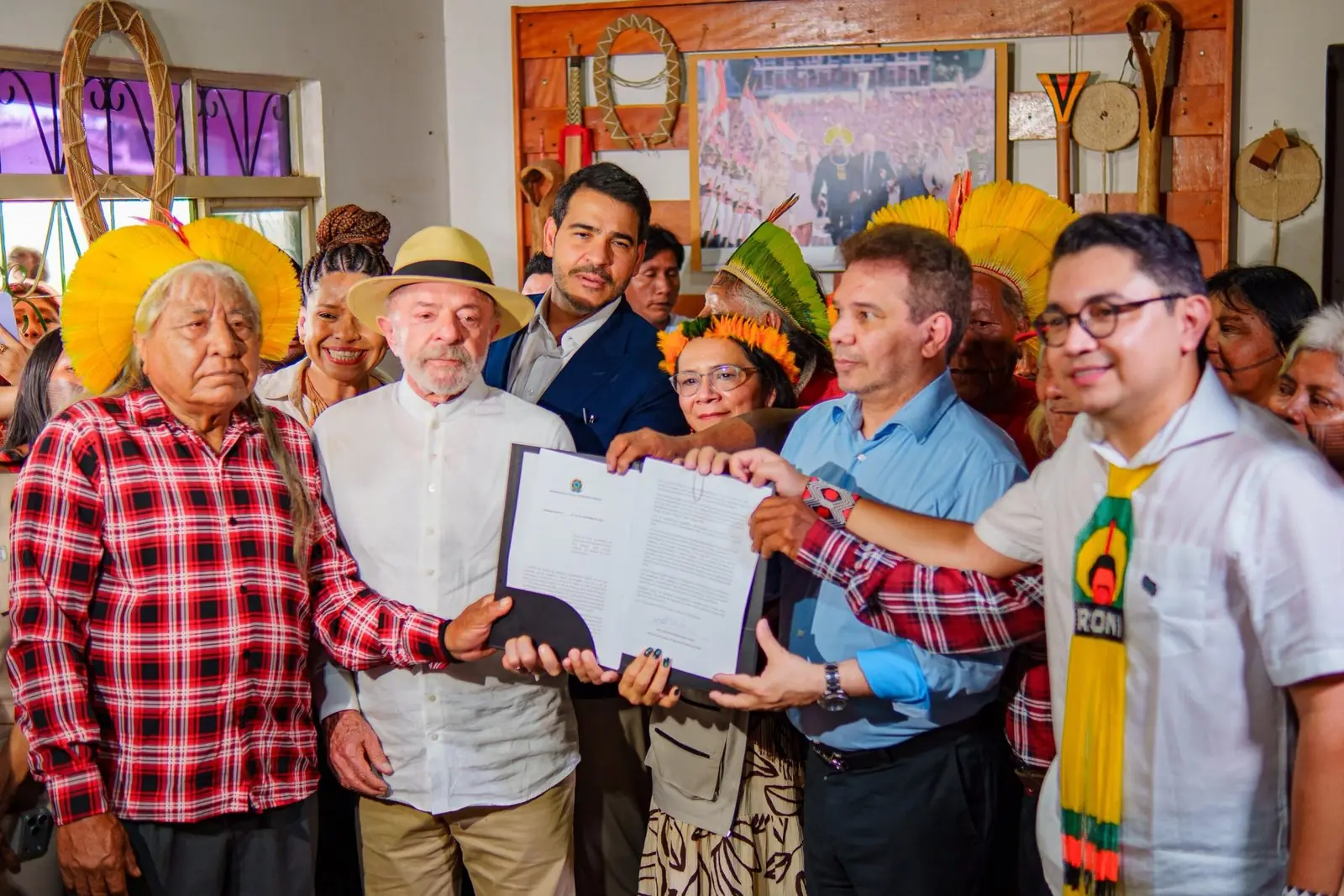
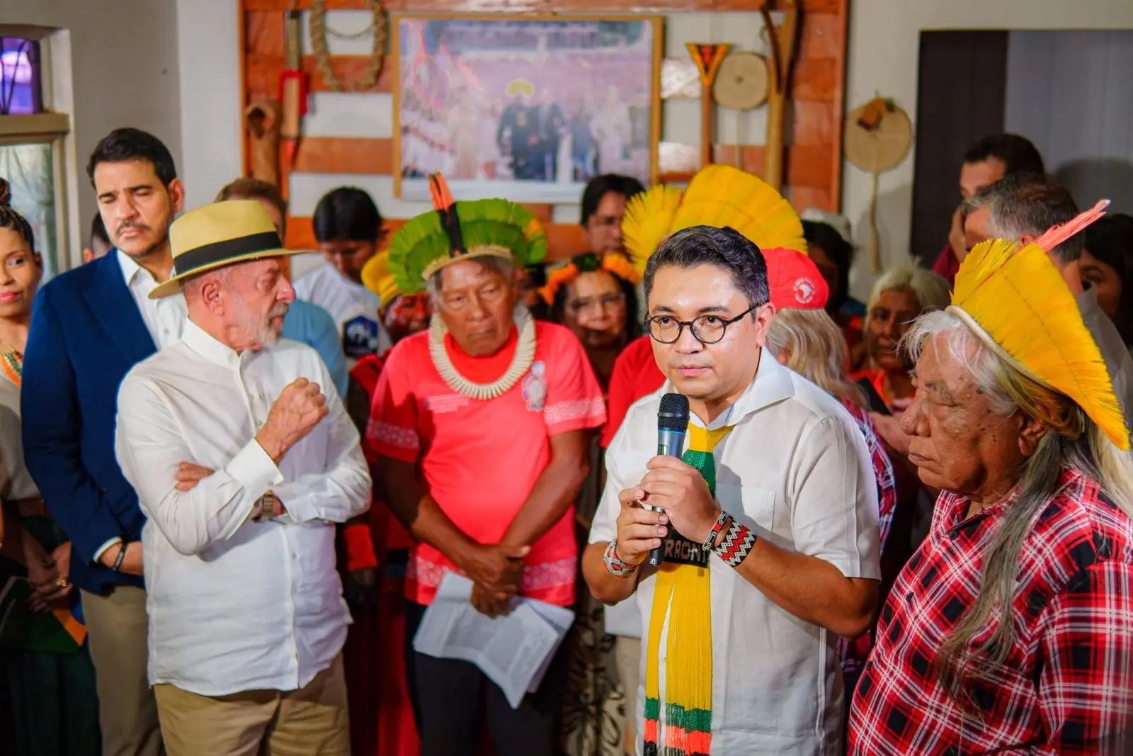
The signing of the Declaratory Ordinance, Instituto Raoni, 19 November 2026. Photos: @oguajajara
President Lula’s visit and the signing of the Declaratory Ordinance amount to institutional recognition of this life’s work and the advance of a historic demand that spanned several governments. The victory also brings new responsibilities for the Brazilian state. Completing the demarcation will require physical demarcation, presidential ratification, the relevant registrations and the land regularisation measures needed to guarantee permanent Indigenous possession.
Effective protection of Kapôt Nhĩnore will also depend on environmental enforcement, conflict prevention and public policies able to strengthen Indigenous peoples’ autonomy and territorial management. The next stages must take into account the particularities of Mẽbêngôkre territoriality, including the spaces needed for traditional mobility, ceremonies, productive activities and the continuity of relationships between villages and family groups.
The participation of the Mẽbêngôkre and Yudjá communities will be essential to ensure that territorial protection reflects their priorities, their knowledge and their own forms of organisation.
The story of Kapôt Nhĩnore shows the consequences of administrative delay for territories under land disputes and economic pressure. The testimony of Indigenous leaders shows their enduring bonds with the land, their experiences of displacement and their commitment to future generations.
As Megaron Txucarramãe said during the mobilisation for demarcation, calling on the federal government to act:
I want to ask everyone in the government, the Ministry of Indigenous Peoples, Funai, the Ministry of Justice, to hurry up the demarcation of Kapôt Nhĩnore.
The Declaratory Ordinance fulfils a fundamental stage of this demand and sets the administrative conditions for moving forward with territorial recognition. The victory of Kapôt Nhĩnore belongs to the collective history of the Mẽbêngôkre and Yudjá peoples, built by generations who kept their relationship with the territory and demanded that their original rights be respected.
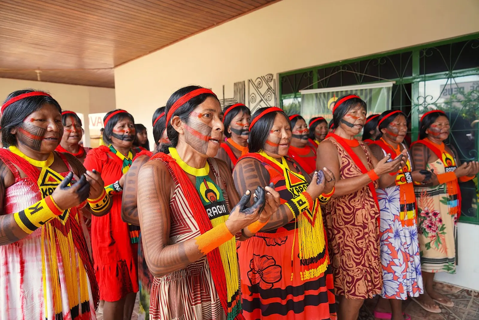
Originally published by Instituto Raoni
This story was written by our partners at Instituto Raoni and first published in Portuguese on 21 November 2026.
Read it in PortugueseStand with the Kayapo in defending their territory
The Kayapo protect more than 9 million hectares of Amazon forest. Your support keeps their guard posts, patrols and expeditions running.
Donate

New York Climate Week 2026
As world leaders gathered in New York City for the UN General Assembly, Climate Week unfolded as a vital global stage for confronting our planet’s most urgent environmental crises. From September 20–24, 2026, The Kayapo Project team was on the ground to ensure Indigenous guardians had a voice in shaping the future of Amazon conservation. Represented by Patkore Kayapo and Thiago Schinaider from the Associação Floresta Protegida, alongside Matthew Aruch from Biome Conservation, our delegation set out with a clear mission: deepen existing relationships, expand our partner network, and elevate Indigenous-led climate action.
Deepening Relationships
Our week kicked off at the Doris Duke Foundation’s Treehouse space with an insightful panel hosted by Mongabay, titled Reinforcing the Invisible Infrastructure for Forest Conservation. The event brought together key voices across global conservation, including leaders from:
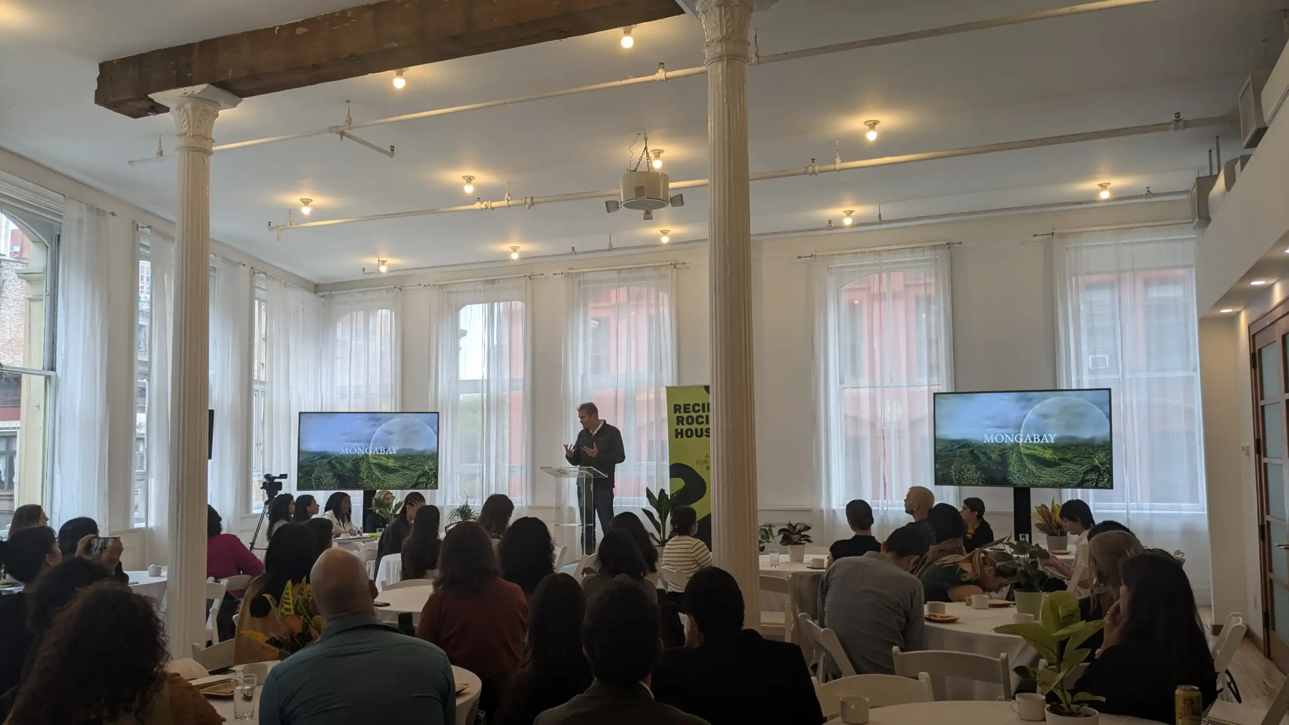
Mongabay’s panel at the Reciprocity House
During the session, we reconnected with allies from Amazon Watch and the Rainforest Foundation US to exchange strategic ideas on forest preservation across Brazil.
We met the Goals House team at COP 30 in Belem and were invited to attend a series of events at the Goals House at the Tavern on the Green in Central Park. The Qatar Foundation sponsored our first Goals house event on traditional knowledge in today’s world called: Tradition Meets Tomorrow. Later, we attended a networking event at the Goals House featuring Indigenous DJ, film producer, and activist Eric Terena.
Building on last year’s panel with the Prince Albert of Monaco Foundation, The Kayapo Project was invited to join events at the Reciprocity House, a celebration of partnership and collectivity, hosted by Tenure Facility, Woodwell Climate Research Center, Pawanka Fund, and Health In Harmony. We attended an event entitled What’s the Reciprocity Story You Want to Tell? Including a lineup of guest speakers from organizations such as Atmos, If Not Us Then Who, Mongabay, Health In Harmony, Woodwell Climate Research Center, Chilli Club, and Tenure Facility.
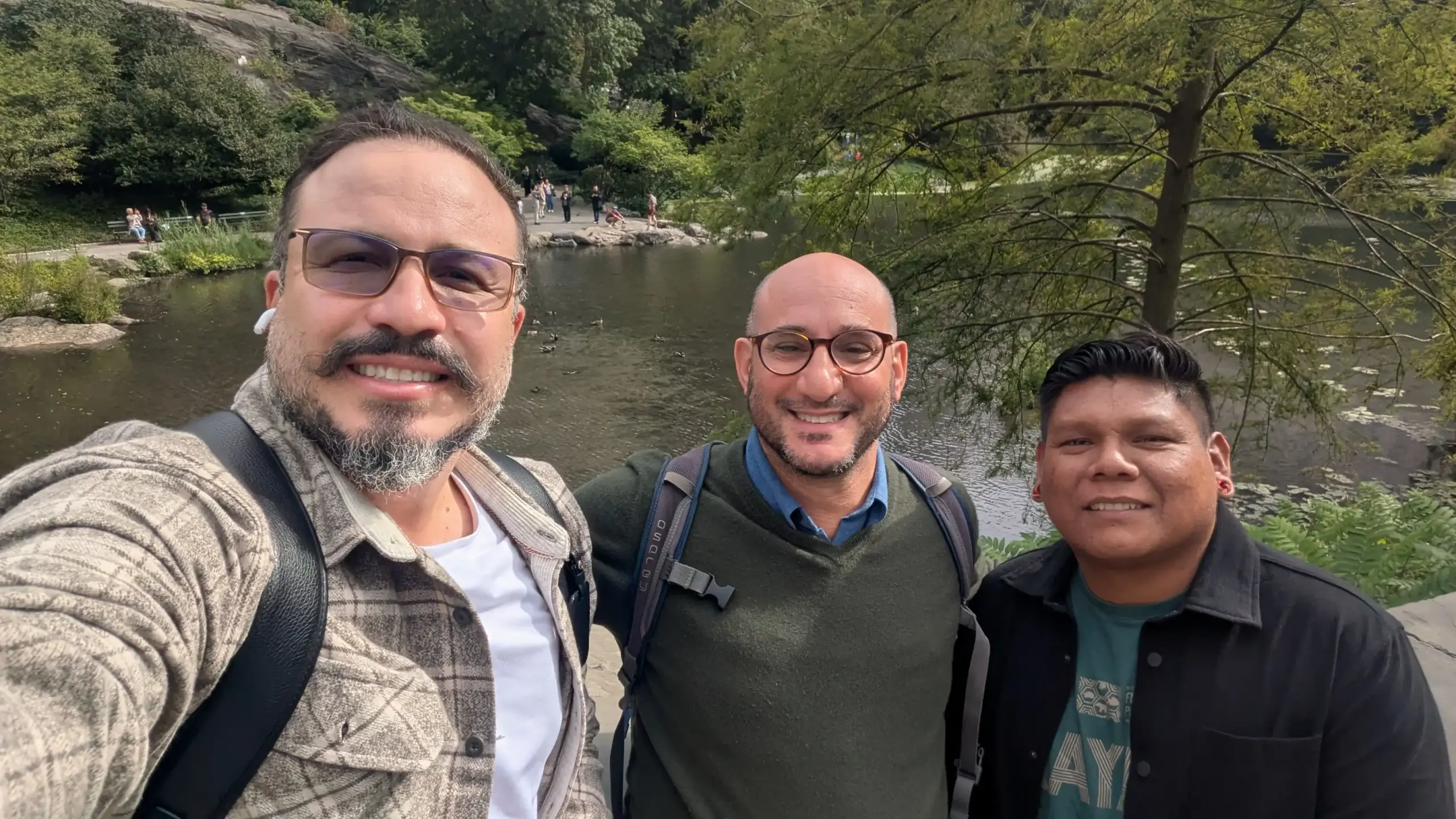
Thiago, Matthew and Patkore in Central Park.
Expanding Our Network
NY Climate Week is an incredible opportunity to meet and engage with new colleagues and partners. Patkore, Thiago, and were invited to discuss Indigenous finance solutions at the Global South House, sponsored by the Brazil Foundation. The event, featuring Alianza Socioambiental Fondos del Sur and Comua : Who gets to fund the future? Brought peers to discuss how funding can become more just and effective for the communities in the Global South already leading solutions for climate and nature?
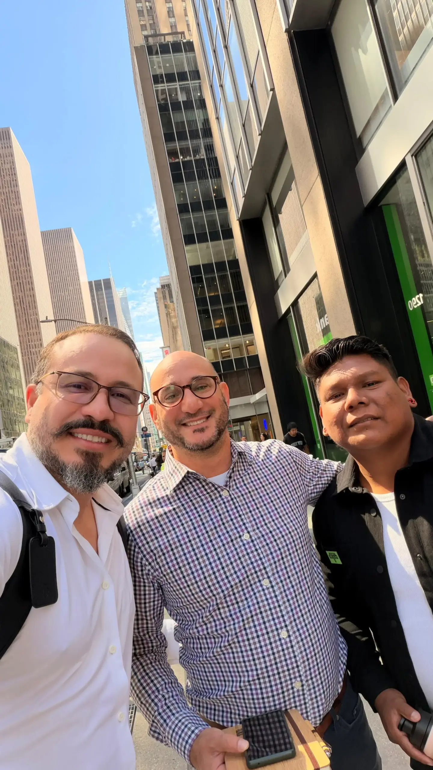
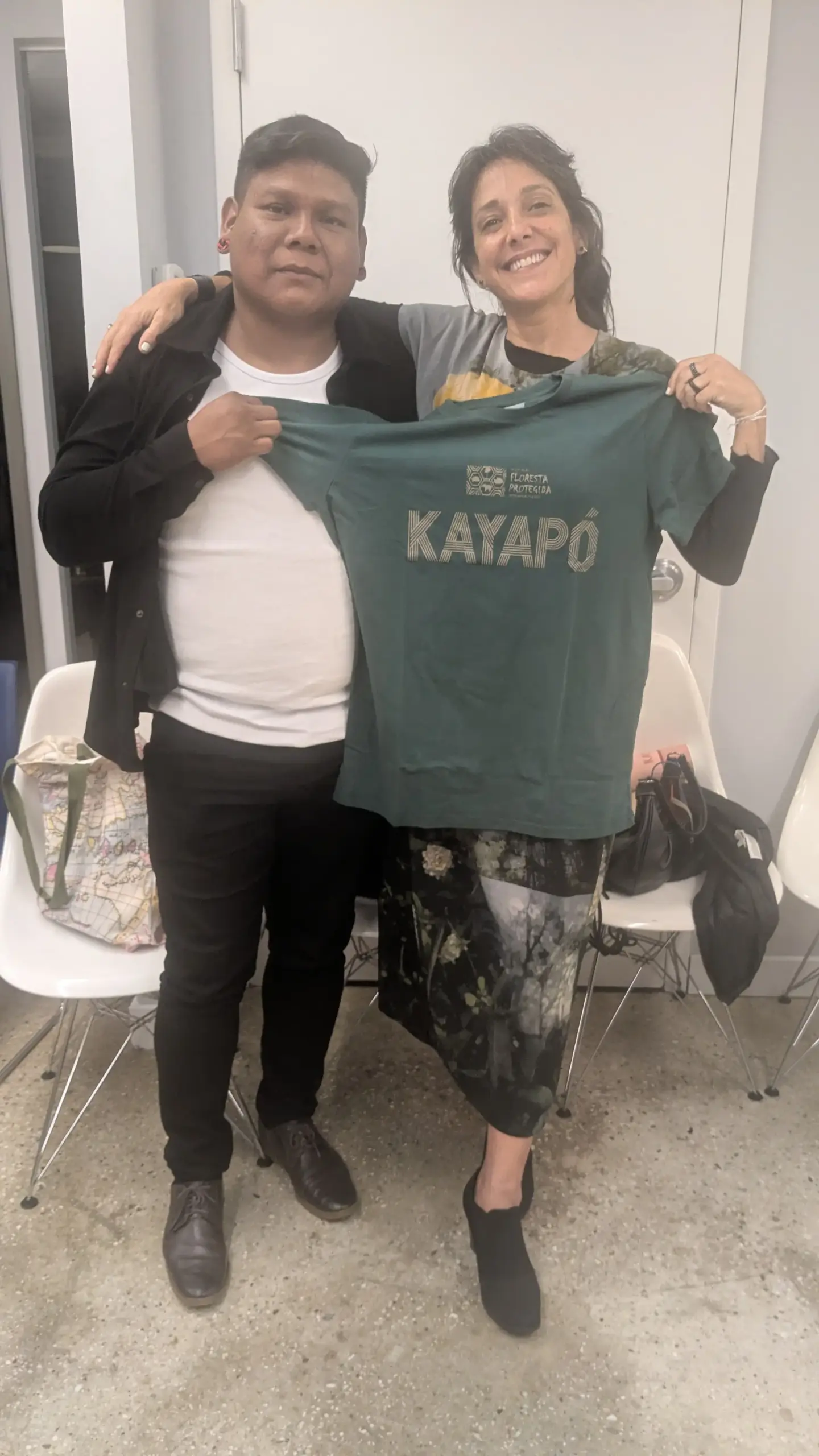
Daniela, Patkore, Thiago and Matt at the Global South House
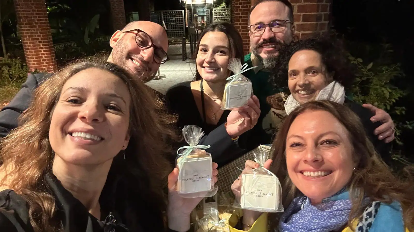
Our delegation was also honored to attend the Thomas E. Lovejoy Award Ceremony and Reception, co-hosted by a coalition of leading environmental organizations:
Thomas E. Lovejoy Award · Co-hosts
GEF
WCS
WWF
This year’s prestigious prize was awarded to renowned Brazilian scientist Carlos Nobre for his lifelong dedication to Amazon science. The evening provided a wonderful setting to reconnect with longtime friends and forge new partnerships.

The Thomas E. Lovejoy Award Ceremony and Reception.
Indigenous Solutions for Climate Action
While networking and socializing was a big part of the week’s activities, we also participated in several important events and conversations about Indigenous and community-led solutions for access to nature-based finance and territorial monitoring.
Carbon Financing from the Bottom Up
Everland and The Wildlife Conservation Society convened an invite-only dialogue of Indigenous, conservation, finance and market leaders to explore how to build carbon projects from the ground up. The focus was on how to bridge the systemic gap in forest finance that brings projects from their concept phase to market and how catalytic and institutional capital can work together to bring high-impact, community-led forest conservation to scale. The dialogue emphasized the need for resource inputs at the initial stages to ensure compliance and mitigate risk for project viability and sustainability.

Patkore and Matt with Concita Sompre, cofounder and other representatives from the Federation of Indigenous Peoples of Para (FEPIPA)
Bio Cultural Monitoring through Indigenous-led Design
At another invite-only dialogue Nia Tero and Conservation Metrics convened practitioners and donors at the Open Society Foundations offices to share and discuss Guardian Connector, an open-source secure data integration and monitoring platform.
Guardian connector is a possible tool that the Kayapo Project can integrate into the Forest School or the Guard Post programs.
The tool positions Indigenous Peoples to collect, manage and own data about their territories on their terms. It integrates across multiple platforms and streamlines the path of data collection to action, helping users create powerful advocacy tools that support guardianship of their lands and waters.

Margarita Mora (Nia Tero), Nantu (Kara Solar Foundation), Patkore, Matt, and Thiago at the Climate Guardians meetings
The Kayapo Project is an Important Voice for Indigenous-led Conservation
As one of the world’s most successful conservation initiatives, The Kayapo Project demonstrates that Indigenous autonomy and effective forest stewardship go hand in hand. Protecting over 9 million hectares of pristine Amazon rainforest while safeguarding Kayapo cultural heritage requires persistent advocacy, global solidarity, and sustained investment. Moving forward from NY Climate Week, we remain committed driving Indigenous-led climate solutions and amplifying community voices on the global stage.
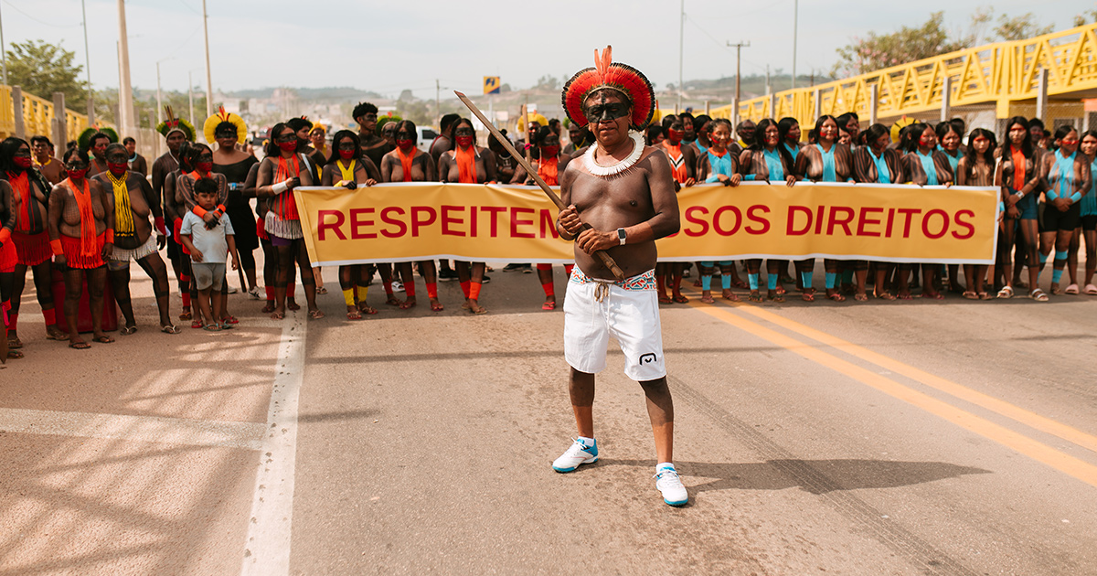
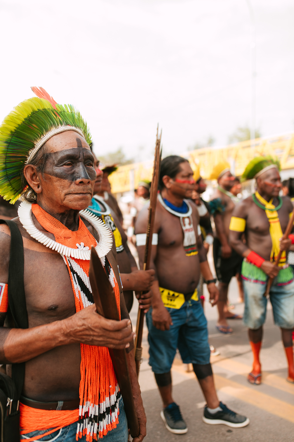
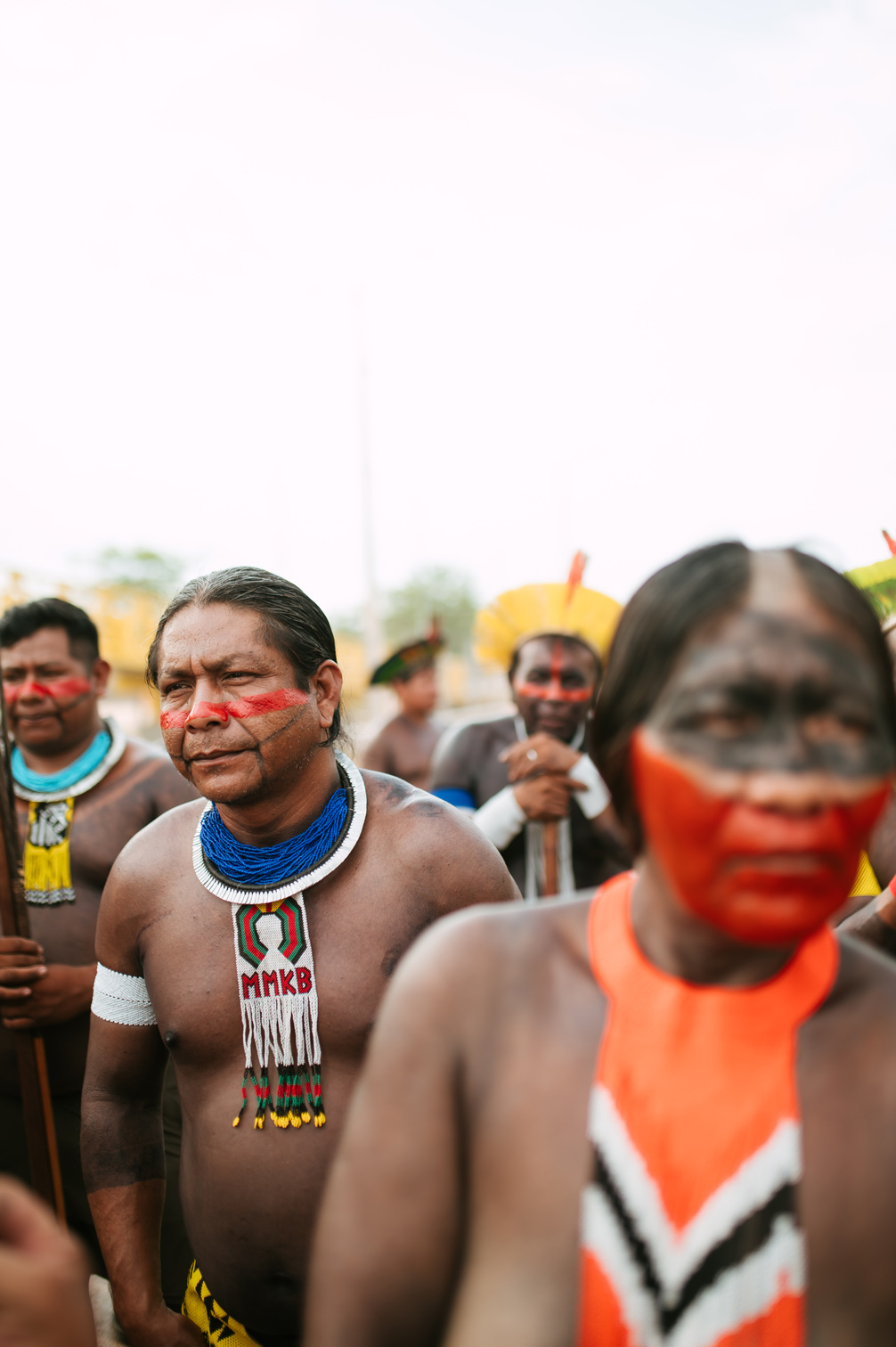
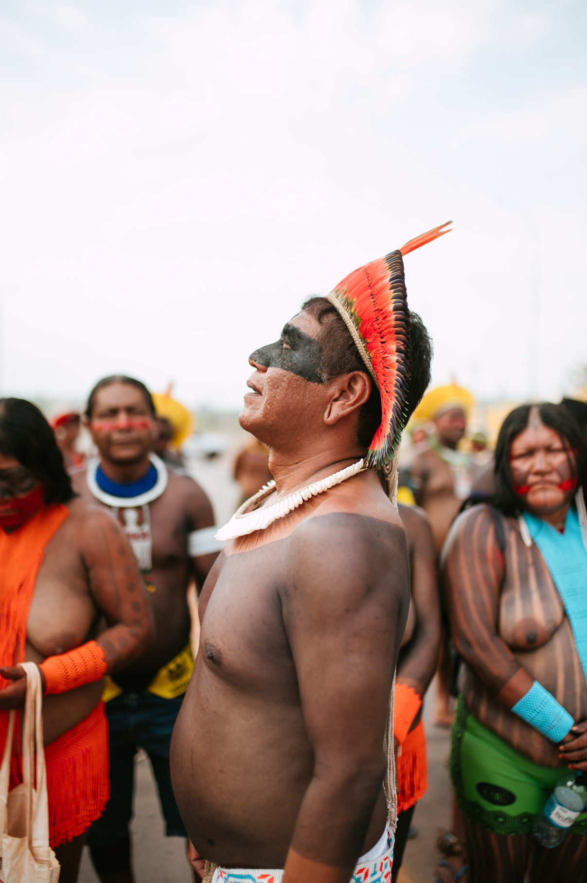
Kayapo and Panará block the BR-163
On Friday, September 25, Kayapo and Panará leaders gathered along the BR-163 highway in Novo Progresso, Pará. They had one clear demand for Via Brasil, the company that runs the highway: keep your commitments to the communities whose land this road cuts through.
The peaceful protest was organized by three Indigenous organizations: Instituto Kabu, Associação Iakiô and Associação Indígena Mantinó. With emergency protection measures set to expire on September 30, they say time is running out.
A highway that profits from Indigenous land
The BR-163 runs from Mato Grosso in the south to the Amazon River near Santarém in the north. It’s the main route for moving soy, corn and other grain out to overseas markets, and hundreds, sometimes thousands, of trucks pass through Novo Progresso on it every day.
Because the highway affects the Panará, Baú and Menkragnoti Indigenous Territories, the concessionaire is required to fund measures that reduce its impacts. These fall under the Indigenous Component of the Basic Environmental Plan (PBA-CI). Until the final plan is approved, a series of emergency measures funds the teams, infrastructure and territorial protection work the communities depend on.
The third cycle of those measures ends on September 30. Without a fourth cycle in place, all of that work could stop.
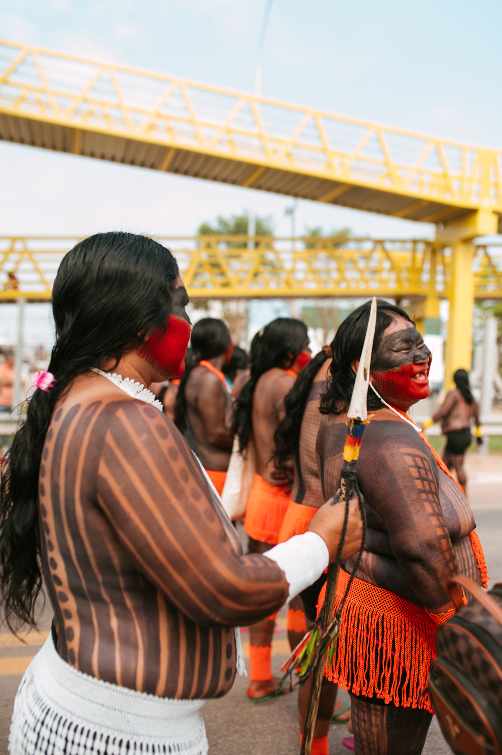
photos: Débora Siqueira
An agreement left hanging
“We are protesting the delay in approving the Emergency Plan, which is an interim measure ahead of the BR-163 PBA. At the time, we reached an agreement with Via Brasil to guarantee these emergency measures while the studies of the highway’s impacts were completed and approved by Funai and the other responsible agencies. So far, the concessionaire has not said anything about returning the studies or about continuing this agreement. We want to make our message clear: the Federal Prosecutor’s Office in Altamira has already been informed of our mobilization, so that our demands can be taken to the courts.”
— Doto Takak-Ire, president of Instituto Kabu
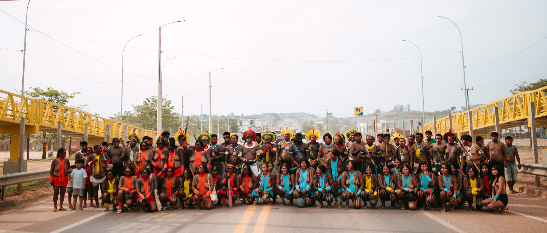
photo: Débora Siqueira
In August 2026, after a thorough process of consulting their communities, the three organizations sent their proposals for the next cycle to Via Brasil and the Federal Court. The company’s reply came on September 4, and the associations say it fell short. Via Brasil asked for more time for technical analysis and questioned the amounts, but it did not dispute any of the proposed measures individually.
A final plan that keeps slipping
The emergency measures were only ever meant to be temporary. They were supposed to be replaced by the final PBA-CI, but that plan has faced repeated delays.
In a filing to the Federal Court on August 31, 2026, the National Foundation of Indigenous Peoples (Funai) noted that the agreed timeline hadn’t been met. The plan was due in January but was only filed on May 29, after a series of extension requests. Funai also found no evidence that the Indigenous organizations had been consulted about the changes to the timeline. Key pieces are still missing, including architectural and engineering designs and a work plan for maintaining and repairing the access roads to the villages.
For the organizations, repeated emergency cycles that don’t cover the communities’ real needs can’t replace the plan they were promised.
Growing threats on the ground
The stakes go well beyond paperwork. According to data from the Rede Xingu+ network cited by the organizations, illegal gold mining and other illicit activities are pushing into the borders of Indigenous lands. There are signs that the BR-163 itself and access roads near the villages are being used as logistics routes for these activities.
That’s why leaders see the PBA-CI’s surveillance and territorial protection measures as essential. Without them, the communities lose key tools for defending their land.
The courts have started to respond. On September 2, the judge of the Federal Civil and Criminal Court of Altamira ordered Funai, the Federal Prosecutor’s Office and Via Brasil to respond on the immediate payment of minimum amounts. That payment would keep the emergency measures running while the full proposals are reviewed.
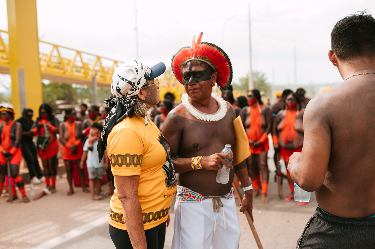
photo: Débora Siqueira
"We're doing our part"
“We’re already mobilized to send our message to Via Brasil and Funai about the delay in reviewing and approving the BR-163 PBA. Together with the Indigenous organizations, we brought together our warriors, chiefs and leaders to hold this protest on the highway. We’re doing our part, and we don’t want to wait any longer. We want an immediate response from the concessionaire.”
— Be-i Kayapó, president of Associação Indígena Mantinó
photos: Débora Siqueira
What the Kayapo and Panará are demanding
-
01
Immediate formalization of the fourth cycle of emergency measures
-
02
An individual technical review of each of their proposals
-
03
Continued emergency funding
-
04
Completion of Funai's review of the final PBA-CI, with free, prior and informed consultation of the communities on any changes to the timeline
The current cycle ends on September 30. The communities are asking for answers before then.
This highway cuts through Kayapo and Panará territory and profits from it every day. The least the company can do is honor what it owes.
Solidarity with the Kayapo and Panará.
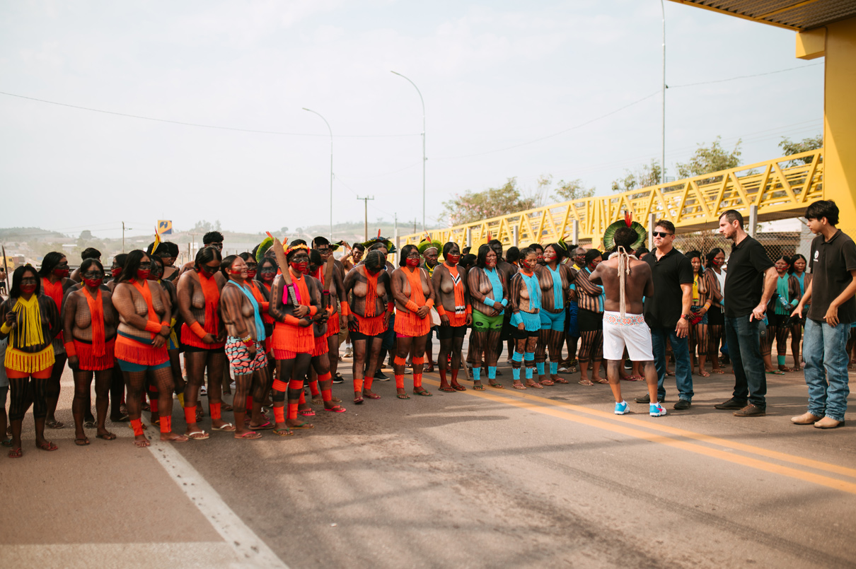
photos: Débora Siqueira
Fighting Fire With Knowledge
Fire has always been part of life in the Kayapo Indigenous Territory. For generations, Kayapo families have used fire to clear and renew their traditional crop fields, following knowledge about when and how to burn that has been passed down over centuries. But the conditions that knowledge was built for are changing.
The Kayapo Territory is home to one of the largest stretches of intact forest in the Amazon, and most of it stays moist enough to resist fire. But it sits at a transition zone. In the south, the forest gradually gives way to savanna, where vegetation is drier and fire spreads more easily. The whole region is also under growing pressure from climate change: this part of the Amazon is steadily getting drier, with more frequent droughts and longer, harsher dry seasons. As the forest loses moisture, a fire that gets out of control can turn into a wildfire that destroys large areas of forest, crops and hunting grounds within days.
This year the risk is even higher. The El Niño climate pattern can bring hotter, drier conditions to the region, which makes every use of fire more dangerous.
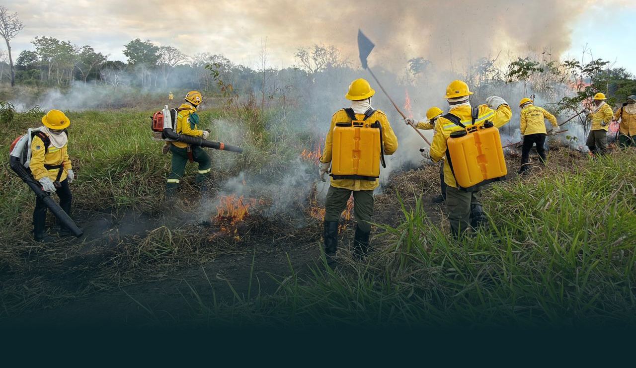
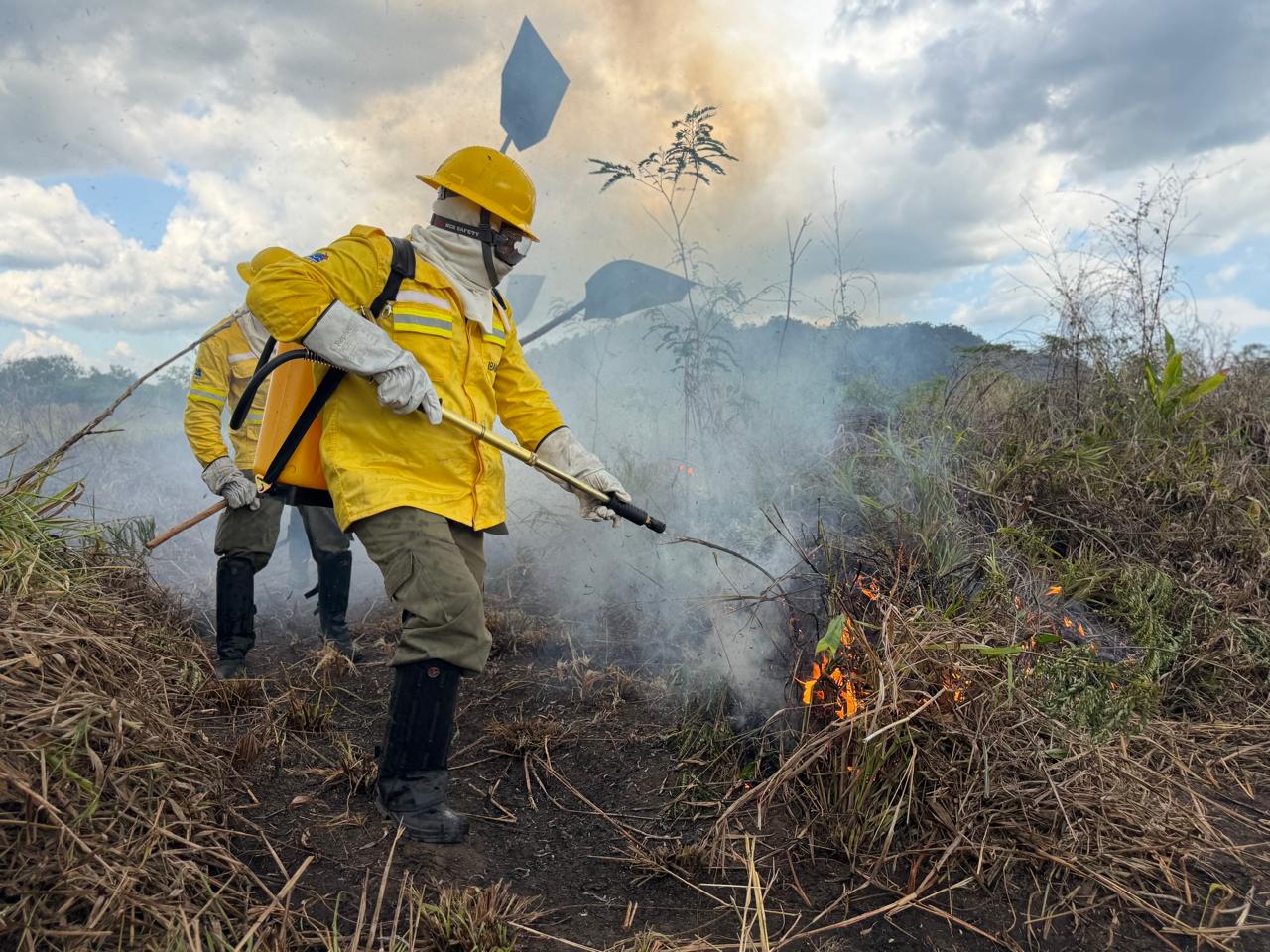
The instructor and firefighter, Traiú Assalu Mehinaco, ignites a plot of vegetation dominated by Brachiaria grass using a drip torch as part of a practical exercise during the course.
From September 9 to 11, 2026, the Protected Forest Association (Associação Floresta Protegida, AFP), Brazil’s National Foundation for Indigenous Peoples (Funai), and PrevFogo, the national fire prevention and firefighting center of Ibama (the Brazilian Institute of Environment and Renewable Natural Resources), held a fire management workshop in Kruwanhõngô village, in the Kayapo Indigenous Territory.
The main goal was to help communities prevent forest fires by using fire in their traditional crop fields in a proper, controlled way, drawing on both traditional knowledge and new techniques and equipment.
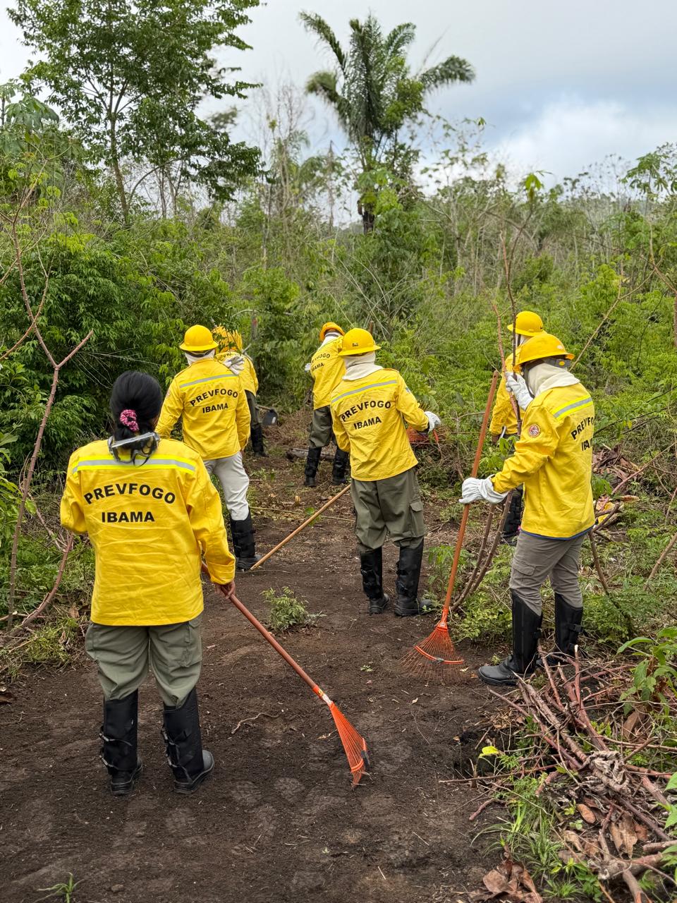
Kayapo course participants creating a “firebreak” as part of a practical exercise in forest fire prevention and suppression.
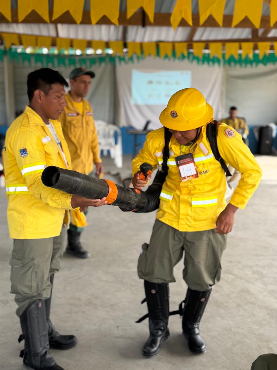
Training on the use of blowers for the prevention and suppression of forest fires during the fire management course.
The training reflected that combined approach. Experienced firefighters and instructors from PrevFogo and from Funai’s Integrated Fire Management Coordination provided technical training. They were joined by Traiú Assalu Mehinaco, an Indigenous firefighter and environmental educator from the Xingu Indigenous Territory, and by two Kayapo elders: Takaknhotire Kayapo of Kamoktidjam village and Takakmakoro Kayapo of Kokotkrere village.
Together, participants talked about the climate crisis and how it is affecting the weather, rainfall patterns and the vulnerability of the Kayapo Territory’s forests to wildfires. They also discussed why new strategies are needed to face this challenge, building on traditional knowledge while adopting new tools and methods.
Participants rated the workshop very positively and left motivated to share what they learned with their communities. Over the coming months, the 25 Kayapo participants will carry this work back to their villages and lead fire prevention efforts on the ground.
Before leaving, they made a set of collective agreements. Each participant committed to:
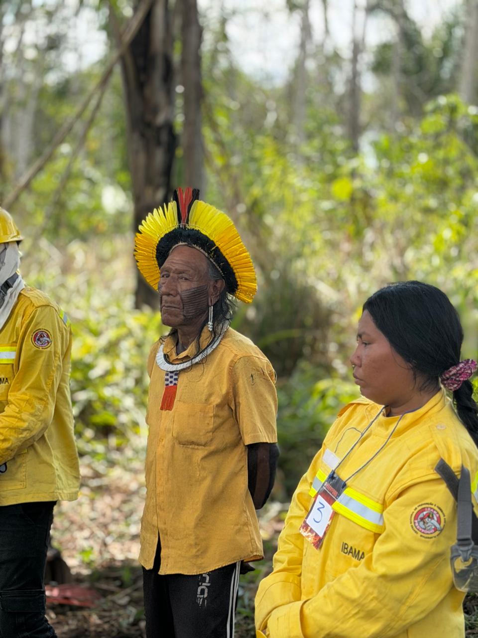
Holding meetings in their own community to raise awareness that every family has a role in preventing forest fires, and that more care is needed in all everyday uses of fire — cooking in the village, fire used on hunting and fishing trips, children playing with fire, and throwing away cigarette butts.
Reviewing how and where their community burns garbage, and taking steps to make this practice safer.
Supporting PrevFogo and Funai teams as they coordinate with communities across the Kayapo Territory, so that any crop fields still waiting to be burned are burned only with technical supervision from PrevFogo. This makes sure all preventive measures are in place and helps avoid forest fires, especially given the possible impacts of El Niño.
The workshop and the participants’ continuing work are the result of a partnership between AFP, Funai and PrevFogo/Ibama. Biome Conservation provides technical and financial support. Additional funding comes from Re:wild, the Bezos Earth Fund, and the Tradition and Future in the Amazon project (Tradição e Futuro na Amazônia), which is managed by Funbio with funding from Petrobras.
Fire Is the Amazon's New Weapon of Deforestation. Guard Posts Are the Answer.
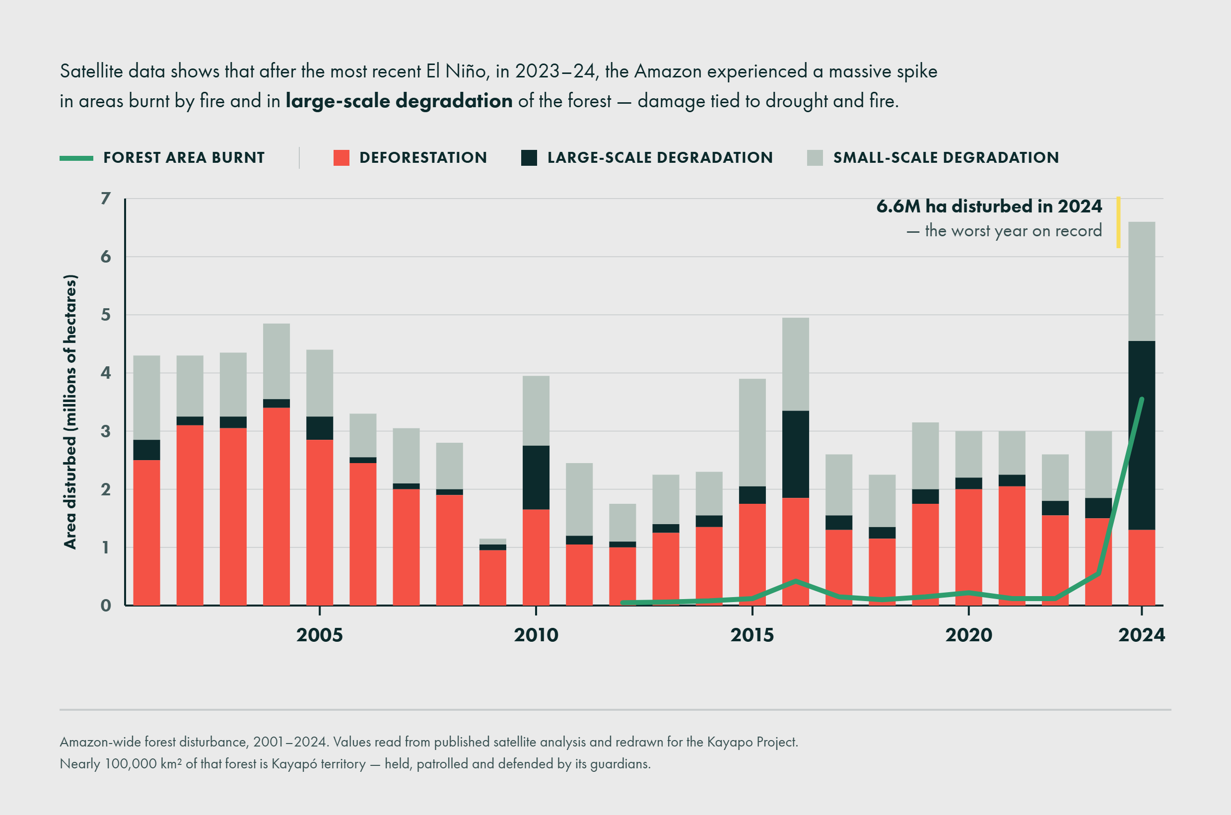
Brazil has genuinely good news this year: Amazon deforestation rates fell to their lowest level since 2013, with 2,874 square kilometers cleared between August 2025 and July 2026 [1]. That’s a 36% drop compared to the previous year. But there’s another headline that seems to contradict it: the number of wildfires across the Amazon rose by more than 30% in the same period, even as the area cleared went down [2].
Fire has become the tool of deforestation, not the byproduct
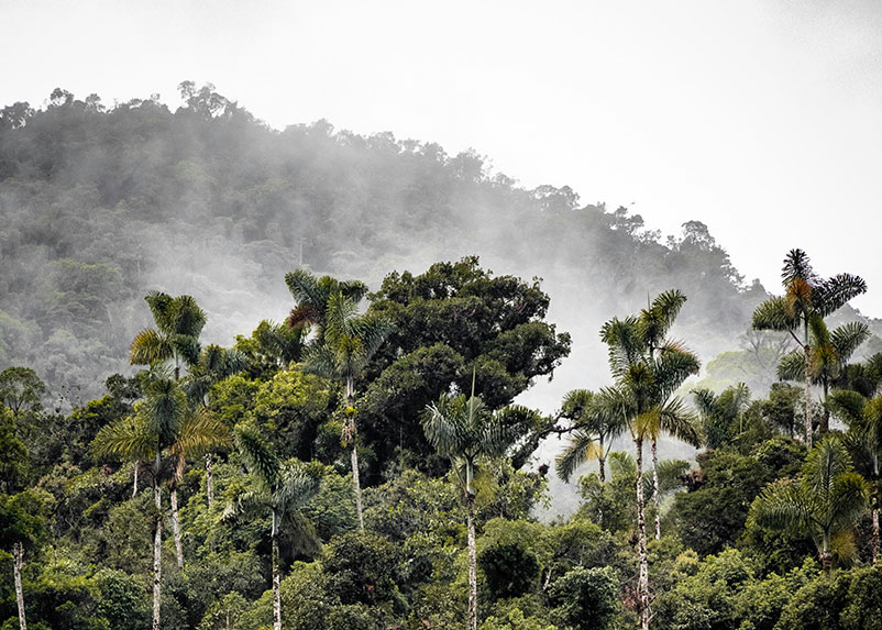
Photo: Unsplash
Analysts point to a simple incentive: burning is harder to trace back to a specific actor than chainsaw logging is, and scorched land degrades faster into something legally easier to claim. This isn’t a new pattern. Researchers first documented Amazon fire and deforestation decoupling nearly a decade ago, noting that even as annual deforestation rates dropped sharply, the occurrence of fire itself did not decline in step [3]. In 2026 that pattern is intensifying.
Timing makes this worse
Right now, August through October is the Amazon’s dry season, when fire risk typically peaks. This year that ordinary seasonal risk is stacked on top of an unfolding El Niño, historically the single biggest driver of severe Amazon drought and fire years. The 2024 Amazon drought, one of the worst on record, was compounded by El Niño conditions [4].
Forecasts for the exact strength of the current event vary in their specifics: NOAA puts the odds of it becoming a “very strong” event at around 80%, while Ecuador’s CIIFEN estimates roughly 69% odds that it will surpass previous records [5]. Forecasters broadly agree this is shaping up to be a major event, not a weak one, with some projecting it could be the strongest in over 150 years [6]. What forecasters largely agree on is the timing: fire risk is elevated in 2026 as El Niño develops, but the most severe impacts typically lag by about a year, putting the highest risk of a record-breaking fire season in the second half of 2027 [7].

The seasonal forecast for September–November 2026 shows widespread warm anomalies in the equatorial Pacific, with sectors exceeding +3°C, reinforcing the signal of a high-intensity El Niño event. Source: NMME Ensemble Average, CIIFEN.
Intact forests are resilient
Its own humidity suppresses fire spread. What burns is forest that’s already been opened up — fragments with drier, more fire-prone edges, sitting right next to frequently burned pasture and regrowth [8].
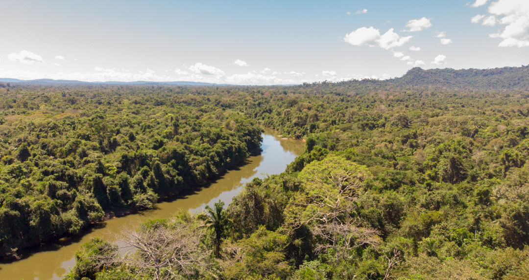
Photo: Pedro Peloso
A large-scale, decade-long burn experiment in the southeastern Amazon tested this directly [9]. Intact forest can shrug off a single low-intensity fire. But repeated burning during drought is a different story: it kills most of the trees, cuts canopy cover roughly in half, and lets invasive grasses move in. Forest edges fare worst of all, because that’s exactly where the drying and grass invasion are already most advanced.
The encouraging counterpoint: forest that stays intact keeps that natural resistance. A newer study found that even forests degraded by fire, drought, and windstorms in the southeastern Amazon can recover if left free of new disturbance — though the regrown forest remains more fragile against the next fire or drought [10]. Intact forest resists. Damaged forest doesn’t recover fully before the next hit.
Guard Posts are a shield against deforestation
Within the Kayapo’s roughly 11-million-hectare territorial bloc, we can compare the 9.4 million hectares that receive organized NGO-backed monitoring investment against the 1.2 million hectares that don’t — and deforestation hotspots cluster overwhelmingly in that smaller, unmonitored slice [11] [12].
The mechanism behind that pattern is straightforward: the Kayapo’s surveillance program covers more than nine million hectares through 16 guard posts placed at vulnerable entry points, functioning as both a physical deterrent and a signal that the territory is actively defended [11]. Those monitoring teams are credited with helping prevent the illegal logging, mining, and land invasion that would otherwise open the forest up: the exact process that turns fire-resistant forest into fire-vulnerable edge.
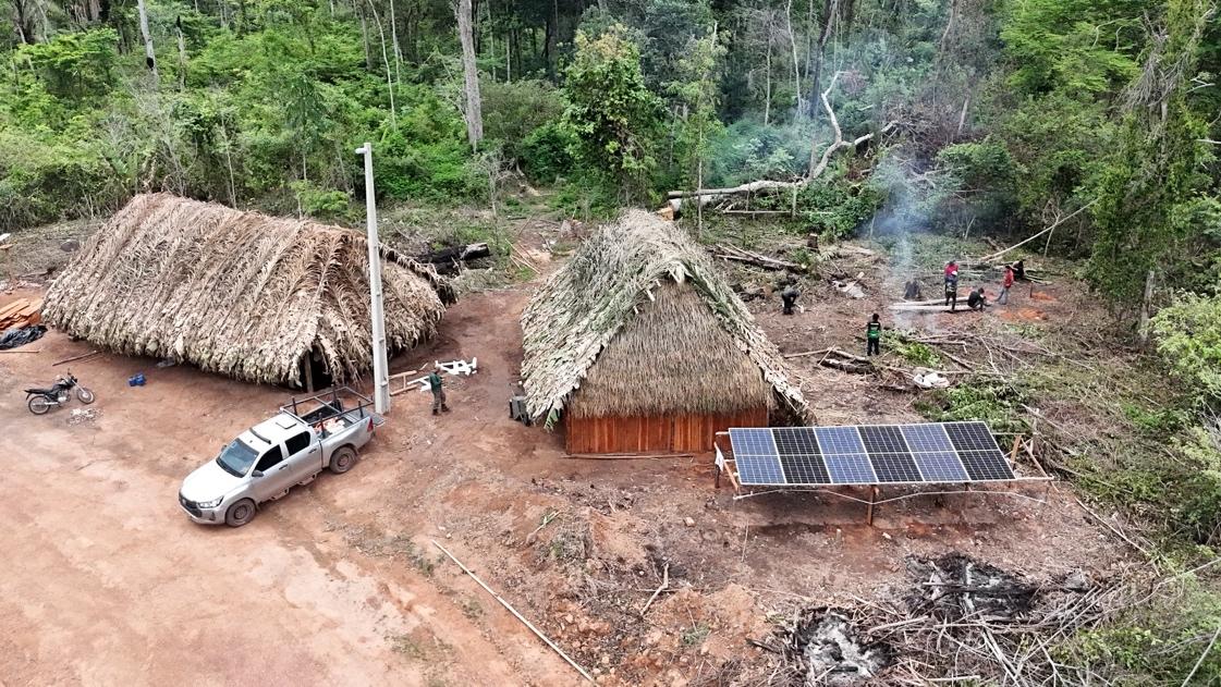
The Capoto guard post.
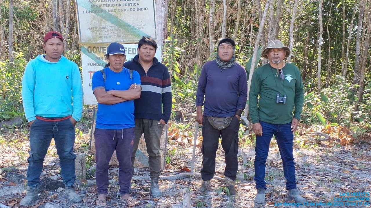
A Pykatoti guard team beside the official government sign marking the border of Menkragnoti territory.
The bottom line
Fire is increasingly the tool of choice on the Amazon’s frontier. This year’s dry season is landing on top of a developing El Niño whose worst effects, if the last two events are any guide, are still a year out. What determines whether a given hectare of forest survives that combination isn’t luck — it’s whether it stayed intact and defended, or got opened up first. Guard posts and territorial monitoring are one of the few interventions with a documented track record of keeping that first domino from falling.
- Mongabay, “Amazon deforestation alerts fall to lowest level since 2013, Brazilian data show” (August 2026)
- Inside Climate News, “Amazon Deforestation at Eight-Year Low, Report Shows” (May 2026)
- Aragão, L.E.O.C. et al., “21st Century drought-related fires counteract the decline of Amazon deforestation carbon emissions,” Nature Communications (2018)
- PBS News, “Extreme drought, wildfires and deforestation battered the Amazon rainforest in 2024”
- Meteored, “CIIFEN confirma: El Niño se fortalece, con 69% de probabilidad de superar récords” (2026); Nature, “A ‘super’ El Niño could transform the Amazon. Is the world’s biggest rainforest doomed?” (2026), citing NOAA’s ~80% odds of a “very strong” event
- AccuWeather, “The 2026 El Niño could become the strongest in a lifetime”
- Amazon Conservation Association, “A New Twist On El Niño: The Bigger Impacts Will Come In 2027”
- Yale School of the Environment, “Amazon Forests Can Recover From Fire — With Some Caveats”
- University of Colorado Boulder, “Decade-long Amazon rainforest burn yields new insight into wildfire vulnerabilities” (2015)
- “Forest recovery pathways after fire, drought, and windstorms in southeastern Amazonia,” PNAS (2026)
- Kayapo Project, “Defend”
- Biome Conservation / ICFC, “Kayapo Project”
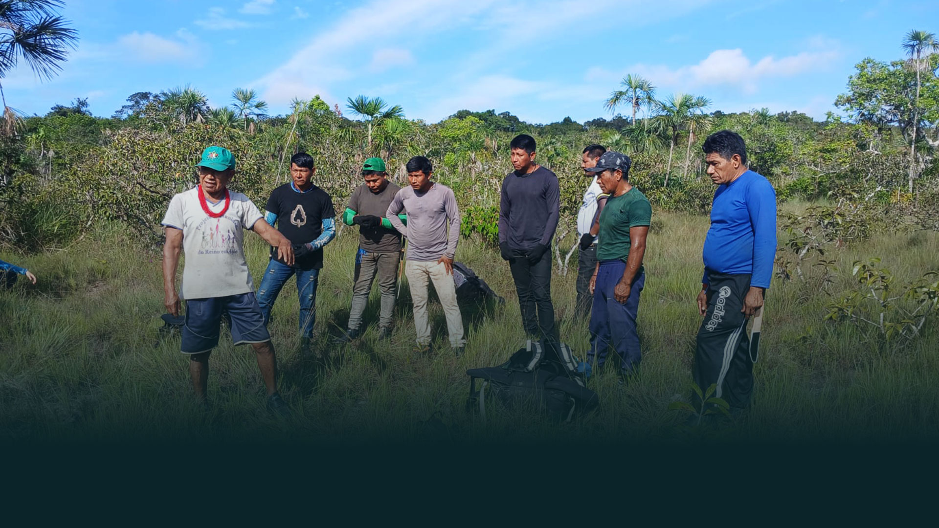
The Ancient Trails Project
The expedition was one of the first field activities of the Ancestral Trails project, approved under the Amazon+10 initiative. Coordinated by the Federal University of Pará (UFPA), the project is developed in partnership with the Federal University of Amazonas (UFAM), the University of São Paulo (USP), the State University of Campinas (Unicamp), the Federal University of Mato Grosso (Unemat) and the Protected Forest Association (AFP). The Amazon +10 initiative also has the support of the State Research Support Foundations (FAPs) of Mato Grosso (FAPEMAT), São Paulo (FAPESP), Amazonas (FAPEAM), and Pará (FAPESPA).
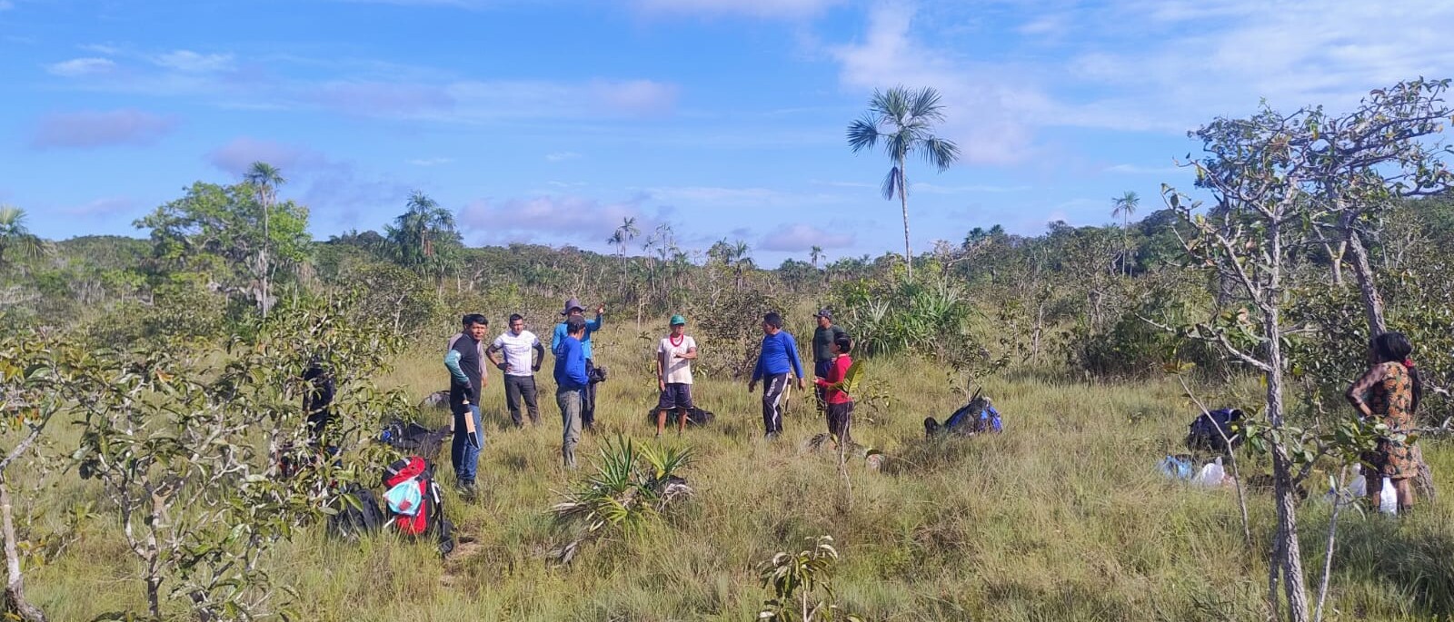
The project seeks to revisit historically important paths from a socio-environmental perspective to better understand the biodiversity of mammals, birds, and aquatic fauna in the context of regional agroextractivist production systems, considering different contexts of conservation and threat to natural resources.
From Kubenkàhnkej to Kokraimoro
The first expedition was carried out between May 31 and June 10, 2026 and its main objective was to reopen an old trail used by the Kayapó people, connecting the Kubenkàhnkej village, on the banks of the Riozinho River, to the Xingu River region, near the Kokraimoro village. The route, approximately 90 kilometers long, represents an important record of the history of occupation and circulation in the territory.
Two teams traveled between the rivers, —the Xingu Team and the Riozinho Team — starting from opposite ends of the trails The teams were composed of Kayapó indigenous and non-indigenous collaborators, including men and women of different age groups. The two teams walked towards the meeting point, reconstructing the ancestral path.
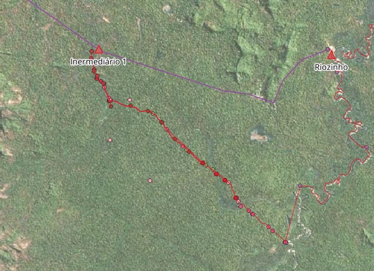
Throughout the expedition, in addition to the reopening of the trail, traditionally managed Brazil nut trees, old areas of Indigenous occupation and traces of local fauna were identified and recorded. As part of the project’s scientific protocol, camera traps were also installed to inventory the region’s biodiversity.
The route revealed an expressive diversity of Amazonian environments, including upland forests with large trees and open understory, old scrublands with dense vegetation and an abundance of lianas, shoal areas dominated by palm trees and waterlogged soils, as well as igapós subject to flooding during the rainy season.
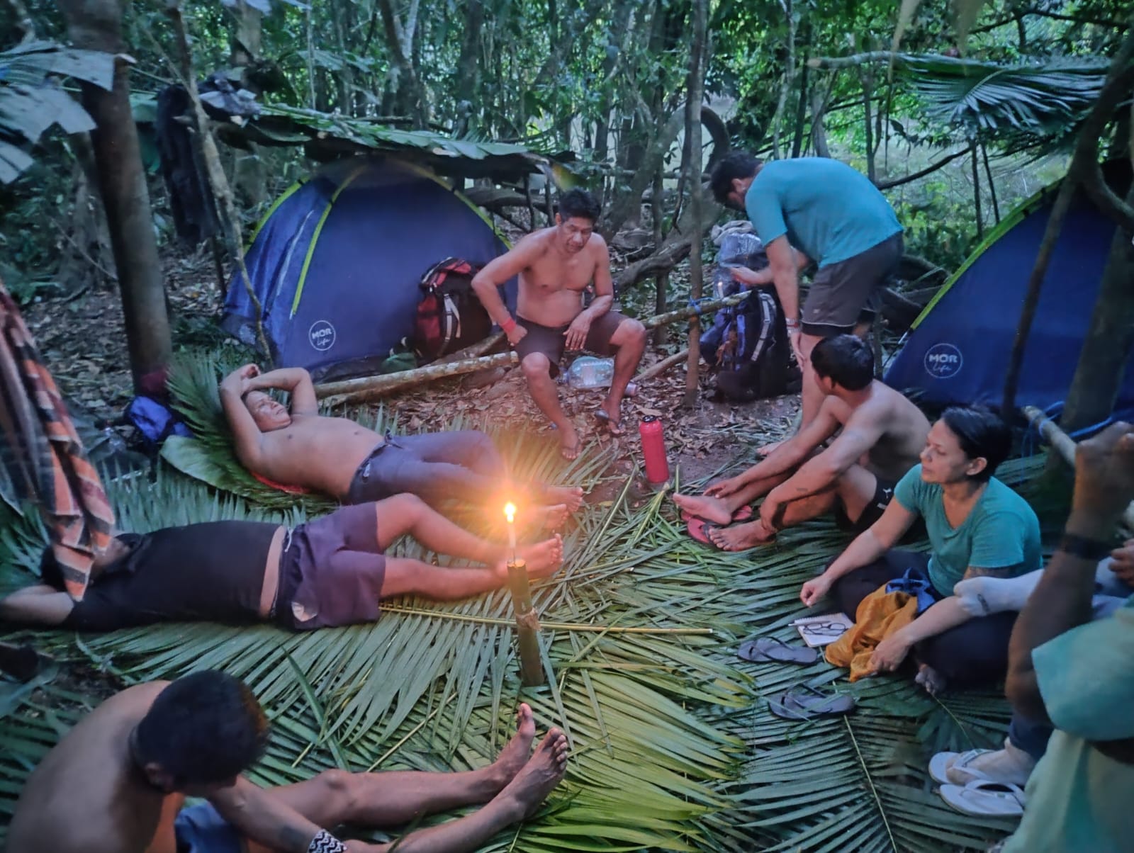
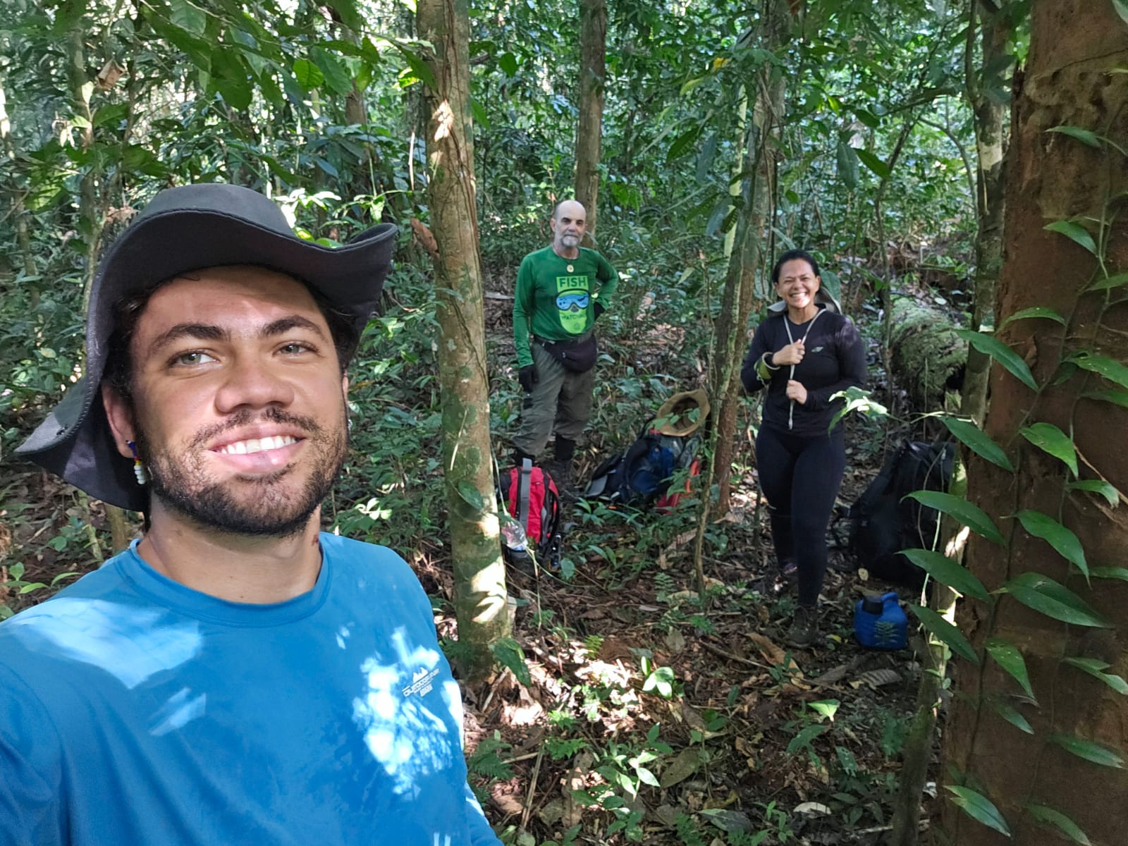
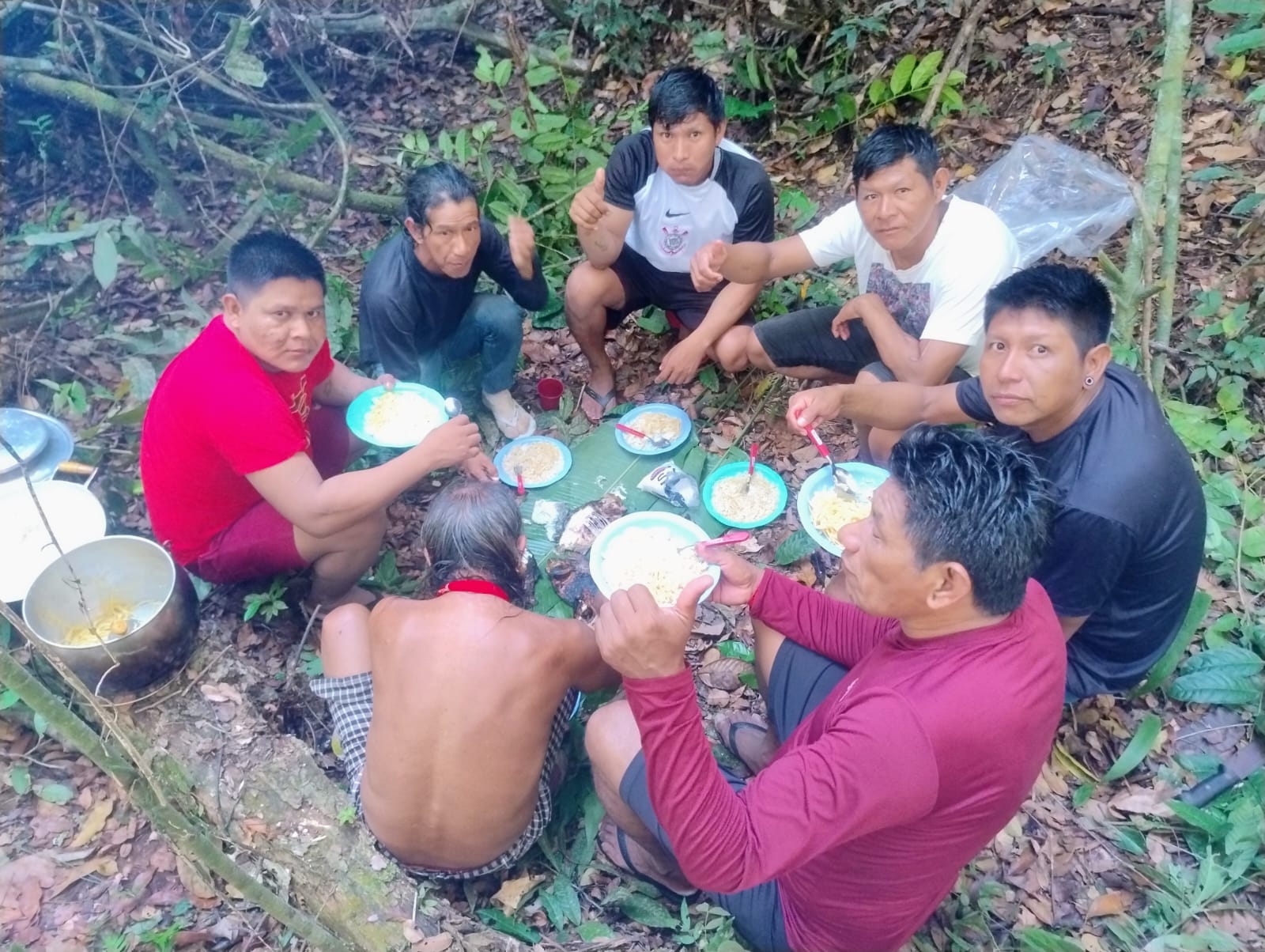
More than reopening a trail, the expedition strengthened the exchange between traditional knowledge and scientific research, laying the foundations for the next stages of the project. The information obtained will be fundamental for the planning of the main expedition, scheduled for the first half of 2027, when the team will be expanded with researchers from the areas of anthropology, archeology, ecology and other specialties.
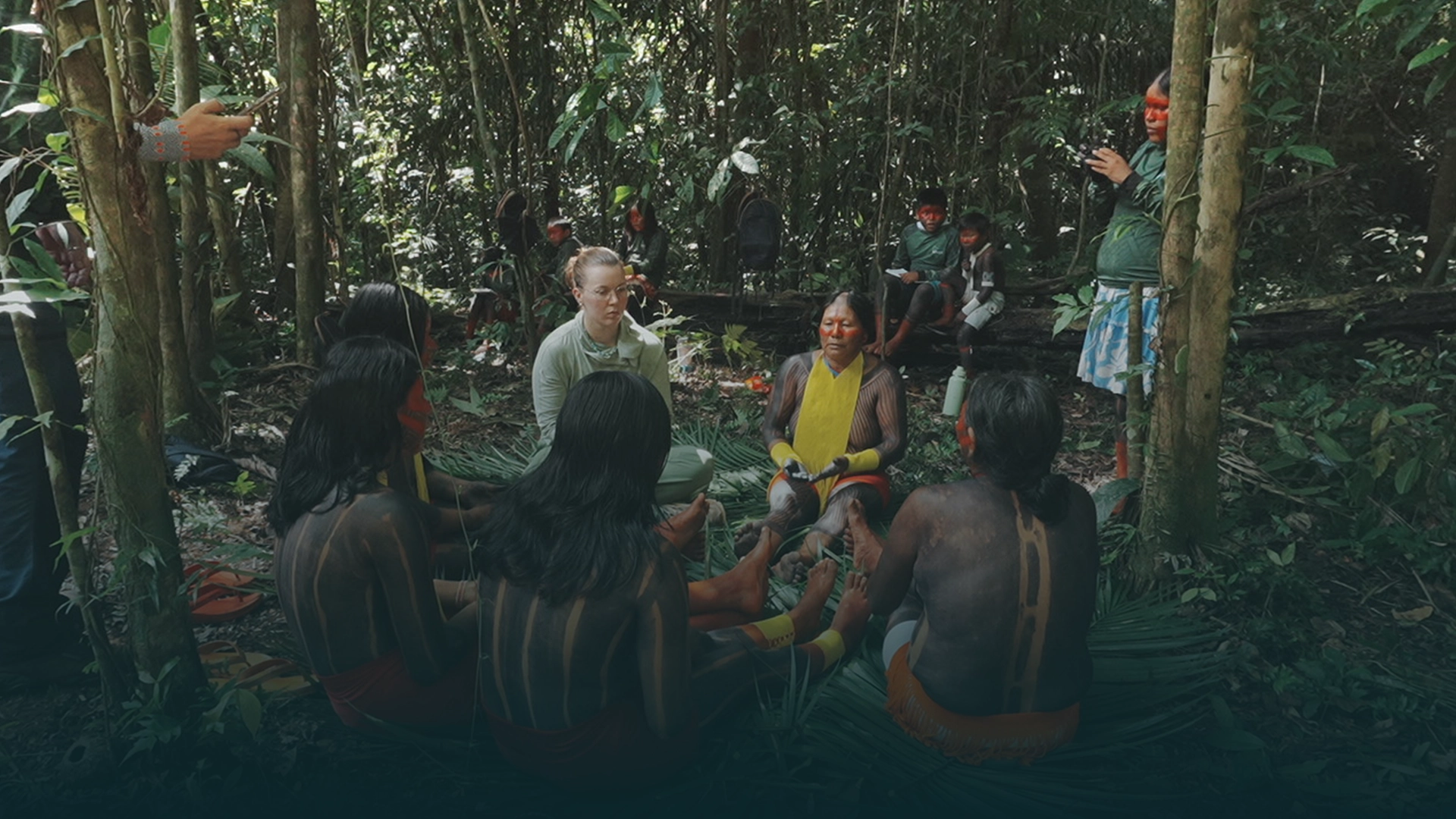
A week at the heart of the Bákra Forest School
I think it must have been difficult to name Bákra: The Kayapó Forest School, because it is so many things at once. It is a school, but it is also a thriving ecosystem that lifts up elders, creates equitable jobs, and builds community through shared joy.
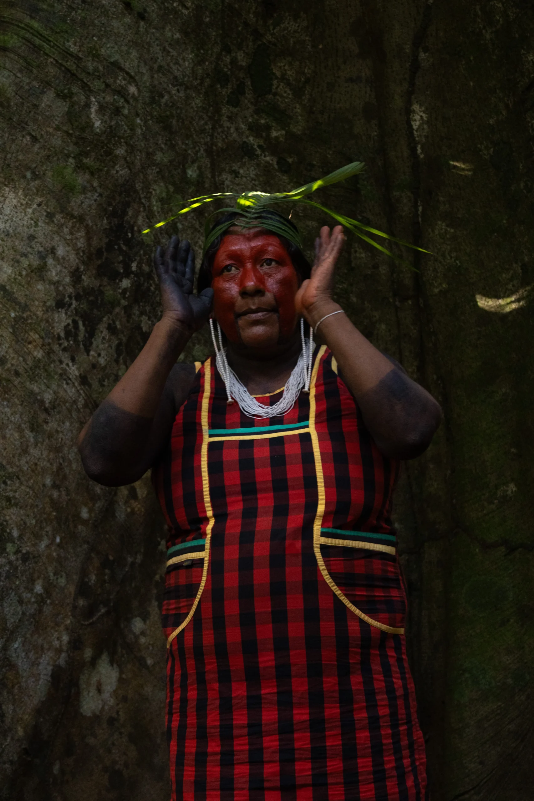
Each week, a new group of 20–30 Kayapó arrived at Kamotidjam — and then at the Bàkra campus, Kajgodjam, once it was ready to host them — and they arrived in force. The elders always arrived enthusiastic and ready to hit the ground running, decked out in their traditional attire: feather headdresses, beaded bracelets, armbands and necklaces, painted in vibrant jenipapo, the Amazonian fruit traditionally used by Indigenous peoples to stain their skin.
With each group, we did a round of introductions to start. I thought it was endearing how each of the elders would stand up and make a large speech about how they were excited to be there and the importance of the program — and then each of the students would stand up and shyly whisper their name and the name of their village.
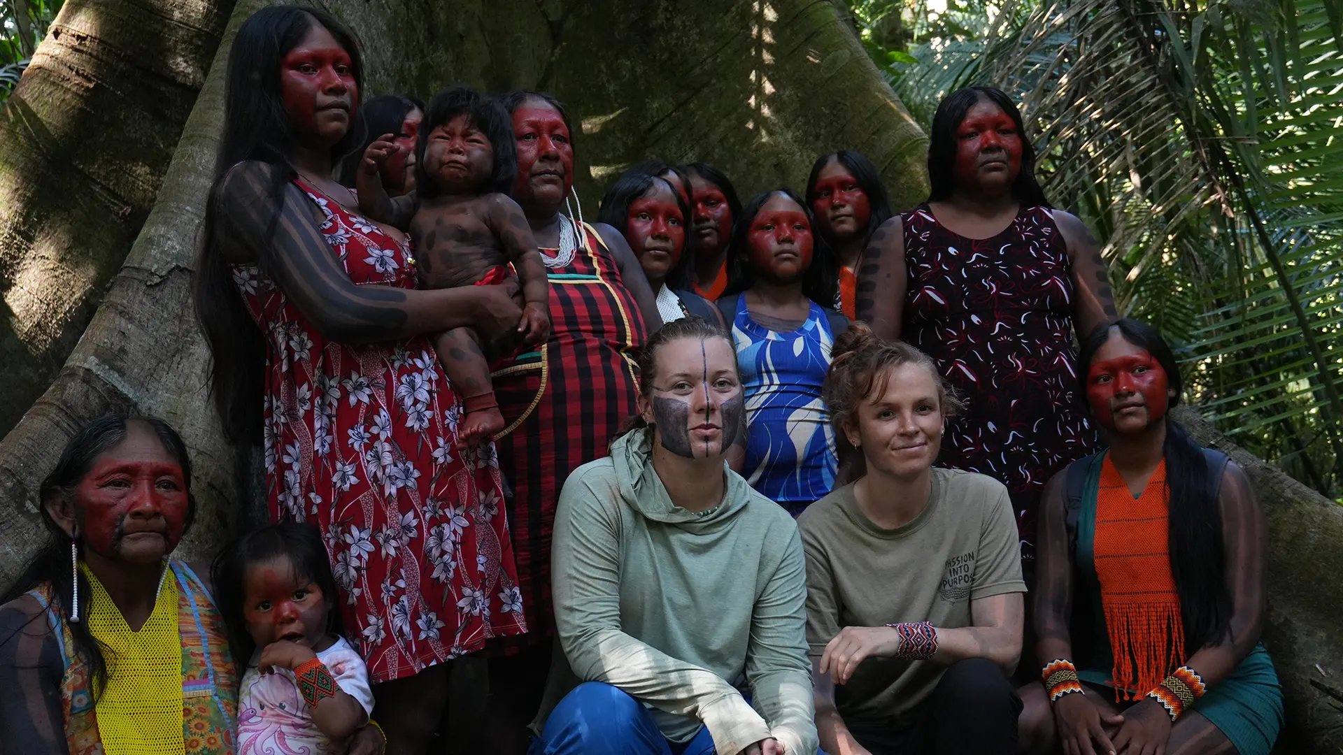
Faces marked in Jenipapo and urucum,
Bákra worked on an intense schedule of activities, driven by what the elders wanted to teach and where they wanted to take their students. A typical week looked like this.
A week at the forest school
Tents, the circle, and the first story
The group arrived in the afternoon from their villages. After everybody set up their tents and settled in, we formed a conversation circle so that everyone could introduce themselves, and our Indigenous coordinators presented the schedule, rules, and expectations of the program. We passed out the t-shirts and student kits while the cooks started preparing dinner. An elder would often tell a traditional story on this first night.
Jenipapo, then into the forest
The people who didn’t arrive already fully painted would paint each other in jenipapo in preparation for entering the forest. They would often paint me as well. I loved the process, and it was always exciting to see what design they would come up with — I rarely wore the same one for very long, as the stain faded pretty quickly, and one of our coordinators, Bekwykukati, would always call me over to redo my paint when it started to fade from my face. In Kayapó culture, many people prefer to be painted before dancing, so it was essential to paint everybody at the start of the program, because there was lots of dancing to come.
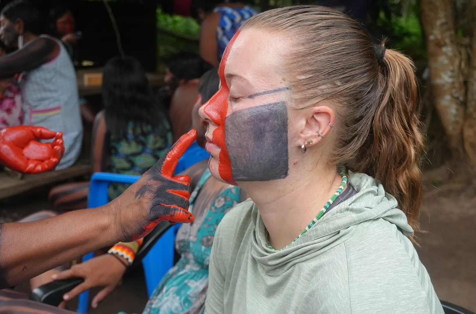
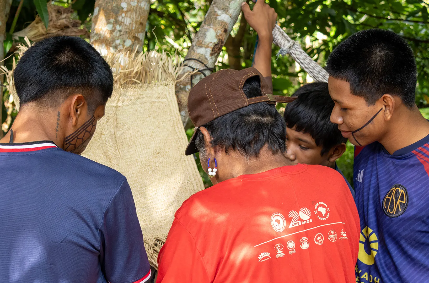
Getting painted with Urucum was a part of every morning before heading out into the forest.
After everybody got painted, our coordinator — or a returning student who knew how to use the cameras and camera traps — gave a brief lesson before we ventured into the forest, usually to a mud pit to install the traps. The elders led the group and pointed out animal paths or hotspots that would make good locations. The students verified that each camera had enough battery and a SIM card installed before deploying them on tree trunks, low to the ground.
Once everybody had their cameras installed, we headed back to camp to eat lunch and relax before the afternoon handicraft — usually the men doing one activity and the women another. The women might paint fabric with their traditional designs while the men wove baskets or other items. After dinner, the whole group might dance together under the stars or around a fire.
Ronko, the Piti tree, and the drones
In the morning we set out early — usually by boat, then on foot — to one of a variety of traditional sites. One was Ronko, an abundant grove of coco de babaçu, a delicious food that tasted a bit like coconut and was also used to make oil for hair or cooking. The grove was home to an enormous Piti tree where we would often do traditional dances and sing traditional songs.
There was also a nice clearing that was great for teaching the students how to launch and collect the drones. We would try to get an aerial view of the site and talk about why it was important and how drones can be used for territorial monitoring. The elders usually stuck to the back of the group, collecting plants and barks that might be useful as medicines or in that afternoon’s handicrafts — and if we came across an açaí tree, people took turns trying to climb it to cut down the fruits at the top.
Later, after lunch, the women would often bead, crochet, or prepare a traditional meal like Berarubu, while the men made a feather headdress or a wooden war club. At night, the whole group gathered by the fire as an elder told a traditional story. My favorite was the one about the man who fell in love with a woman in the stars, who eventually brought down all the good foods they enjoy eating today — manioc, pumpkin, and papaya.
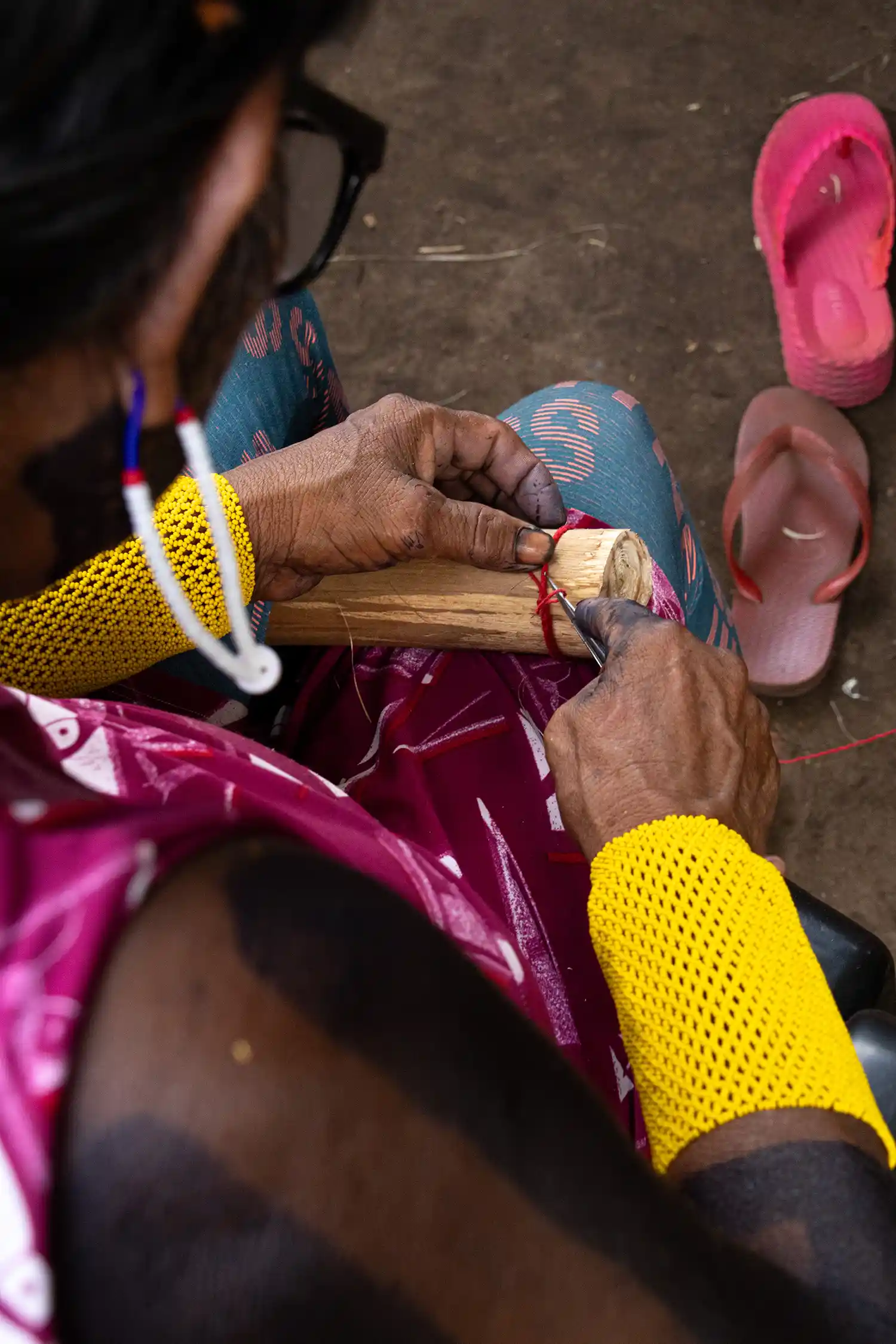
An elder teaching the girls how to crochet the traditional leg bands that the young children wear.
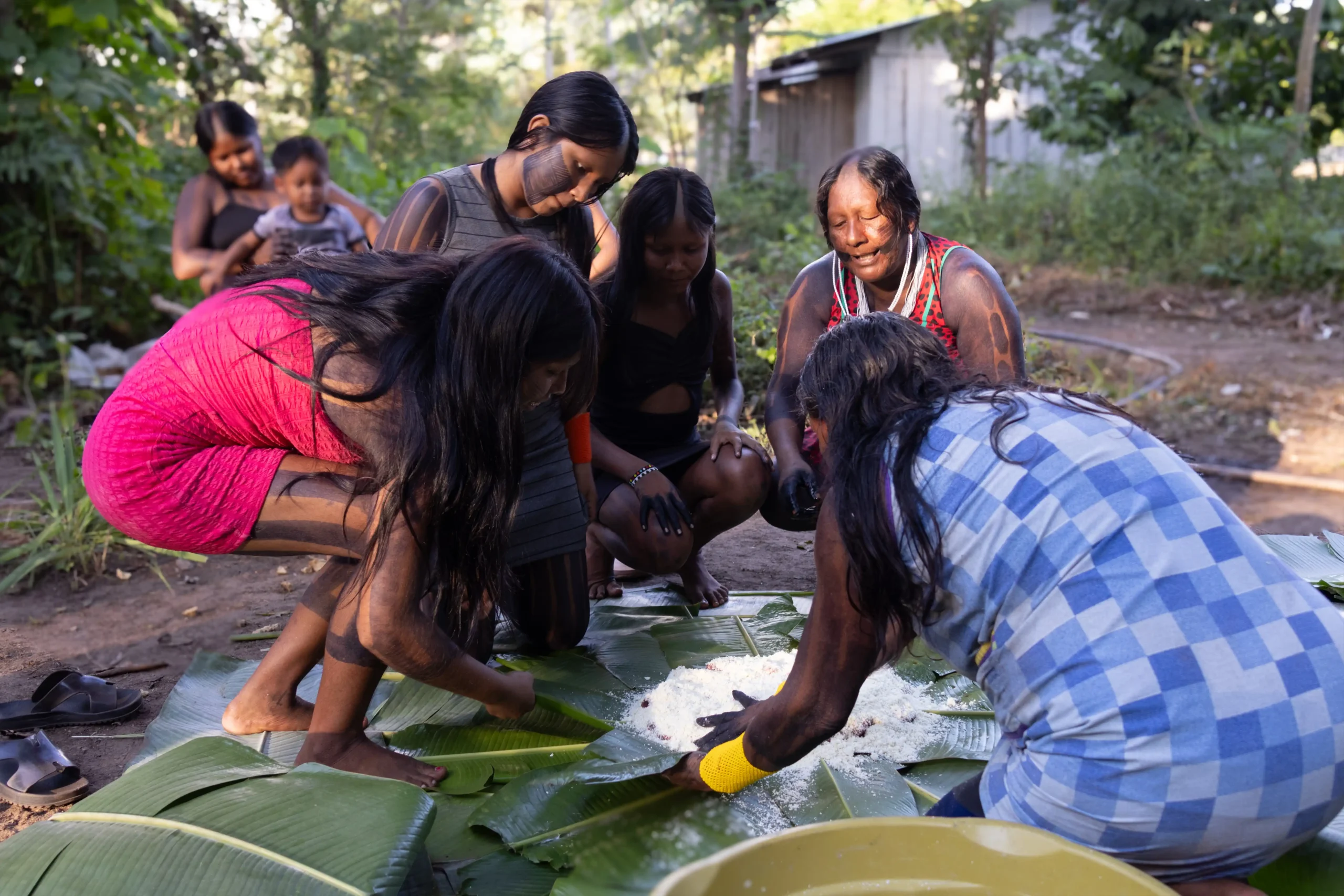
Berarubu in the making — manioc flour and meat folded into banana leaves, hands working together across generations.
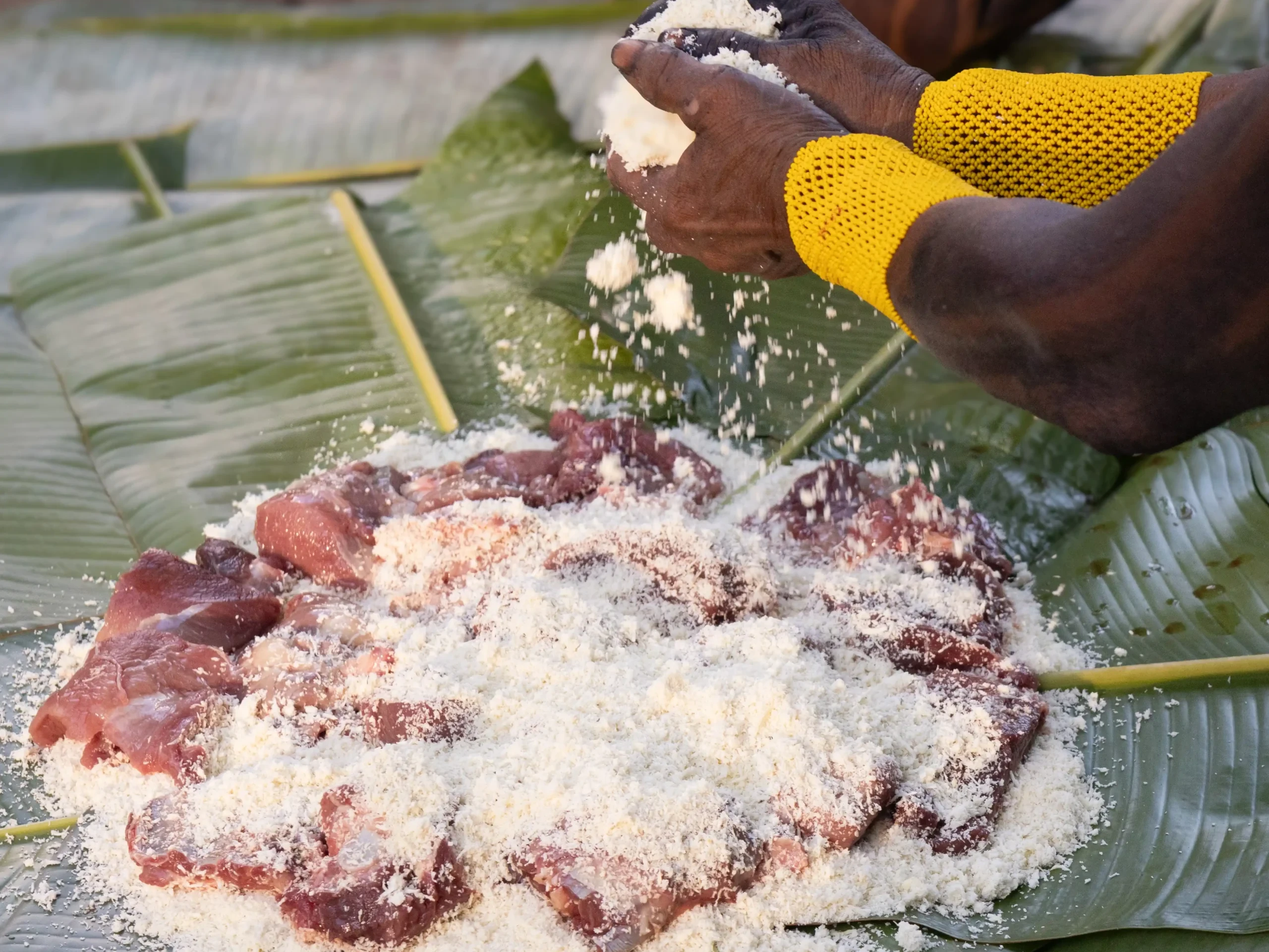
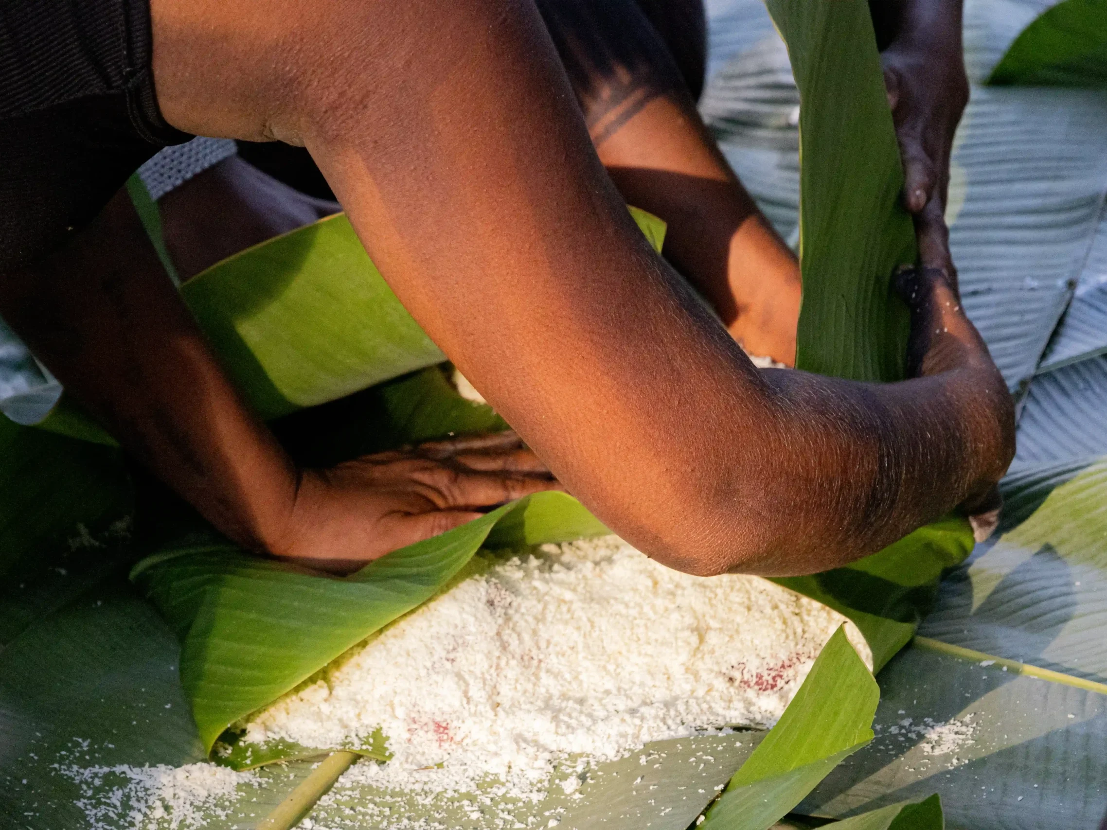
Layering and wrapping the parcel before it goes to the coals.
What the cameras caught
In the morning we set out to collect the camera traps from the first day, and everybody came back into camp itching to see the photos. We would pull them up on a laptop and the whole group gathered around to ooh and ahh at everything the cameras caught. It was exciting to see the biodiversity we captured in just four days — tapirs, anteaters, a variety of birds, and, surprisingly for me, deer similar to those I saw in my backyard growing up in Virginia.
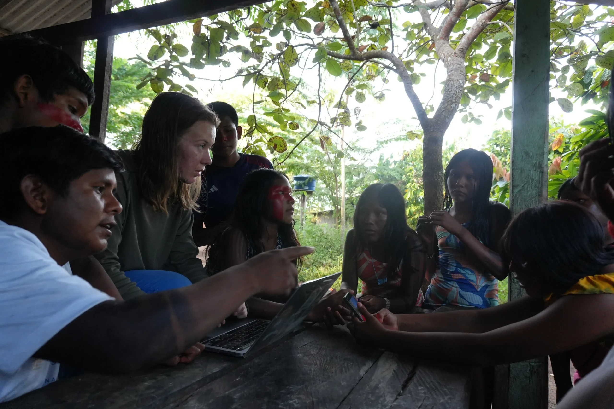
Registering students for the Forest School.
After coffee and breakfast, the group departed — and we reset for the next one.
What eight weeks held
Eight weeks of this schedule was a lot. A lot of personal growth, a lot of immersion within the Mebengôkre-Kayapó culture, a lot of time to practice speaking Mebengôkre, and a lot of opportunity to actually form relationships with the people whose association I had been working in for the past year.
The importance of this program is undeniable. The passing down of culture and tradition has stagnated — young women struggling to climb the açaí trees their grandmothers scale with ease, young men not knowing the words to their traditional songs.

Indigenous-Led Conservation: Matt's Journey to Kayapo Territory
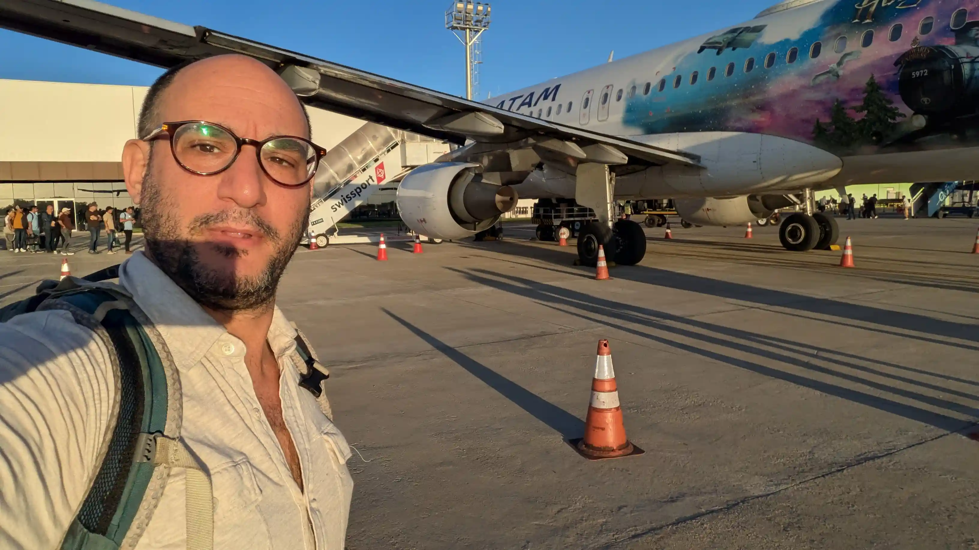
May 18–19 · Washington DC to Peixoto de Azevedo
I had the pleasure to participate in several institutional strengthening and governance meetings with two partner Kayapo associations, the Instituto Raoni and Instituto Kabu. My IR meetings took place at their headquarters in Peixoto de Azevedo and IK during their annual general assembly in the village of Pykany.
Traveling to these meetings is not easy. First, I connected on a series of flights from DC → Panama → Brasilia, where I was able to meet (and rest) briefly with Dr. Adriano Jerozlimski, Director, Kayapo Project in Brasil.
The Journey Begins
Early the morning of May 19, I flew to Sinop, a medium sized city in the state of Mato Grosso, the heartland of the Brazilian industrial agricultural sector, where I met my uber driver Andre and we headed north on the BR-163, the “Soybean Highway.” 4 hours and 200km later, we arrived in Peixoto de Azevedo. Along the road, corn pellets flew from the back of large trucks and battered the windshield of the Chevrolet Montana. In Peixoto, gold mining is 90% of the economy and statues all over the town pay tribute to the economic past time:
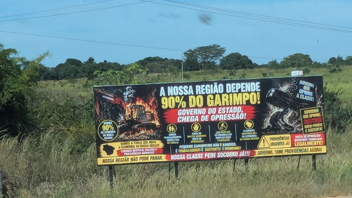
A billboard on the edge of town addresses the gold-mining debate.
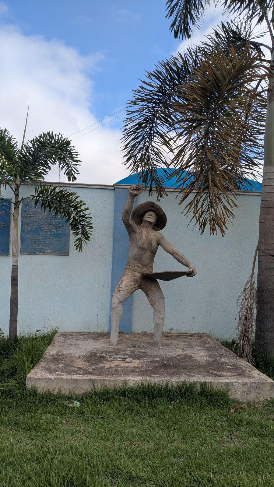
A statue honoring the garimpeiro, the local gold prospector.

Gold-buying storefronts light up downtown at dusk.
That afternoon, the Instituto Raoni was unable to meet. Cacique Raoni had fallen ill and they were meeting with his team of doctors to arrange for the best possible treatment. We made arrangements to meet the following day in the office.
May 18–19 · Washington DC to Peixoto de Azevedo
Meeting the Instituto Raoni
The Instituto Raoni is a small building off the BR- 163. The offices and rooms inside are organized by department. There is a room for the executive team, the communications team, the finance team, the women’s department and the bioeconomy and sales team. I spent my first day with IR meeting the team and co-working with the Bioeconomy and sales team. For me, this was a special moment. I started working with the Kayapo in 2014 and joined the Kayapo Project team in 2023. These were my first minutes with IR outside the pressure of an assembly, budget, or project meeting. Having some informal time to be present with the team, get to know the personalities, hobbies, and spaces they navigate will be incredibly helpful as we continue to work together and collaborate.
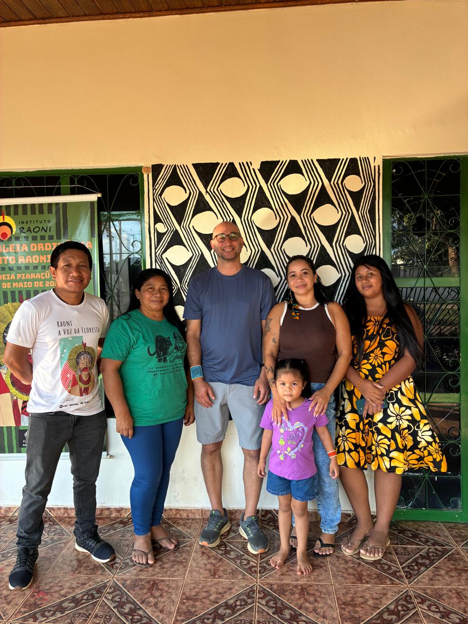
At IR with bio economy and women's departments

A trophy case inside the Instituto Raoni headquarters.
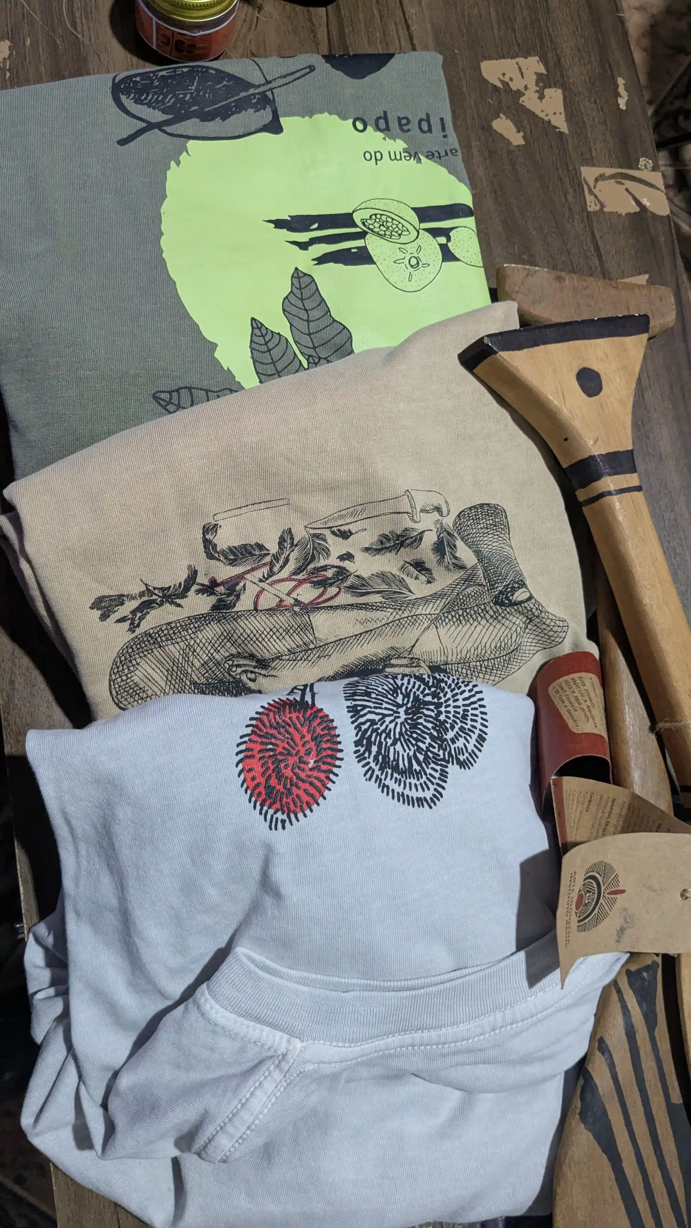
Products from IR’s bioeconomy and sales department.
I worked with the IR team for the next three days, spending time in conversation and at lunch with the finance and executive teams, discuss how we can best support IR’s territorial and cultural conservation initiatives, how to improve dialogue and process, and also sharing ideas around future initiatives with the IR such as the Kayapo Forest School, currently in operation along the Xingu and Riozinho Rivers.
On Friday May 22nd, the whole team was in the office and I gave a short presentation on Biome Conservation, The Kayapo Project in general and a few of the initiatives I work on such as the forest school, field course, and a media at the guard posts. The leadership team and others who had just returned from the Pykany village, where I would be headed in a few days, joined me. To round out my visit, I had a chance to visit with Cacique Raoni, thank him for his leadership, and wish him a speedy recovery.
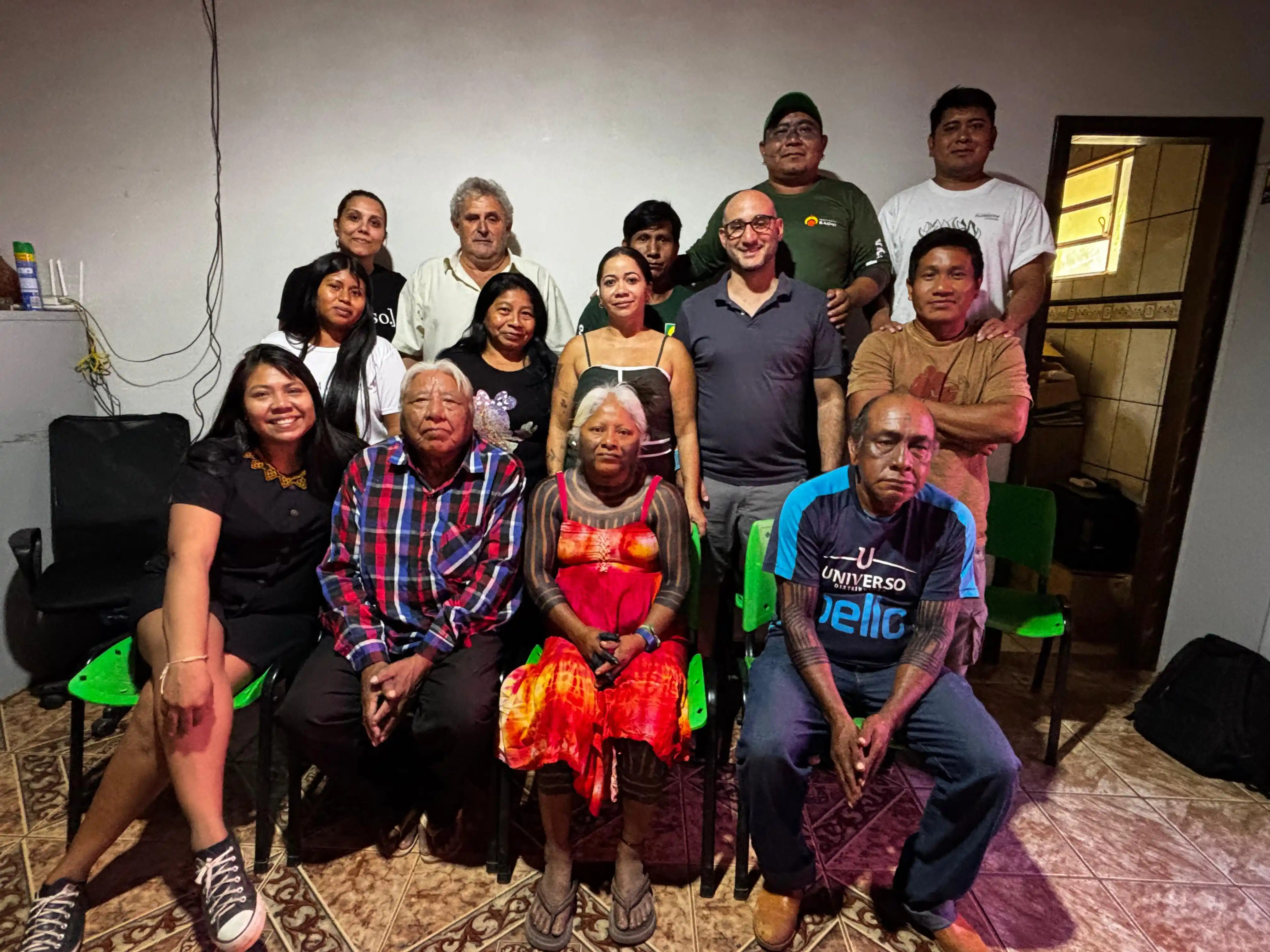
With the IR team and Kayapo leaders in Peixoto de Azevedo.
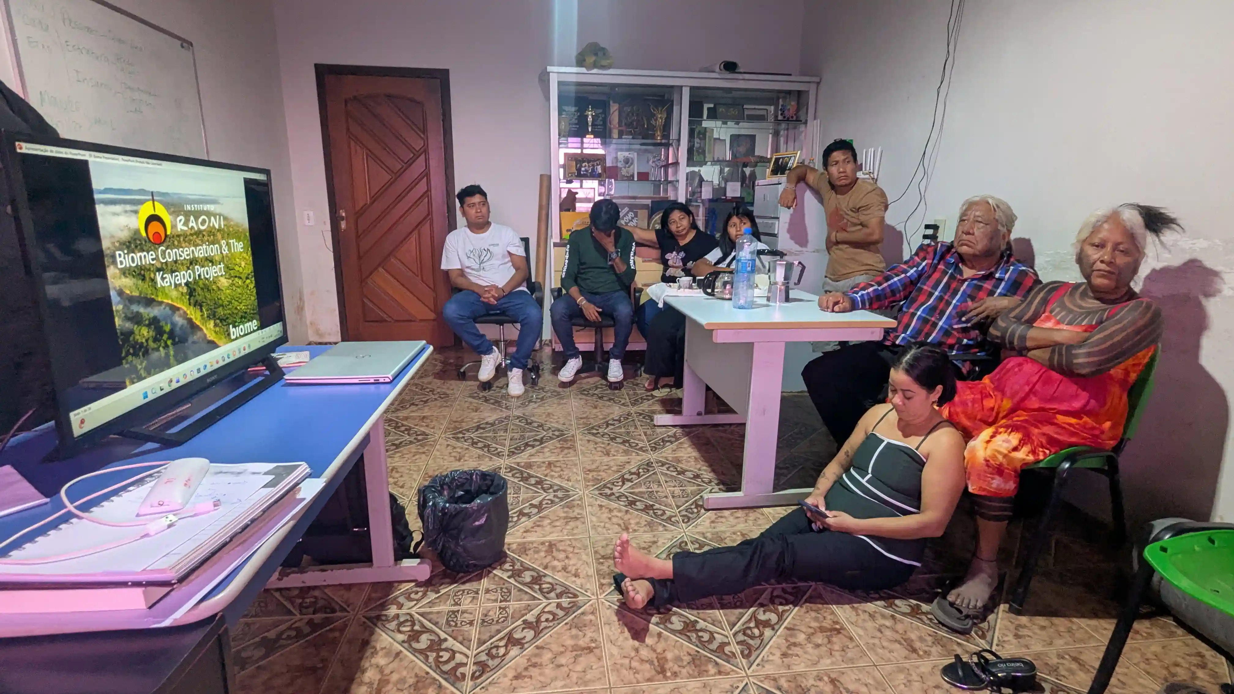
Presenting on Biome Conservation and The Kayapo Project, with Cacique Raoni in attendance.
The Road to Pykany | BR-163
From Peixoto to Pykany
From Peixoto I was back on the Soy highway, this time traveling with Brasilia-based Kayapo project colleague Igor Richwin Ferreira toward the village of Pykany for the annual assembly of the Instituto Kabu. 250 km later, we arrived to the town of Castelo dos Sonhos, historically a hotbed of deforestation activity.
Concerned about driving through the forest at night to Pykany, we stayed in a hotel. In the morning, we met up with colleagues from the Instituto Socioambiental and began the journey from the town to the forest, watching the landscape change from dusty frontier town to ranchlands to close canopy forest. Along the way, we stopped for coffee and conversation at one of the 19 Kayapo Guard posts, navigated a precarious wooden bridge, and passed through a set of small villages along the dirt road to Pykany in the heart of the TI Menkragnoti.
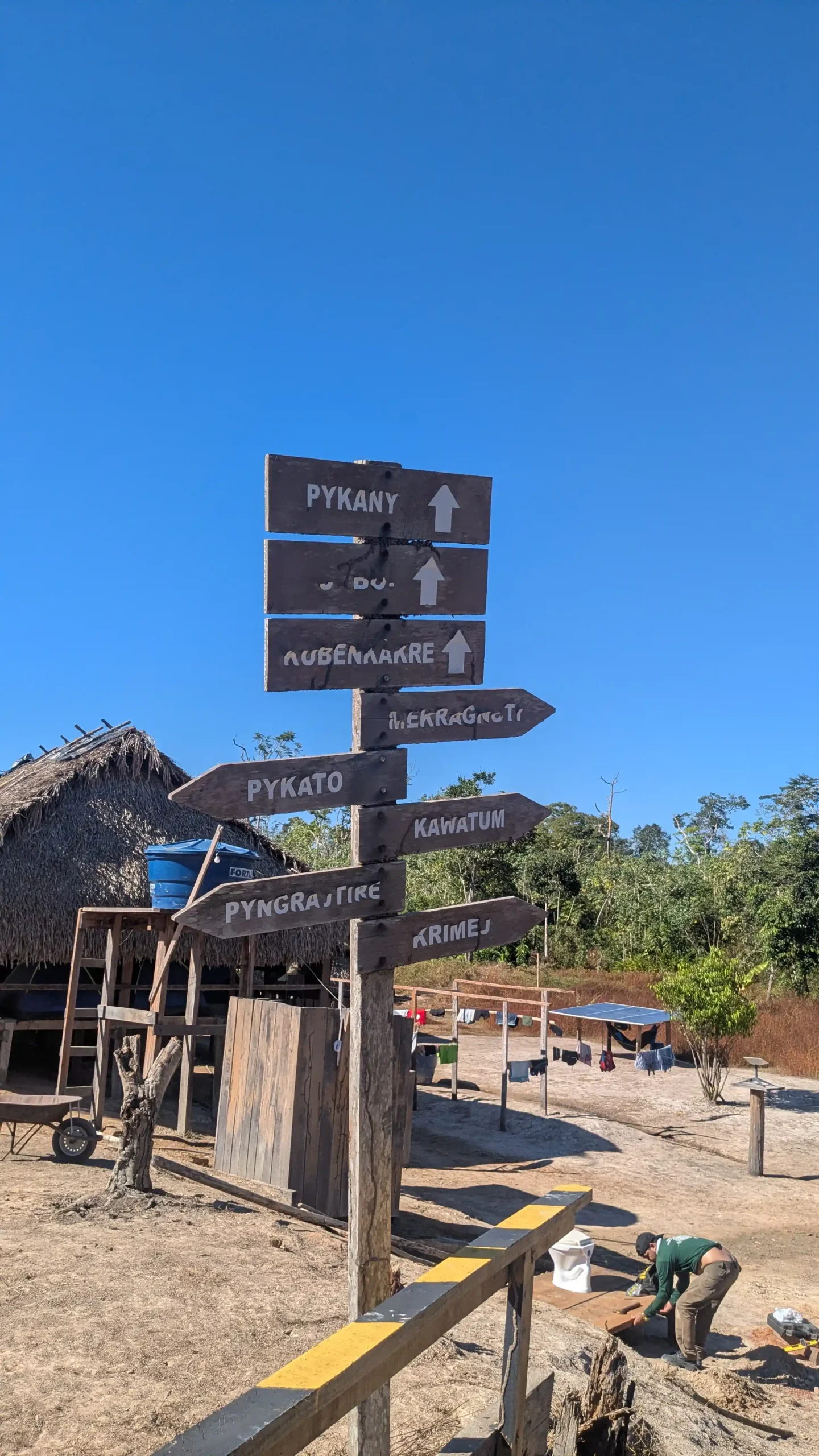
A signpost marking the villages along the route, Pykany included.
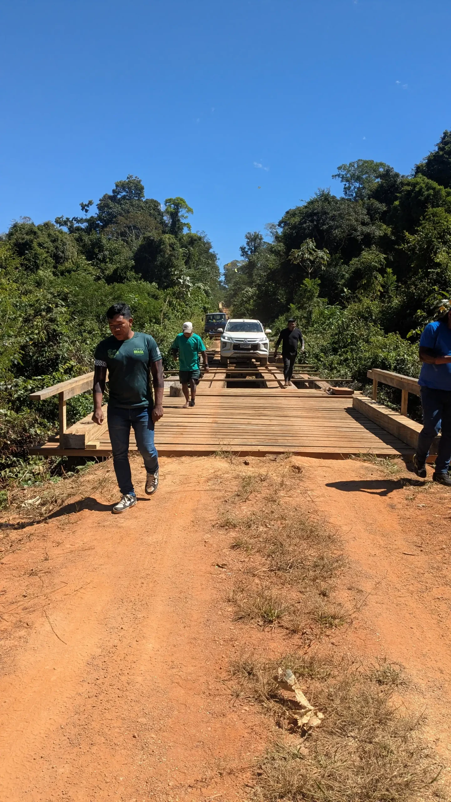
Crossing one of the precarious wooden bridges along the way.
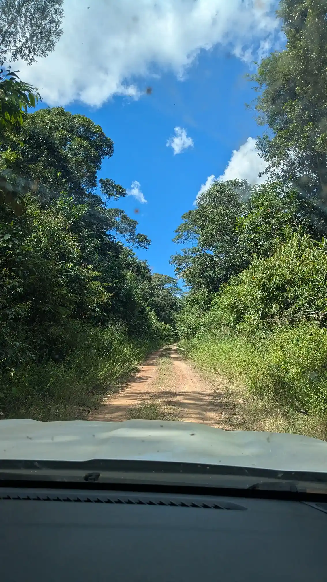
The landscape closes into dense canopy forest en route to Pykany.
Pykany Village I TI Menkragnoti
The Instituto Kabu General Assembly
The general assemblies are an opportunity for the leadership of the represented communities to come together to learn about the previous year’s activities, deliberate, discuss and approve the budget and activities for the coming year. It is also one of the only times that all the Kayapo leadership is in the same place at the same time with their external collaborators. These events are a unique opportunity to absorb the full spectrum of Kayapo initiatives, particularly those that sit outside the portfolio of Biome and the Kayapo Project. I met IK leadership, community leaders, and institutional peers to discuss ways we can all work together toward the mission of Kayapo territorial and cultural protection.
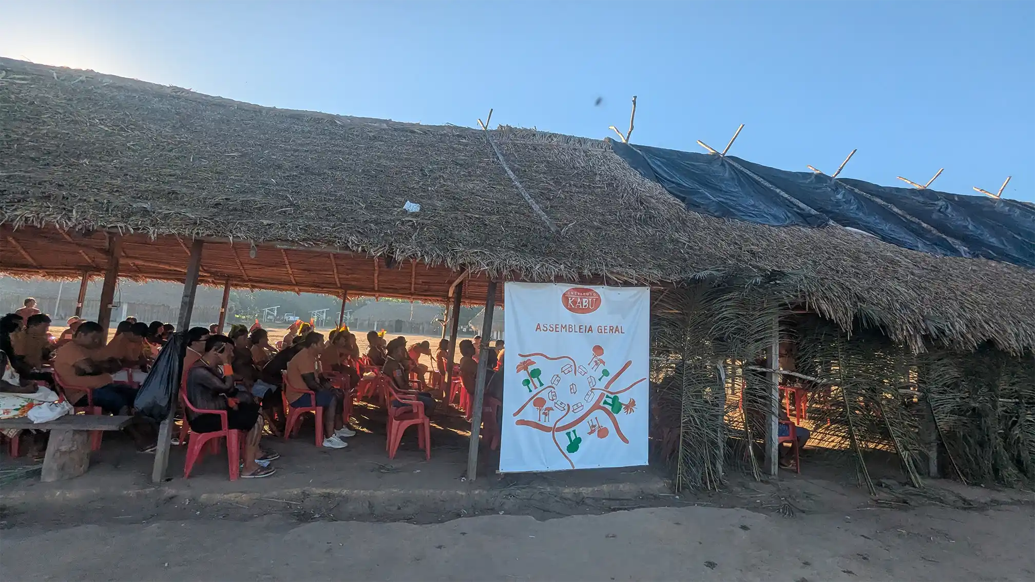
During the meeting, I presented to a large audience of Kayapo chiefs, once again sharing the work of Biome and the Kayapo Project including the territorial monitoring and surveillance program, the Kayapo Forest School, and opportunities for tourism and exchange with IK communities. My presentation was reinforced by Patkore and other representatives from the Protected Forest Association, who added details and cultural clarifications to my conversation. I am pleased to say that the Instituto Kabu has approved the implementation of the Kayapo Forest School in 2027 to complement their other initiatives.
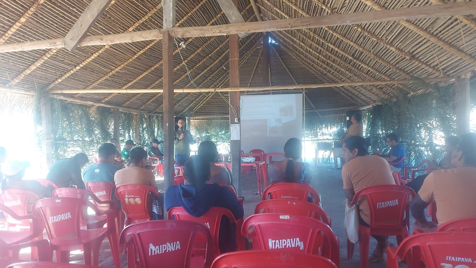
Presenting Biome and Kayapo Project initiatives.
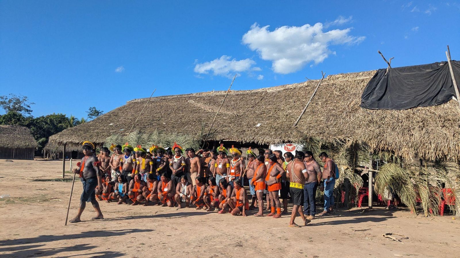
Kayapo leaders gathered in full traditional dress for the assembly.
May 30 | The Journey Home
Reflections on The Road Back
It takes three days to get home. First a long drive back from the forest to Castelo dos Sonhos. Then, the full 450km return trip, once again having the truck assaulted by fragments of corn and soy along the BR-163. A night in Sinop followed by planes from Sinop→Brasilia→Panama and finally Washington DC. Over the three days I was struck by a few important concepts:
The Kayapo Project is Indigenous-led Conservation
It is the Kayapo and their representative association who are implementing the programs, taking the risks, and putting in the hard work. Our job must be to leverage our positions to amplify their stories and provide the necessary support for success.
The Kayapo Project is a vast local → global ecosystem of collaboration and projects.
Not just in my visits, but also in the stories of our Kayapo collaborators. While I was there, I met a colleague from Greenpeace who was arranging a trip for Kayapo representatives to visit Europe for support. In the past, I’ve met folks from the German Embassy, Conservation International, Re:wild and other peers working to support the Kayapo. The work also covers a full spectrum of activities from sewing and artisan projects to environmental reviews of the potential train that may run alongside the BR-163.
The Kayapo are uniquely threatened and conservation can only go so far.
The regional economies are overwhelmingly anchored in intensive, extractive activities such as mining, logging, and agriculture. Without providing alternative economic activities to the Kayapo and their Brazilian neighbors, the threat on Kayapo lands will persist.
The Kayapo Project Team is an incredible, international, intercultural group.
Every time I visit the Kayapo Project partners, I am in awe of the intercultural and professional skills of our Brazil-based colleagues who work day (and night) in and out to ensure that the projects move forward. Their phones are an endless stream of voice notes and messages with an infinite set of demands and questions.
– Matthew Aruch
Support the Kayapo
For more information or to support the Kayapo, please contact Matthew Aruch
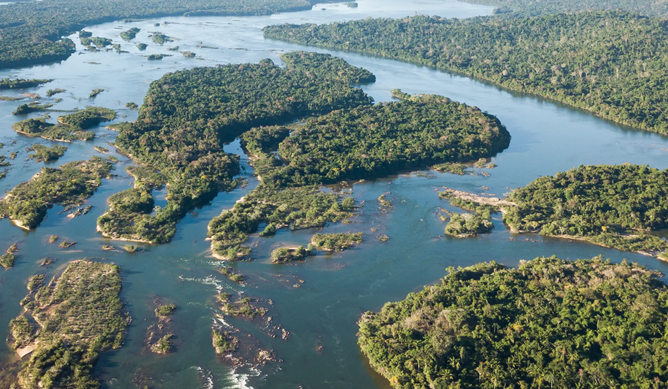
Large Scale Conservation
Kayapo territory, spanning approximately 9.4 million hectares across the southeastern Amazon, is one of the largest continuously protected Indigenous forest landscapes on Earth. Here, the forest is not a fragment. It is whole, connected, and alive.

Stability at Scale
Across the Amazon and beyond, once-continuous ecosystems are being fragmented into smaller and smaller patches broken apart by roads, agriculture, mining, and expanding infrastructure. What remains are often isolated fragments, no longer large enough to sustain the full systems that once thrived there. But in some places, the original scale still exists.
For decades, the Kayapo people have defended their lands against encroaching deforestation: from illegal logging and gold mining to expanding agriculture. Through strong governance systems, including territorial monitoring and guard posts, they have maintained the integrity of their forest across millions of hectares.
This continuity creates stability across a vast, intact landscape. It allows the forest to function as a system, not just a collection of trees, but a living, interconnected whole. And it is precisely this kind of large-scale stability that makes forests so important for climate stability.
Kayapo territory stores an estimated 720 million metric tons of above-ground carbon. Keeping this carbon locked in trees and soils helps prevent massive greenhouse gas emissions that would otherwise accelerate climate change.
Large forest systems are more resilient to drought, fire, and external pressures. When protected over time, they provide a form of climate security that smaller, fragmented forests cannot.

Kayapo Territory seen from space, surrounded by forest fires.

Life Needs Space
Wide-ranging species like jaguars depend on vast territories to hunt, reproduce, and maintain healthy populations. Their presence signals something deeper: a complete and functioning food web beneath them. From large herbivores like tapirs and peccaries to birds, fish, and countless smaller species, each layer of life depends on the others.
In fragmented forests, these relationships begin to break down. Species lose the ability to move, populations become isolated, and ecological balance is lost.
In Kayapo territory, the scale of the landscape allows life to move freely. Rivers like the Xingu and Iriri still run largely undisturbed, supporting rich aquatic ecosystems. Forests remain connected across vast distances, enabling species to roam, adapt, and thrive.
The rainforest creates its rain
Through evapotranspiration, trees release vast amounts of water vapor into the atmosphere, recycling moisture and feeding clouds. This process sustains rainfall locally and helps transport moisture deep into the continent through what we call “flying rivers.” These aerial flows carry water across thousands of kilometers, influencing rainfall patterns far beyond the forest itself.
Large, intact forests are essential to this system. When forests are fragmented or degraded, this moisture cycle weakens, with potential impacts on ecosystems and agriculture across South America.
As one of the largest intact forest blocks in the southeastern Amazon, Kayapo territory plays a critical role in maintaining this hydrological system. Its scale helps ensure that the forest continues to function as a living engine of water and climate.

Kayapo territory shows that when forests remain whole, they function as stable, living systems that sustain climate, biodiversity, and water cycles. Protecting forests at scale is about maintaining the conditions that make life on Earth possible.
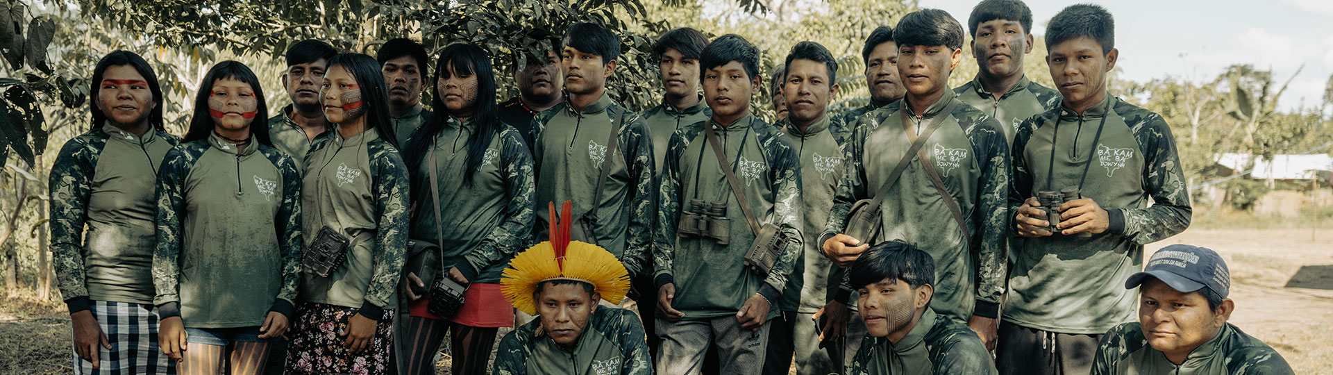
The Prince Albert II of Monaco Foundation launches a new partnership with Associação Floresta Protegida
Safeguarding Indigenous Land and Culture: Prince Albert II of Monaco Foundation Announces Partners with the Associação Floresta Protegida and the Kayapo People in the Brazilian Amazon
The Mebêngôkre-Kayapó-led Associação Floresta Protegida (AFP – Protected Forest Association) and the Kayapo Project are pleased to announce a new partnership with the Prince Albert II of Monaco Foundation’s Forest and Communities Initiative (FCI). This collaboration will help strengthen the Kayapó people’s long-standing efforts to safeguard approximately 9.4 million hectares of tropical forest across six federally demarcated Indigenous Territories in south-central Pará and northern Mato Grosso.
Home to nearly 12,000 people, these lands form a vital ecological barrier against deforestation in one of the most threatened regions of the Amazon Basin. Together, The Prince Albert of Monaco Foundation and the AFP will fortify the protection of Kayapo culture and lands through community-led education and territorial monitoring and surveillance programs.
From 2026-2028, the FCI will work with the AFP and the Kayapo Project to support and implement the Kayapo Forest School to prepare the next generation of Kayapo leaders. Each year, the Kayapo Forest School will provide hundreds of Kayapo youth a five-day field program that integrates traditional Indigenous knowledge with conservation technologies such as drones and camera traps. Each year of the partnership, the Kayapo Forest school will expand to other regions of the Kayapo managed Indigenous lands.
At the same time, the FCI will support the Kayapo territorial monitoring and surveillance guard post program. The guard post program trains and employs more than 1,500 Kayapo guardians to protect more than 2200km of Kayapo border from invasion. The guard posts are a clear signal that the Kayapo are organized and prepared to protect their territory from land invasions.
Together, these initiatives will ensure that Kayapo lands and culture are safeguarded for future generations.
Patkore Kayapo, President of AFP said: “The Forests and Communities Initiative provides important resources directly to Indigenous associations and communities. The partnership with the Prince Albert of Monaco Foundation will provide essential support for the protection of Kayapo culture, rivers, lands, and biodiversity. The partnership reinforces durable Indigenous governance and autonomy.”
Romain Ciarlet, Vice-Chairman and CEO, Prince Albert II of Monaco Foundation, added: “Protecting the world’s forests requires strong partnerships with those who have safeguarded them for generations. Indigenous peoples are not only guardians of biodiversity; they are key actors in the global response to climate and environmental challenges. Through the Forests and Communities Initiative, the Prince Albert II of Monaco Foundation is committed to strengthening Indigenous-led conservation by supporting local governance, education and territorial protection.”
About the Forests and Communities Initiative
The mission of the Forests and Communities Initiative is to support conservation of forest ecosystems through the action of indigenous peoples and local communities (IP and LCs) and through the development of a supporting network of actors providing a multidisciplinary set of expertise. To learn more about the Forests and Communities Initiative, visit www.forestsandcommunitiesinitiative.org.
About the Prince Albert II of Monaco Foundation
Founded by HSH Prince Albert II of Monaco in 2006, the Foundation is a global non-profit organisation dedicated to advancing planetary health for current and future generations. It co-creates initiatives and supports hundreds of projects in three priority areas: the Mediterranean Basin, the Polar Regions, and the Least Developed Countries (as classified by the United Nations). Its key missions include preserving endangered species, protecting freshwater ecosystems, developing a sustainable blue economy, and supporting the younger generations.
About the Kayapo Project
The Kayapo Project, a flagship program of Biome Conservation, is an Indigenous-led NGO alliance ensuring Mebêngôkre-Kayapo (Kayapo) cultural, economic, political, and territorial autonomy over more than nine million hectares of federally demarcated Indigenous lands located in the highly threatened southeastern Amazon. For more on the Kayapo Project, visit kayapo.org.
About Associação Floresta Protegida
The Associacao Floresta Protegida is an Indigenous-led nonprofit organization based in Tucumã, in the Brazilian State of Pará. The AFP works with 43 communities in the Kayapo, Menkragnoti, and Las Casas Indigenous Territories. Visit florestaprotegida.org.br to learn more.