
Fire Is the Amazon's New Weapon of Deforestation. Guard Posts Are the Answer.
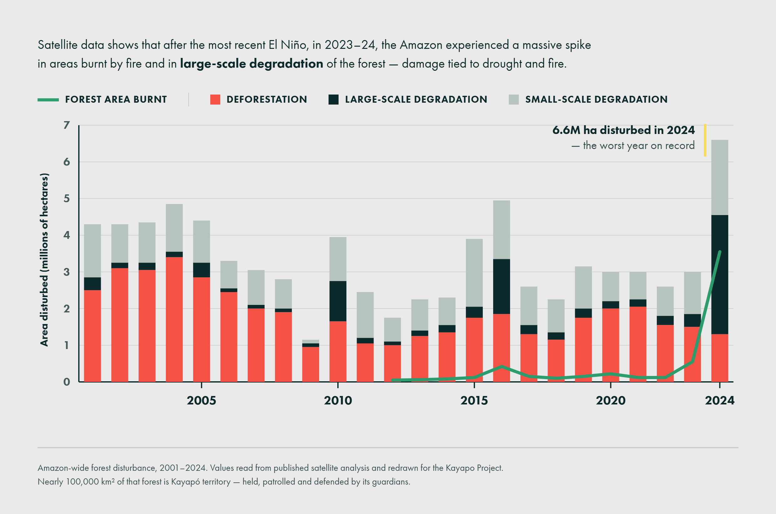
Brazil has genuinely good news this year: Amazon deforestation rates fell to their lowest level since 2013, with 2,874 square kilometers cleared between August 2025 and July 2026 [1]. That’s a 36% drop compared to the previous year. But there’s another headline that seems to contradict it: the number of wildfires across the Amazon rose by more than 30% in the same period, even as the area cleared went down [2].
Fire has become the tool of deforestation, not the byproduct
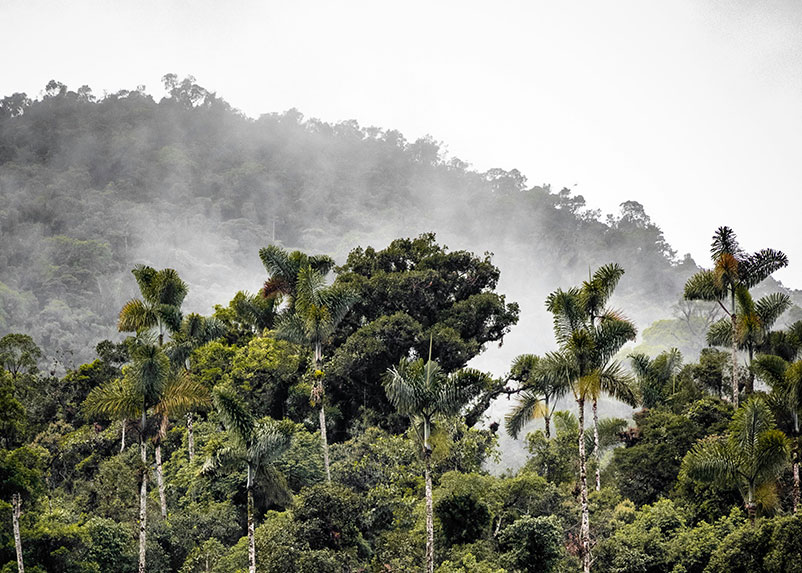
Photo: Unsplash
Analysts point to a simple incentive: burning is harder to trace back to a specific actor than chainsaw logging is, and scorched land degrades faster into something legally easier to claim. This isn’t a new pattern. Researchers first documented Amazon fire and deforestation decoupling nearly a decade ago, noting that even as annual deforestation rates dropped sharply, the occurrence of fire itself did not decline in step [3]. In 2026 that pattern is intensifying.
Timing makes this worse
Right now, August through October is the Amazon’s dry season, when fire risk typically peaks. This year that ordinary seasonal risk is stacked on top of an unfolding El Niño, historically the single biggest driver of severe Amazon drought and fire years. The 2024 Amazon drought, one of the worst on record, was compounded by El Niño conditions [4].
Forecasts for the exact strength of the current event vary in their specifics: NOAA puts the odds of it becoming a “very strong” event at around 80%, while Ecuador’s CIIFEN estimates roughly 69% odds that it will surpass previous records [5]. Forecasters broadly agree this is shaping up to be a major event, not a weak one, with some projecting it could be the strongest in over 150 years [6]. What forecasters largely agree on is the timing: fire risk is elevated in 2026 as El Niño develops, but the most severe impacts typically lag by about a year, putting the highest risk of a record-breaking fire season in the second half of 2027 [7].
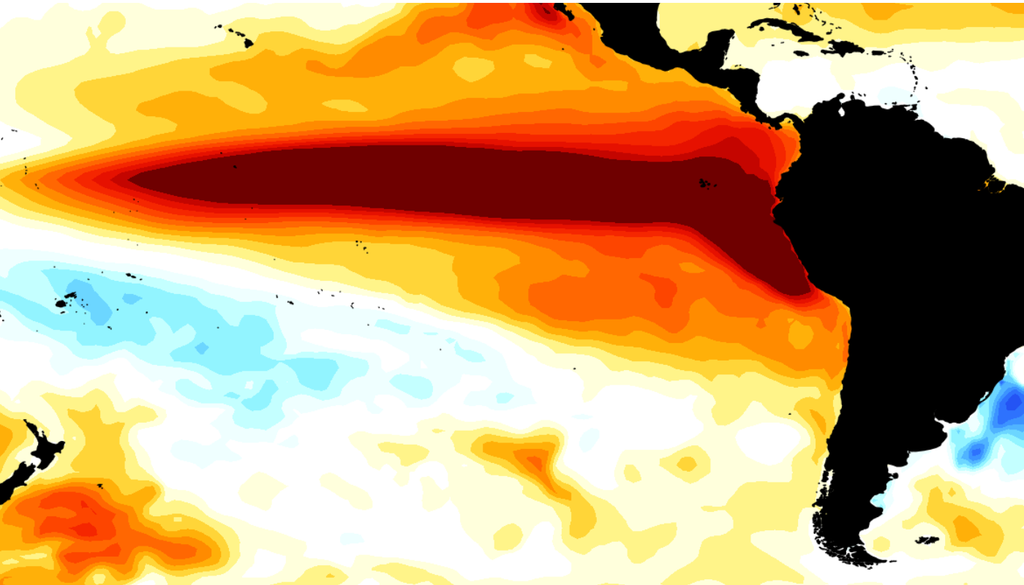
The seasonal forecast for September–November 2026 shows widespread warm anomalies in the equatorial Pacific, with sectors exceeding +3°C, reinforcing the signal of a high-intensity El Niño event. Source: NMME Ensemble Average, CIIFEN.
Intact forests are resilient
Its own humidity suppresses fire spread. What burns is forest that’s already been opened up — fragments with drier, more fire-prone edges, sitting right next to frequently burned pasture and regrowth [8].
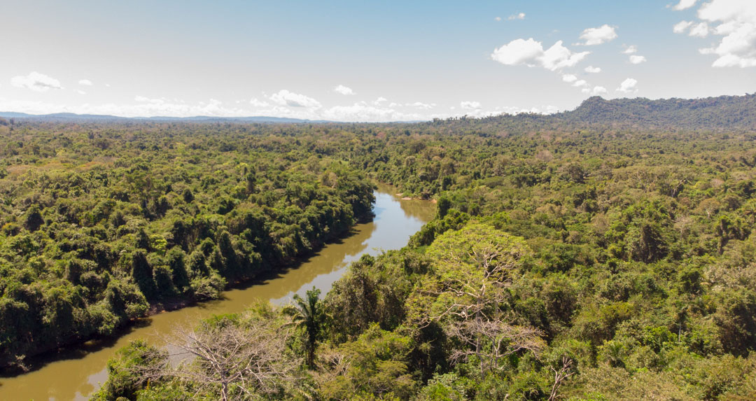
Photo: Pedro Peloso
A large-scale, decade-long burn experiment in the southeastern Amazon tested this directly [9]. Intact forest can shrug off a single low-intensity fire. But repeated burning during drought is a different story: it kills most of the trees, cuts canopy cover roughly in half, and lets invasive grasses move in. Forest edges fare worst of all, because that’s exactly where the drying and grass invasion are already most advanced.
The encouraging counterpoint: forest that stays intact keeps that natural resistance. A newer study found that even forests degraded by fire, drought, and windstorms in the southeastern Amazon can recover if left free of new disturbance — though the regrown forest remains more fragile against the next fire or drought [10]. Intact forest resists. Damaged forest doesn’t recover fully before the next hit.
Guard Posts are a shield against deforestation
Within the Kayapo’s roughly 11-million-hectare territorial bloc, we can compare the 9.4 million hectares that receive organized NGO-backed monitoring investment against the 1.2 million hectares that don’t — and deforestation hotspots cluster overwhelmingly in that smaller, unmonitored slice [11] [12].
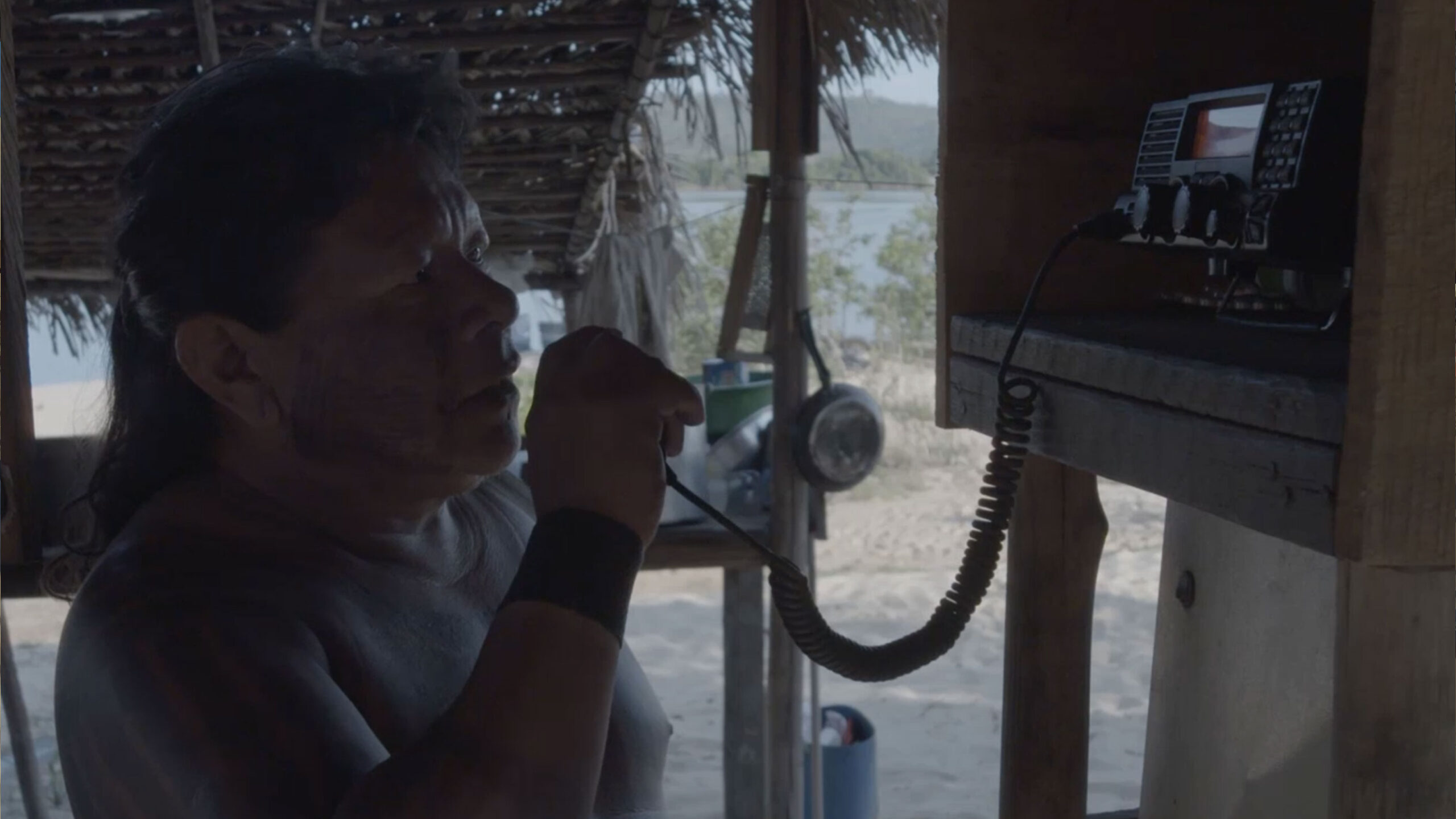
The mechanism behind that pattern is straightforward: the Kayapo’s surveillance program covers more than nine million hectares through 16 guard posts placed at vulnerable entry points, functioning as both a physical deterrent and a signal that the territory is actively defended [11]. Those monitoring teams are credited with helping prevent the illegal logging, mining, and land invasion that would otherwise open the forest up: the exact process that turns fire-resistant forest into fire-vulnerable edge.
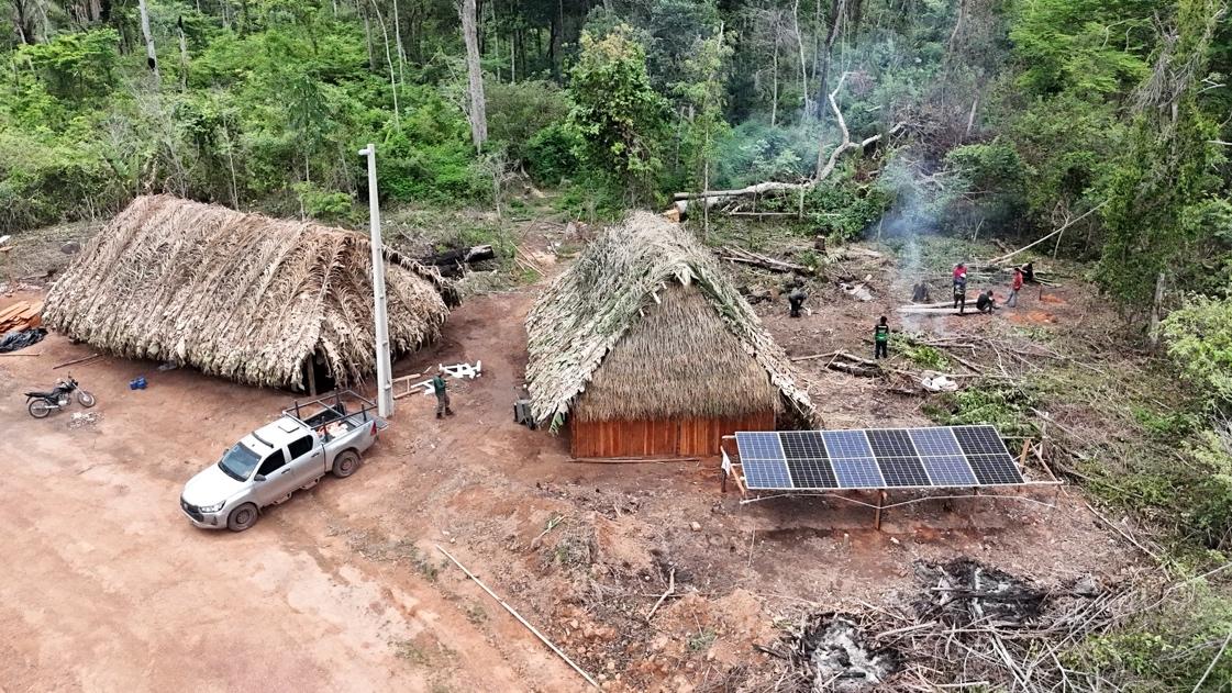
The Capoto guard post.
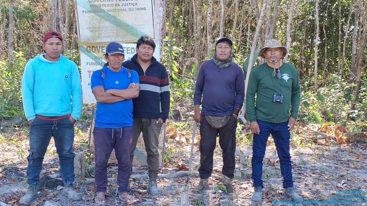
A Pykatoti guard team beside the official government sign marking the border of Menkragnoti territory.
The bottom line
Fire is increasingly the tool of choice on the Amazon’s frontier. This year’s dry season is landing on top of a developing El Niño whose worst effects, if the last two events are any guide, are still a year out. What determines whether a given hectare of forest survives that combination isn’t luck — it’s whether it stayed intact and defended, or got opened up first. Guard posts and territorial monitoring are one of the few interventions with a documented track record of keeping that first domino from falling.
- Mongabay, “Amazon deforestation alerts fall to lowest level since 2013, Brazilian data show” (August 2026)
- Inside Climate News, “Amazon Deforestation at Eight-Year Low, Report Shows” (May 2026)
- Aragão, L.E.O.C. et al., “21st Century drought-related fires counteract the decline of Amazon deforestation carbon emissions,” Nature Communications (2018)
- PBS News, “Extreme drought, wildfires and deforestation battered the Amazon rainforest in 2024”
- Meteored, “CIIFEN confirma: El Niño se fortalece, con 69% de probabilidad de superar récords” (2026); Nature, “A ‘super’ El Niño could transform the Amazon. Is the world’s biggest rainforest doomed?” (2026), citing NOAA’s ~80% odds of a “very strong” event
- AccuWeather, “The 2026 El Niño could become the strongest in a lifetime”
- Amazon Conservation Association, “A New Twist On El Niño: The Bigger Impacts Will Come In 2027”
- Yale School of the Environment, “Amazon Forests Can Recover From Fire — With Some Caveats”
- University of Colorado Boulder, “Decade-long Amazon rainforest burn yields new insight into wildfire vulnerabilities” (2015)
- “Forest recovery pathways after fire, drought, and windstorms in southeastern Amazonia,” PNAS (2026)
- Kayapo Project, “Defend”
- Biome Conservation / ICFC, “Kayapo Project”

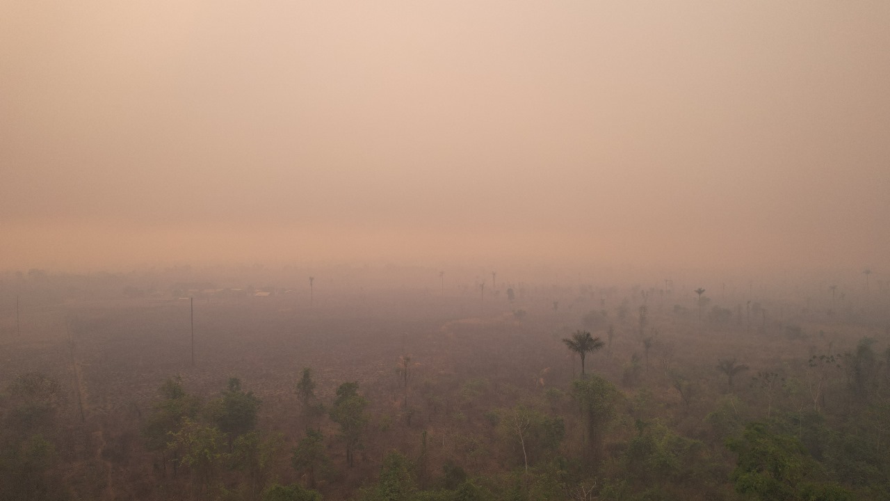
Fire and Resilience: The Kayapo Fight to Preserve Their Land
The Amazon is experiencing one of the worst droughts in recorded history. Among those affected are the Kayapo, guardians of one of the largest and most biodiverse tracts of the Amazon rainforest.
A recent article on Mongabay spoke about the drought and its effects on Kayapo land, with the alarming subheading: “Almost 20% of the Kayapó Indigenous Territory has burned in this year’s Amazon drought, the worst ever recorded in Brazil.” Let’s put this very concerning information in the right context.

Did 20% of the Kayapo’s Indigenous Land Burn?
The heading from the Mongabay article implies that one fifth of Kayapo forest has been reduced to ashes. This is very far from the case.
The confusion arises from the name of one of five officially ratified and contiguous indigenous territories of the Kayapo that together form a block of 10.6 million ha. One of these five territories is called the “Kayapo Indigenous Territory” which encompasses 3.28 million ha of the total block. The article was referring to only the Kayapo Indigenous territory; or 3.28 million hectares of the Kayapo’s 10.6 million hectare forest estate. For reference, 10 million hectares is roughly three times the size of Belgium.
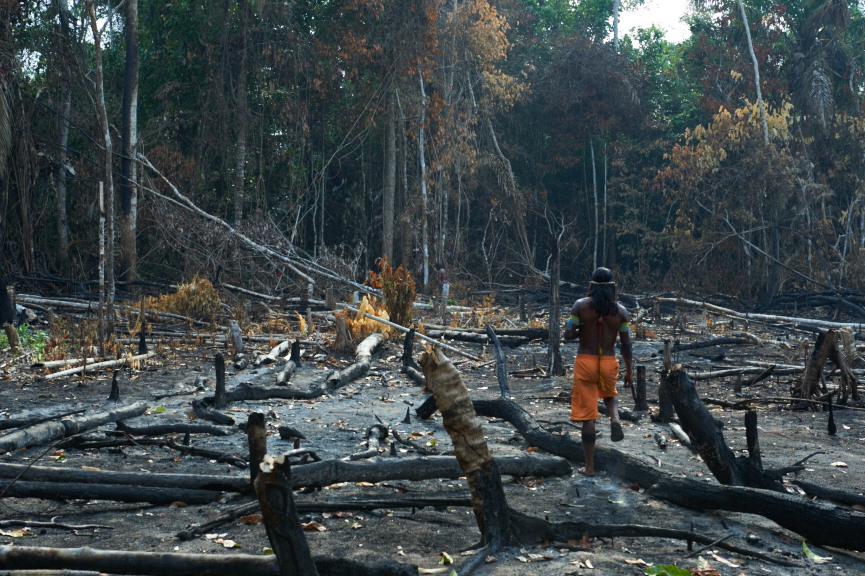
Photo: Martin Schoeller
The Kayapo-NGO alliance is working
The Kayapo-NGO alliance represents more than 9.1 million hectares of the overall 10.6 million hectare Kayapo territorial block. The remaining 1.5 million hectares of Kayapo territory that is located mostly along the eastern border of TI Kayapo is heavily invaded by goldmining and logging and does not form part of the Kayapo-NGO alliance.
The Kayapo living in this eastern band of the TI Kayapo succumbed to goldmining and logging pressure before conservation NGOs arrived on the scene in the 1990’s. The result has been extensive degradation of the forest and pollution of rivers in this area. Kayapo culture has suffered here as well, given their livelihoods and traditional knowledge are tied to the health of natural ecosystems. Most of this year’s fires occurred throughout this eastern band of the TI Kayapo where high intensity logging has left forests flammable. Unlogged primary forest does not burn.
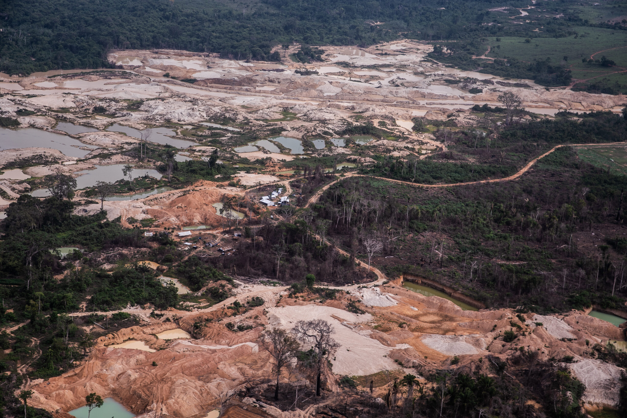
The impact of gold mining in areas of Kayapo Indigenous Territory not a part of the Kayapo-NGO alliance.
The other large source of fire hotspots in Kayapo land this year was on the large patches of savanna covering rocky plateaus of the Brazilian shield where high forest cannot grow. These large savanna patches (cerrado) burn naturally every year.
However, in this brutal summer season there was anomalous burning along the floodplain borders of the Riozinho river, one of the interior rivers in the TI Kayapo. This floodplain edge was able to catch fire because of grassy and scrubby vegetation found in this semi-flooded habitat.
Although the fire in Kayapo territory was worse than normal this year, the bottom line is that over nine million hectares of the NGO-alliance remained largely intact because it is protected by Kayapo guardians and has not been degraded by illegal activity. The Kayapo forest of the allied Kayapo remains continues to demonstrate the resilience of unlogged primary forest and the effectiveness of the Kayapo-NGO alliance.
Kayapo lands of the Kayapo Project alliance are monitored and protected by the territorial surveillance program, which relies on 16 strategically placed border guard posts expeditions by foot and boat to monitor areas not covered by guard posts.
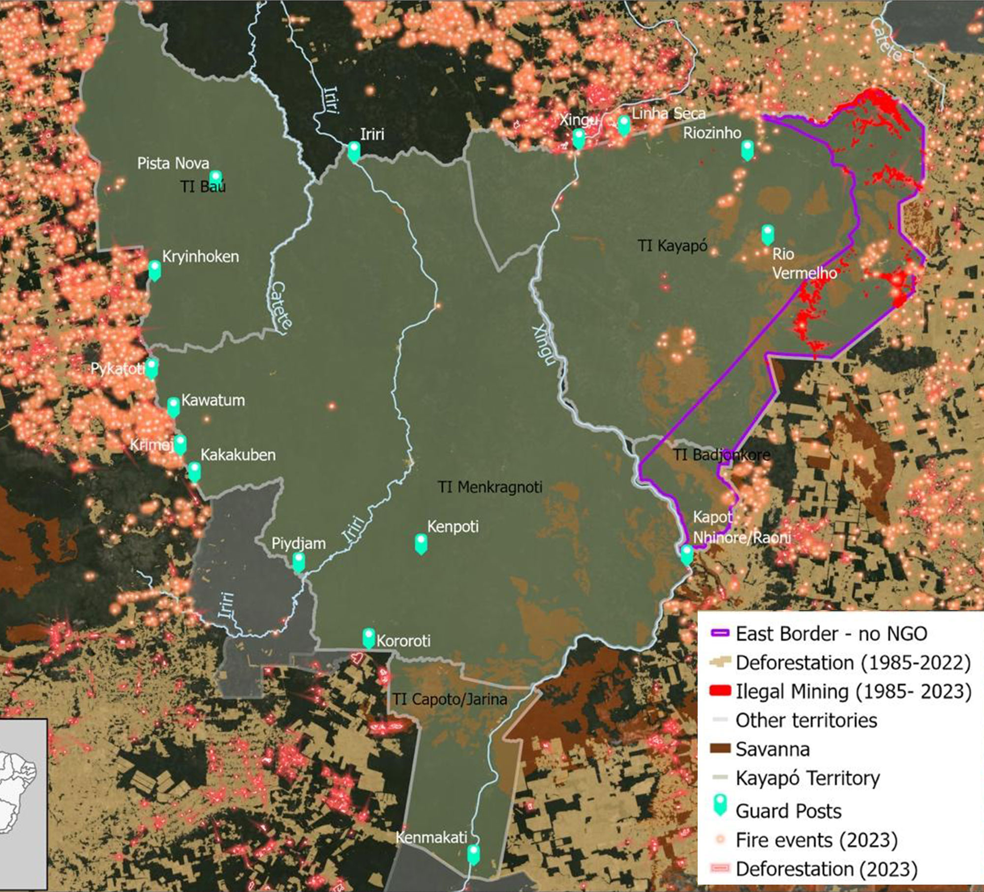
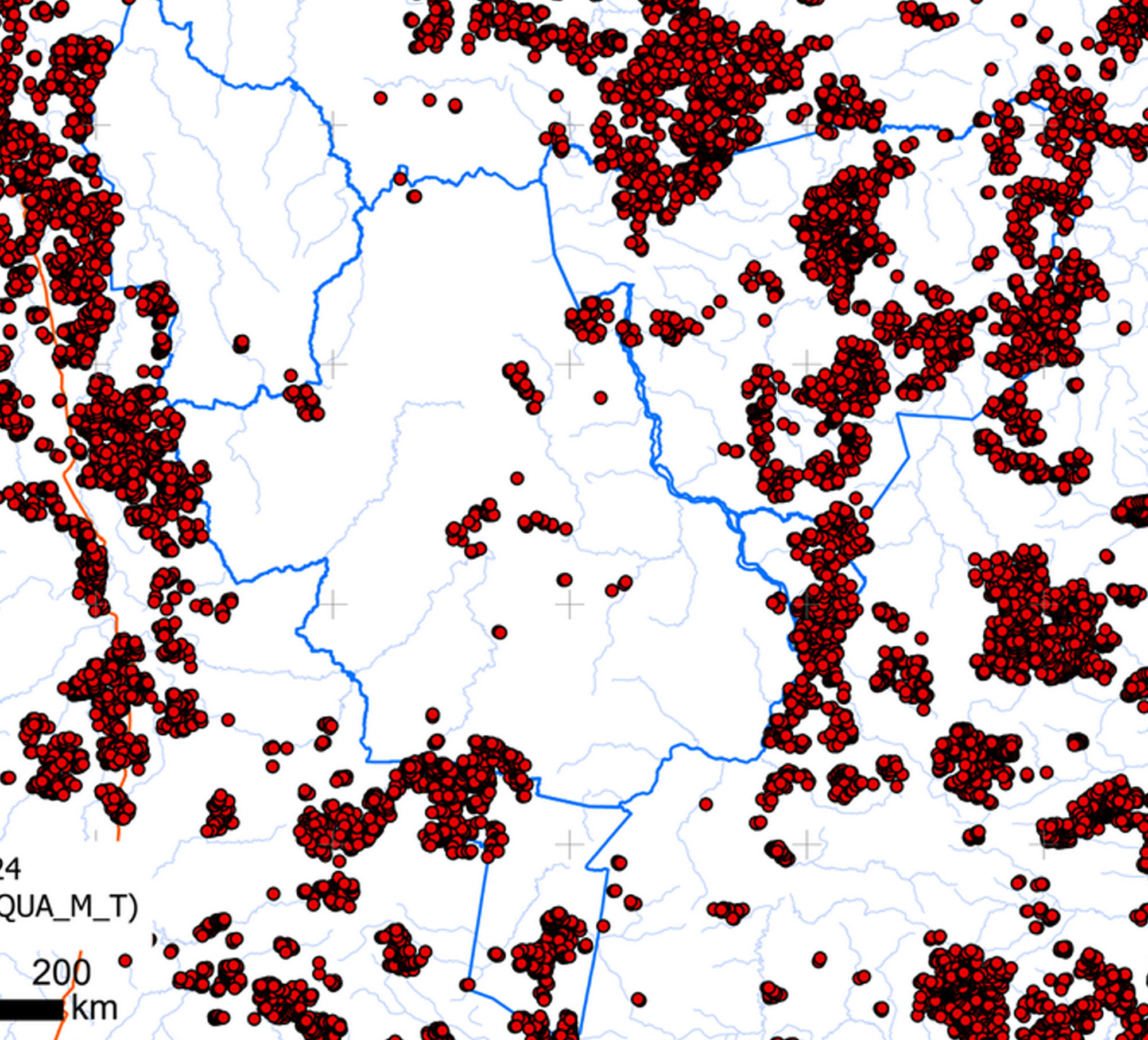
Map 1 on the left shows the 5 officially recognized Kayapo Territories: Bau Indigenous Territory, Kayapo Indigenous Territory, Menkragnoti Indigenous Territory, Capoto/Janina Indigenous Territory, Badjonkore Indigenous Territory
Map 2 on the right shows the forest fires as of September
Did 20% of the Kayapo’s Indigenous Land Burn?
The heading from the Mongabay article implies that one fifth of Kayapo forest has been reduced to ashes. This is very far from the case.
The confusion arises from the name of one of five officially ratified and contiguous indigenous territories of the Kayapo that together form a block of 10.6 million ha. One of these five territories is called the “Kayapo Indigenous Territory” which encompasses 3.28 million ha of the total block. The article was referring to only the Kayapo Indigenous territory; or 3.28 million hectares of the Kayapo’s 10.6 million hectare forest estate. For reference, 10 million hectares is roughly three times the size of Belgium.
Map 1 on the left shows the 5 officially recognized Kayapo Territories: Bau Indigenous Territory, Kayapo Indigenous Territory, Menkragnoti Indigenous Territory, Capoto/Janina Indigenous Territory, Badjonkore Indigenous Territory
Map 2 on the right shows the forest fires as of September
Photo: Martin Schoeller
The Kayapo-NGO alliance is working
The Kayapo-NGO alliance represents more than 9.1 million hectares of the overall 10.6 million hectare Kayapo territorial block. The remaining 1.5 million hectares of Kayapo territory that is located mostly along the eastern border of TI Kayapo is heavily invaded by goldmining and logging and does not form part of the Kayapo-NGO alliance.
The Kayapo living in this eastern band of the TI Kayapo succumbed to goldmining and logging pressure before conservation NGOs arrived on the scene in the 1990’s. The result has been extensive degradation of the forest and pollution of rivers in this area. Kayapo culture has suffered here as well, given their livelihoods and traditional knowledge are tied to the health of natural ecosystems. Most of this year’s fires occurred throughout this eastern band of the TI Kayapo where high intensity logging has left forests flammable. Unlogged primary forest does not burn.
The impact of gold mining in areas of Kayapo Indigenous Territory not a part of the Kayapo-NGO alliance.
The other large source of fire hotspots in Kayapo land this year was on the large patches of savanna covering rocky plateaus of the Brazilian shield where high forest cannot grow. These large savanna patches (cerrado) burn naturally every year.
However, in this brutal summer season there was anomalous burning along the floodplain borders of the Riozinho river, one of the interior rivers in the TI Kayapo. This floodplain edge was able to catch fire because of grassy and scrubby vegetation found in this semi-flooded habitat.
Although the fire in Kayapo territory was worse than normal this year, the bottom line is that over nine million hectares of the NGO-alliance remained largely intact because it is protected by Kayapo guardians and has not been degraded by illegal activity. The Kayapo forest of the allied Kayapo remains continues to demonstrate the resilience of unlogged primary forest and the effectiveness of the Kayapo-NGO alliance.
Kayapo lands of the Kayapo Project alliance are monitored and protected by the territorial surveillance program, which relies on 16 strategically placed border guard posts expeditions by foot and boat to monitor areas not covered by guard posts.
What This Means for the Future
These fires cannot be downplayed; they are a strong reminder that without conservation efforts, the rainforest will rapidly and irreversibly be destroyed. However, it’s important to note that most of the other fires occurred along the eastern band of goldmining and logging-impacted Kayapo land, where the forest has been badly degraded by these illegal activities. This distinction is critical, as it highlights the effectiveness of the Kayapo’s efforts to protect their rainforests and shows that there is still hope to protect some of the last pockets of true wilderness left on Earth.
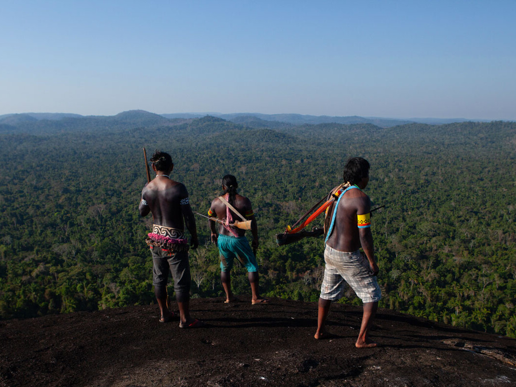
Kayapo’s land continues to thrive under the stewardship of the Kayapo. Photo: Simone Giovine
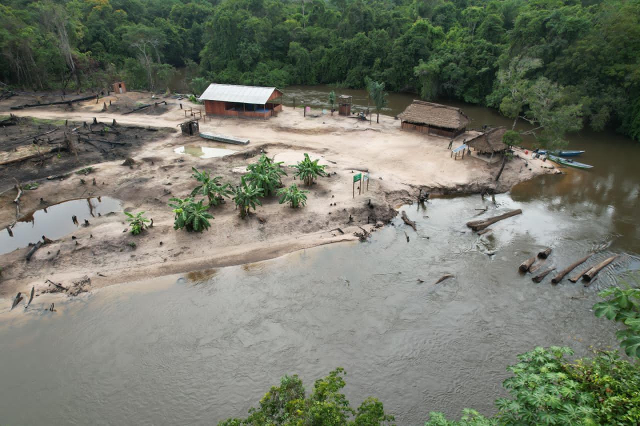
The Kakakuben guard post on the western border
As climate change drives more extreme weather patterns—from droughts to devastating fires—it becomes even more crucial to protect the rainforest’s carbon stores and biodiversity. Indigenous guardians like the Kayapo lead this fight by safeguarding some of the largest carbon reserves on Earth, demonstrating that empowering indigenous people is one of the most effective ways to combat both local and global environmental crises.
The best news is that we know what works: empowering the Kayapo to protect their land has been one of the most successful conservation stories on Earth.